
| ประเทศนอร์ดิก: เดนมาร์ก, ฟินแลนด์, ไอซ์แลนด์, นอร์เวย์, สวีเดน ไวกิ้งกับนอร์สโบราณ • ประวัติศาสตร์ • วัฒนธรรมชาวซามิ • ฤดูหนาว • สิทธิ์ในการเข้าถึง • พายเรือ • เดินป่า • อาหาร • เพลง • นอร์ดิก นัวร์ |
ใน ประเทศนอร์ดิก ของ ฟินแลนด์, ไอซ์แลนด์, นอร์เวย์ และ สวีเดน มีพื้นที่ขนาดใหญ่ที่มีประชากรเบาบางเหมาะสำหรับ แบกเป้ในถิ่นทุรกันดาร และการเดินป่าแบบพักแรมหลายวัน และพื้นที่สำหรับการเดินป่าแบบไปเช้าเย็นกลับ แม้กระทั่งใกล้กับเมืองและหมู่บ้านส่วนใหญ่ ในนอร์เวย์ รวมถึงการเดินป่าไปยังยอดเขาสูง มีภูมิประเทศที่หลากหลายในประเทศนอร์ดิก ตั้งแต่ภูเขาไฟไอซ์แลนด์ไปจนถึงป่าตะวันออกในฟินแลนด์ จากเทือกเขาอัลไพน์ของนอร์เวย์ไปจนถึงที่ราบลุ่มอันเงียบสงบของเดนมาร์กและทางตอนใต้ของสวีเดน อิสระในการเดินเตร่เรียกอีกอย่างว่า สิทธิในการเข้าถึง หรือในภาษาสวีเดน/นอร์เวย์ allemansrätten/allemannsretten ("สิทธิของมนุษย์ทุกคน") ให้ทุกคนเข้าถึงธรรมชาติส่วนใหญ่ได้
ในฤดูหนาวซึ่งอาจหมายถึงตั้งแต่มกราคมถึงกุมภาพันธ์หรือตั้งแต่ตุลาคมถึงพฤษภาคมขึ้นอยู่กับจุดหมายปลายทาง เล่นสกีข้ามประเทศ เป็นวิธีที่ควรไป อย่างน้อยสำหรับระยะทางไกลในหลายพื้นที่ - การแบกเป้ในถิ่นทุรกันดารและการเล่นสกีที่ทุรกันดารถือเป็นกิจกรรมเดียวกันไม่มากก็น้อย ที่จุดหมายปลายทางที่มีเส้นทางเดินป่า มักจะมีเส้นทางเล่นสกีในฤดูหนาว
คำแนะนำด้านล่างบางส่วนยังเกี่ยวข้องกับวิธีอื่นๆ ในการสำรวจภูมิทัศน์ธรรมชาติอีกด้วย
สำหรับ หมู่เกาะแฟโร, กรีนแลนด์ และ สฟาลบาร์ดูบทความหลักของพวกเขา
แม้ว่าพื้นที่รกร้างว่างเปล่าในเดนมาร์กจะมีขนาดเล็กมากเมื่อเทียบกับประเทศนอร์ดิกอื่นๆ แต่ประเทศนี้ก็ยังมีโอกาสใช้ชีวิตกลางแจ้งอยู่บ้าง ดู ตั้งแคมป์ดั้งเดิมในเดนมาร์ก.
| โควิด -19 ข้อมูล: ไม่อนุญาตให้มาถึงกระท่อมที่รกร้างว่างเปล่าของนอร์เวย์โดยไม่ต้องจองอีกต่อไป ในฟินแลนด์ สิ่งอำนวยความสะดวกต่างๆ ปิดให้บริการในฤดูใบไม้ผลิปี 2020 แต่เปิดให้เข้าชมอีกครั้ง และขอให้ผู้เข้าชมหลีกเลี่ยงจุดพักผ่อนที่พลุกพล่าน และปฏิบัติตามคำแนะนำด้านสุขอนามัย ระยะทาง ฯลฯ อย่างระมัดระวัง ไม่มีสบู่และน้ำยาฆ่าเชื้อ ดังนั้นจึงควรนำติดตัวไปด้วย | |
| (ข้อมูลปรับปรุงล่าสุด 02 ก.พ. 2564) |
เข้าใจ

| “ | เขาต้องการไฟซึ่งตอนนี้กำลังมา ชาเย็นถึงเข่า; อาหารและเสื้อผ้าที่คนเร่ร่อนกระหาย ผู้ซึ่งเคยชินกับหนามที่ตกลงมา | ” |
—ฮาวามาล | ||
นอร์เวย์ สวีเดน และฟินแลนด์รวมกันครอบคลุมพื้นที่กว่าหนึ่งล้านตารางกิโลเมตร ซึ่งกว้างกว่าออสเตรียและสวิตเซอร์แลนด์รวมกันถึงสิบเท่า พื้นที่เดินป่าประกอบด้วยฟยอร์ดในมหาสมุทรแอตแลนติกที่ชื้นและอบอุ่นและชายฝั่งของนอร์เวย์ ผ่านยอดเขาสูงที่เป็นป่าของเทือกเขาสแกนดิเนเวีย ไปจนถึงที่ราบกว้างใหญ่และป่าลึกภายใน
เพียงไม่กี่ชั่วอายุคนในประเทศนอร์ดิกส่วนใหญ่อาศัยอยู่ในชนบท ด้วยจำนวนประชากรที่เบาบางและท้องทุ่งที่ขาดแคลน การป่าไม้ การประมง และการเก็บผลเบอร์รี่ทำให้คนจำนวนมากมีรายได้เสริมที่สำคัญ ทุกวันนี้ การเดินป่า ตกปลา และเก็บผลไม้เล็ก ๆ เป็นส่วนสำคัญของวันหยุดพักผ่อนของคนในท้องถิ่น ส่วนใหญ่เป็นงานอดิเรกที่กระท่อมฤดูร้อน ไม่ใช่ทุกคนที่เป็นนักปีนเขาที่ทุรกันดารอย่างจริงจัง แต่มีเพียงไม่กี่คนเท่านั้น
แง่มุมหนึ่งของประเพณีกลางแจ้งของชาวนอร์ดิกคือการล่าสัตว์เป็นเรื่องแปลกสำหรับหลาย ๆ คนจากประเทศที่นี่คือสิ่งที่สงวนไว้สำหรับเจ้าของที่ดินซึ่งเป็นชนชั้นสูง ในประเทศแถบนอร์ดิก ป่าส่วนใหญ่เป็นของเกษตรกรเสมอ และป่าเหล่านี้มีการล่าสัตว์เป็นแหล่งอาหารที่สำคัญในบางครั้ง ในชนบทเป็นส่วนหนึ่งของชมรมล่าสัตว์ในท้องถิ่นเป็นเรื่องปกติ คำภาษาฟินแลนด์สำหรับถิ่นทุรกันดาร erämaaยังหมายถึงพื้นที่ล่าสัตว์และตกปลา ในสมัยโบราณผู้คนจะเดินป่าอย่างแม่นยำเพื่อซื้ออาหารและขนสัตว์ และการเดินป่าก็มีร่องรอยของประเพณีนี้ด้วย อย่างน้อยก็สำหรับนักปีนเขาบางคน
แม้แต่พื้นที่ห่างไกลก็แทบจะไม่มีใครแตะต้องอย่างแท้จริง ทางตอนเหนือส่วนใหญ่จะใช้เลี้ยงกวางเรนเดียร์ ป่าที่ไม่มีการป้องกันส่วนใหญ่ใช้สำหรับการทำป่าไม้ ในทางปฏิบัติ คนส่วนใหญ่จะสังเกตเห็นสิ่งนี้เป็นครั้งคราวเท่านั้น
เนื่องจากจำนวนประชากรที่เบาบาง โดยเฉพาะในภาคเหนือ เส้นทางจะค่อนข้างเงียบ ยกเว้นใกล้รีสอร์ทท่องเที่ยวหลัก นอกเส้นทางคุณจะเห็นคนไม่กี่คนแม้อยู่ใกล้เมือง ใกล้ถนนสายหลัก คุณอาจได้ยินเสียงการจราจร แต่ในไม่ช้าในพื้นที่ที่มีประชากรเบาบาง คุณจะได้ยินแต่ความเงียบเท่านั้น
สภาพภูมิอากาศและภูมิประเทศ

ประเภทของภูมิประเทศและสภาพอากาศแตกต่างกันไปอย่างมาก ตั้งแต่ภูเขาสูงชันของนอร์เวย์ไปจนถึงที่ราบเกือบราบของฟินแลนด์ออสโตรโบทเนีย ตั้งแต่สภาพอากาศปานกลางและฝนตกของชายฝั่งมหาสมุทรแอตแลนติก ไปจนถึงภูมิอากาศแบบเกือบทวีปของฟินแลนด์ภายในประเทศ และจากสภาพอากาศที่อบอุ่นทางตอนใต้ สู่ธารน้ำแข็งในภูเขาและทุ่งทุนดราทางตอนเหนือ
พื้นที่พัฒนาน้อยกว่า 5% ของนอร์เวย์ (พื้นที่เกษตรกรรม ถนน เมือง) และสัดส่วนในประเทศอื่นๆ ก็ใกล้เคียงกัน ในนอร์เวย์ ประมาณ 50% ของพื้นที่เป็นพื้นที่โล่งบางประเภทที่ไม่มีป่า รวมถึงพื้นแข็งที่ไม่มีต้นไม้และหินเปล่า มากกว่า 30% เป็นป่า และประมาณ 5% เป็นพื้นที่ชุ่มน้ำและบึง (โดยเฉพาะในนอร์เวย์ตะวันออก Trøndelag และ Finnmark) 5% เป็นน้ำจืด (แม่น้ำและทะเลสาบ) และ 1% เป็นน้ำแข็งหรือหิมะถาวร ในฟินแลนด์ 70% เป็นป่าไม้ ในขณะที่พื้นที่เปิดโล่งส่วนใหญ่เป็นทะเลสาบและหนองบึง ส่วนทางเหนือสุดก็มีป่าทึบขนาดใหญ่เช่นกัน นอกจากนี้ในพื้นที่ชุ่มน้ำของสวีเดนยังพบเห็นได้ทั่วไป (ประมาณ 20% ของพื้นที่) ไอซ์แลนด์ประมาณ 63% เป็นภูมิประเทศที่แห้งแล้ง 23% มีพืชพรรณบางชนิด ธารน้ำแข็ง 12% ปกคลุม และ 3% เป็นทะเลสาบ
บริการพยากรณ์อากาศโดยทั่วไปมีคุณภาพดี แต่อาจจำเป็นต้องอาศัยประสบการณ์ในท้องถิ่นเพื่อตีความ: สภาพลมแตกต่างกันไปขึ้นอยู่กับโทโพโลยีในท้องถิ่นและสำหรับอุณหภูมิจะมีการบอกค่าสูงสุดของวันโดยเฉลี่ยในการพยากรณ์จำนวนมาก ความแปรปรวนและอุณหภูมิกลางคืนจะต้องถูกอนุมาน โดยทั่วไปลมจะแรงกว่าในภูเขาสูงและแห้งแล้งและตามชายฝั่งด้านนอก โดยปกติความแตกต่างระหว่างอุณหภูมิสูงสุดและต่ำสุดในแต่ละวันจะอยู่ในช่วง 3–15°C (5–30°F) เว้นแต่จะมีการเปลี่ยนแปลงสภาพอากาศที่สำคัญ ท้องฟ้าแจ่มใสมักจะหมายถึงคืนที่หนาวเย็น อุณหภูมิวันสูงสุดเฉลี่ยในเดือนกรกฎาคมอยู่ที่ประมาณ 15°C (60°F) ถึงประมาณ 23°C (75°F) ขึ้นอยู่กับสถานที่ ในเดือนมกราคม ตั้งแต่ประมาณจุดเยือกแข็งไปจนถึงประมาณ -10°C (15°F) ภูเขาสูง ไม่นับ อุณหภูมิสุดขั้วอาจแตกต่างกันตั้งแต่ 35 °C (95 °F) ในฤดูร้อนถึง -50 °C (-55 °F) ในฤดูหนาวทางตอนเหนือ
บริการพยากรณ์อากาศและข้อมูลเกี่ยวกับสภาพอากาศสำหรับฟินแลนด์จาก สถาบันอุตุนิยมวิทยา (สมาร์ทโฟน) หรือ Foreca, สำหรับนอร์เวย์จาก สำนักอุตุนิยมวิทยาและข่าวสภาพอากาศ และสำหรับไอซ์แลนด์จาก สำนักงานอุตุนิยมวิทยาไอซ์แลนด์.
พื้นที่อยู่ในเขตชายแดนระหว่าง Westerlies และ Subarctic; สภาพอากาศอาจถูกครอบงำโดยระบบสภาพอากาศบางอย่างหรืออาจคาดเดาสภาพอากาศสลับกันได้ยาก ใกล้ชายฝั่งมหาสมุทรแอตแลนติก (เช่นในไอซ์แลนด์และในและใกล้นอร์เวย์) และการเปลี่ยนแปลงอย่างรวดเร็วของสภาพอากาศที่ระดับความสูงสูงเป็นเรื่องปกติ

ภูเขาสูงและธารน้ำแข็งเป็นเรื่องยากที่จะเยี่ยมชมบางช่วงเวลาของปี เมื่อพิจารณาระดับความสูง จำไว้ว่าแนวต้นไม้อาจอยู่ต่ำกว่า 400 เมตรในส่วนเหนือสุดของฟินแลนด์และนอร์เวย์ ในภูเขาสูงของนอร์เวย์และไอซ์แลนด์ หิมะสามารถคงอยู่หลังจากฤดูหนาวจนถึงเดือนมิถุนายน และผืนใหญ่สามารถอยู่ได้ตลอดฤดูร้อน โดยการเดินเท้า โดยทั่วไปแล้ว ภูเขาสูงของนอร์เวย์สามารถเยี่ยมชมได้เฉพาะช่วงครึ่งหลังของฤดูร้อนและต้นฤดูใบไม้ร่วง (โดยทั่วไปคือเดือนกรกฎาคมถึงกันยายน ผู้เยี่ยมชมควรได้รับข้อมูลเฉพาะสำหรับแต่ละพื้นที่)
พื้นผิวบนภูเขาสูงเป็นส่วนใหญ่ที่ขรุขระมาก มักเป็นหินหลวม ก้อนหิน หิมะ และธารน้ำแข็ง การเดินป่ามักจะต้องใช้กำลังมาก และจำเป็นต้องมีรองเท้าบู๊ตที่ดี พื้นผิวที่ขรุขระและแห้งแล้งนี้ปรากฏขึ้นที่ระดับความสูงต่ำกว่ามากในนอร์เวย์มากกว่าในทวีปยุโรปหรือในเทือกเขาร็อกกี้ของสหรัฐฯ แม้แต่ที่ระดับน้ำทะเล 1,000 ถึง 1,500 เมตรก็มีสภาพเทือกเขาแอลป์ที่สูงซึ่งแทบไม่มีพืชพรรณและทุ่งหิมะเหลืออยู่ตลอดฤดูร้อน

ที่ระดับความสูงที่ต่ำกว่า แต่เหนือแนวต้นไม้มักมีป่าล้มที่เดินง่าย นี่คือภูมิประเทศทั่วไปใน "หุบเขาต่ำ" (lågfjäll) เช่น ทางตอนเหนือของฟินแลนด์และระหว่างภูเขาสูงและป่าในสวีเดน สภาพภูมิประเทศที่เปียกชื้นใกล้แนวต้นไม้มักมีต้นหลิวปกคลุมอย่างหนาแน่น (Salix) พุ่มไม้ค่อนข้างลำบากที่จะผ่าน หุบเขามักเป็นป่า โดยส่วนใหญ่มีต้นเบิร์ชล้ม แต่ก็มีบางจุดที่มีต้นสนและป่าสนและป่าสนและต้นสนที่ต่ำกว่าเล็กน้อย
ป่าสนและป่าสปรูซเป็นส่วนทางตะวันตกสุดของแถบไทกาอันยิ่งใหญ่ทางเหนือของยูเรเซีย แถบไทกาครอบคลุมพื้นที่ส่วนใหญ่ของฟินแลนด์และสวีเดน และบางส่วนของนอร์เวย์ (โดยเฉพาะนอร์เวย์ตะวันออกและบริเวณชายแดนบางพื้นที่) ในที่ราบลุ่ม โดยเฉพาะอย่างยิ่งในบางส่วนของฟินแลนด์และสวีเดน ยังมีตรอกและแอ่งน้ำมากมาย ยุคน้ำแข็งทิ้งเอสเกอร์ไว้ ซึ่งทำให้ภูมิทัศน์มีลักษณะกลิ้งไปมาเฉพาะในบางภูมิภาค ทางตอนใต้ของฟินแลนด์และสวีเดนส่วนใหญ่อยู่ใต้ระดับน้ำทะเลเมื่อน้ำแข็งหมด และหินก็มักจะมองเห็นได้แม้บนเนินเขาเตี้ยๆ ด้วยต้นไม้ที่เติบโตในที่ที่มีดินสะสมเพียงพอ ทำให้เป็นป่าโปร่งบนยอดเขา ยกเว้นบางภูมิภาค มีเพียงส่วนน้อยของที่ดินที่เป็นพื้นที่เกษตรกรรม ป่าไม้เป็นส่วนใหญ่ แม้ว่าส่วนใหญ่จะใช้สำหรับการทำป่าไม้ แต่ก็มีพื้นที่โล่งมากมาย พบป่าเก่าแก่ที่นี่และที่นั่น ซึ่งได้รับการช่วยเหลือจากภูมิประเทศที่ยากลำบาก และพื้นที่ขนาดใหญ่ที่ห่างไกลจากถนนและแม่น้ำมากพอ
ระดับความสูงและภูมิประเทศ


ระดับความสูงสูงสุดอยู่ในส่วนตะวันตกของคาบสมุทรสแกนดิเนเวียจากทางใต้สุดของนอร์เวย์ ผ่านภาคกลางของนอร์เวย์และบริเวณชายแดนติดกับสวีเดนและจนถึง ทรอมส์ และ Finnmark จังหวัดทางตอนเหนือสุด ระดับความสูงเหล่านี้มักถูกเรียกว่าภูเขาสแกนดิเนเวีย ยอดเขาสูงสุดอยู่ในนอร์เวย์ โยทันไฮเมนโดยที่ยอดเขาสูงสุดคือ 2469 เมตร ยอดเขา 200 แห่งในนอร์เวย์สูงกว่า 2,000 เมตร – ส่วนใหญ่อยู่ใน Jotunheimen แต่ยังอยู่ใน รอนเดน และ Dovrefjell. ยอดเขาสูงสุดของสวีเดนอยู่ใน แลปแลนด์ ใกล้ชายแดนนอร์เวย์ มียอดเขาสูงกว่า 2,000 เมตร ยอดเขาสูงสุดของไอซ์แลนด์อยู่ใน are การตกแต่งภายในของไอซ์แลนด์ และ ไอซ์แลนด์ใต้โดยมียอดหนึ่งจุดสูงกว่า 2,000 เมตร ที่ราบลุ่มในนอร์เวย์ส่วนใหญ่จำกัดอยู่ที่หุบเขาและชายฝั่ง โดยทั่วไป ระดับความสูงที่สูงขึ้นยังหมายถึงภูมิประเทศที่ป่าเถื่อนที่สุด โดยเฉพาะอย่างยิ่งตามแนวชายฝั่งมหาสมุทรแอตแลนติกของนอร์เวย์ที่มีฟยอร์ดขนาดมหึมา (เช่น ซอคเนฟยอร์ด) และยอดเขาที่สูงตระหง่านขึ้นโดยตรงจากมหาสมุทรเช่นใน โลโฟเทน. อย่างไรก็ตามมีที่ราบสูงบางแห่งที่มีภูมิประเทศที่ราบเรียบกว่า (ที่ราบสูง) เช่น Hardangervidda ที่ราบสูง, Dovrefjell, พื้นที่สูงทอดยาวระหว่างหุบเขาใหญ่ของนอร์เวย์ตะวันออก และ Finnmarksvidda (ภายใน Finnmark ที่ราบสูง). เนื่องจากสภาพอากาศที่เย็นกว่าในตอนเหนือสุด Finnmarksvidda และระดับความสูงอื่น ๆ ใน Finnmark จึงค่อนข้างแห้งแล้งแม้เพียง 300 ถึง 500 เมตรเหนือระดับน้ำทะเล
ต่างจากภาคตะวันตก ฟินแลนด์ มีลักษณะเป็นธรณีสัณฐานอ่อนโยนด้วยป่าไม้หรือทุ่งโล่ง ระดับความสูงสูงสุดของฟินแลนด์อยู่ที่ประมาณ 1300 เมตรเท่านั้น และภูเขาที่สูงกว่า 1,000 เมตรเหนือระดับน้ำทะเลสามารถพบได้ใน "แขน" ของฟินแลนด์ทางตะวันตกเฉียงเหนือสุดขั้วเท่านั้น นอกจากข้อยกเว้นบางประการในภาคตะวันออก คุณจะไม่ค่อยพบภูเขาที่สูงกว่า 300 เมตรทางใต้ของ แลปแลนด์. ในทางกลับกัน ฟินแลนด์ส่วนใหญ่ถูกปกคลุมด้วยทะเลสาบและลำธาร
เทียบกับฟินแลนด์แล้ว สวีเดน เป็นเนินเขาและทางเหนือของแนวเส้นทางสตอกโฮล์ม-ออสโลส่วนใหญ่มีป่ารกร้างไม่มีเมืองใหญ่ ในที่สุด Scaniaทางตอนใต้สุดของสวีเดนทำให้นึกถึงเดนมาร์ก เนเธอร์แลนด์ หรือเยอรมนีตอนเหนือ โดยพื้นฐานแล้วจะแบนราบเหมือนแพนเค้ก และส่วนใหญ่เป็นพื้นที่เกษตรกรรม
ไอซ์แลนด์เป็นหมันเช่นเดียวกับนอร์เวย์ ระดับความสูงสูงสุดของไอซ์แลนด์อยู่ในพื้นที่ภายในของไอซ์แลนด์และในเทือกเขาทรอลลาสกากิทางเหนือของไอซ์แลนด์ ที่อื่นในระดับความสูงของไอซ์แลนด์ต่ำกว่า 600 เมตร
ภูเขา

ในภาษานอร์เวย์ "ภูเขา" ("fjell") ส่วนใหญ่หมายถึงระดับความสูงที่อยู่เหนือแนวต้นไม้ ที่ราบสูงที่ลาดชันน้อย ค่อนข้างราบเรียบ ไม่มีต้นไม้และไม่มียอดเด่นชัด มักเรียกกันว่า "วิดเด" (รายการด้านล่างบนบางส่วนรวมถึงที่ราบสูงเช่น Finnmarksvidda อันกว้างใหญ่ทางตอนเหนือ)
เทือกเขาสแกนดิเนเวียสามารถแบ่งได้คร่าวๆ ตามแผนที่
- A & B: ภูเขาอาร์กติก
- รวมทั้ง Kebnekaise, อุทยานแห่งชาติสะเร็ก, Lyngen เทือกเขาแอลป์, โลโฟเทน, ธารน้ำแข็ง Svartisen, นาร์วิก, พื้นที่รกร้างว่างเปล่า Käsivarsi
- C: ที่ราบสูงชายแดนตอนกลาง (นอร์เวย์และสวีเดน)
- D: ช่วงฟยอร์ด
- รวมทั้ง Sunnmøre & รอมสดาล เทือกเขาแอลป์, Jostedalsbreen ธารน้ำแข็งส่วนใหญ่ most ซงเนฟยอร์เดน
- E: เทือกเขากลาง
- รวมทั้ง รอนเดน-Dovrefjell, โยทันไฮเมน (สูงสุดในยุโรปเหนือ)
- F: ที่ราบสูงตอนใต้
- รวมทั้ง Hardangervidda ที่ราบสูงและ โรกาแลนด์/เซเตสดาล ที่ราบลุ่ม
ฤดูกาล
ฤดูเดินป่าในฤดูร้อนโดยทั่วไปคือช่วงกลางเดือนพฤษภาคมถึงต้นเดือนกันยายน ยกเว้นในภาคเหนือและบนภูเขาสูง ซึ่งจะเริ่มในเดือนมิถุนายน แม้แต่ในเดือนกรกฎาคมในบางพื้นที่ การเดินป่าส่วนใหญ่เป็นเรื่องง่ายในช่วงเวลาเหล่านี้ และไม่จำเป็นต้องเตรียมการ ทักษะและอุปกรณ์น้อยกว่าช่วงอื่นๆ ของปี แต่จุดหมายปลายทางบางแห่งยังคงมีความต้องการ ยุงและยุงในฤดูร้อนส่วนใหญ่จะสร้างความรำคาญในหลายพื้นที่ โดยเฉพาะบริเวณใต้แนวต้นไม้ทางตอนเหนือตั้งแต่ปลายเดือนมิถุนายนถึงเดือนสิงหาคม ในเดือนสิงหาคม กลางคืนจะมืด เด็กๆ กลับไปโรงเรียนและสถานที่ท่องเที่ยวบางแห่งปิดให้บริการในฤดูหนาว
ต้นฤดูใบไม้ร่วง (ส่วนใหญ่ในเดือนกันยายน) เป็นช่วงเวลาของ รุสก้าเมื่อใบไม้เปลี่ยนเป็นสีแดงและเหลืองสวยงามเป็นพิเศษใน แลปแลนด์ และ Finnmark (แต่ช่วงนั้นมักจะสั้น – ฤดูหนาวมาเร็ว) ชาวบ้านจำนวนมากออกไปเก็บเห็ดและลิงกอนเบอร์รี่ ช่วงนี้มักจะเป็นฤดูเดินป่าที่ดี วันโดยทั่วไปไม่รุนแรง แม้ว่าน้ำค้างแข็งอาจปรากฏขึ้นในเวลากลางคืนและหิมะแรกอาจปรากฏขึ้นในช่วงปลายเดือน แมลงส่วนใหญ่หายไปและอากาศก็มักจะสดใส ปลายฤดูใบไม้ร่วง (ตุลาคม–พฤศจิกายน) ไม่ใช่ฤดูที่ดีที่สุดสำหรับผู้มาเยือนส่วนใหญ่ มืดและเปียก โดยมีหิมะตกแปลกแต่ไม่มีหิมะปกคลุม (สกีรีสอร์ตเปิดได้ แต่มักจะต้องพึ่งหิมะเทียม) . ในเดือนพฤศจิกายน บางครั้งอุณหภูมิลดลงถึง -15 °C (5 °F) หรือน้อยกว่านั้นแม้แต่ในฟินแลนด์ตอนใต้
ในช่วงกลางฤดูหนาวไม่มีพระอาทิตย์ขึ้นเลย และอาจมีความหนาวจัด วันก็สั้นเช่นกันในภาคใต้ คุณอาจต้องการสัมผัสกับคืนอาร์กติกหรือคริสต์มาสในบ้านเกิดของ Father Christmas (ฟินน์เชื่อว่าเขาอาศัยอยู่ในแลปแลนด์และพยุหะของอังกฤษจะมาเยี่ยมเขา) มิเช่นนั้นคุณอาจจะชอบเดือนกุมภาพันธ์ในภาคใต้หรือต้นฤดูใบไม้ผลิทางตอนเหนือสำหรับการเดินป่าในฤดูหนาว หากคุณกำลังจะใช้สิ่งอำนวยความสะดวกสกีรีสอร์ท สังเกตยอดเขาในช่วงวันหยุดฤดูหนาว คุณอาจได้รับการต่อรองราคาตามระยะเวลา ดูสิ่งนี้ด้วย ฤดูหนาวในประเทศนอร์ดิก.
ฤดูใบไม้ผลิเป็นฤดูที่คนในพื้นที่ชื่นชอบมาก กลางวันมีแสงสว่าง พระอาทิตย์ก็แรง และธรรมชาติก็ตื่นขึ้น การเดินป่าในถิ่นทุรกันดารอาจเป็นเรื่องที่เรียกร้องมาก โดยมีหิมะลึกที่นี่และพื้นดินเปล่าที่นั่น และมีน้ำมาก แต่จุดหมายปลายทางหลายแห่งไม่มีปัญหา ทางตอนเหนือและบนภูเขาสูง เดือนมิถุนายนยังคงเป็นช่วงที่หิมะละลายและน้ำในลำธารสูง และในภูเขาสูง หิมะอาจยังคงอยู่จนถึงเดือนกรกฎาคมหรือหลังจากนั้น หิมะที่เน่าเสียและน้ำสูงทำให้การเดินป่าในพื้นที่ได้รับผลกระทบยากขึ้นในช่วงต้นฤดูร้อนที่อื่น ต่อมาหิมะที่เหลือมักจะแข็งและแข็งพอที่จะเดินต่อไปได้
ฤดูใบไม้ผลิเป็นช่วงปลายของภูเขาสูงของประเทศนอร์เวย์ แม้ในเดือนมิถุนายน พื้นที่บางส่วนสามารถเข้าถึงได้ด้วยสกีเท่านั้น นี่เป็นเรื่องจริงในภูเขาเช่นนอร์เวย์ โยทันไฮเมน และ Hardangerviddaซึ่งหิมะอาจคงอยู่ตลอดเดือนมิถุนายน และหิมะเป็นหย่อมๆ อาจยังคงอยู่จนถึงปลายฤดูร้อน แม้แต่ในฟินแลนด์ก็มีการแข่งขันสกีช่วงกลางฤดูร้อน (at คิลปิสจาร์วี). ชาวนอร์เวย์ปีนเขาด้วยการเดินเท้าโดยแบกสกีไปยังพื้นที่ที่สามารถเล่นสกีต่อได้
อิสระในการเดินเตร่

สิทธิขั้นพื้นฐานของทุกคน (สิทธิในการเข้าถึง เสรีภาพในการเดินเตร่) คือสิทธิที่จะเดินเตร่ เล่นสกี หรือทางเรือ สิทธิที่จะพักค้างคืนในเต็นท์ และสิทธิในการเลือกผลเบอร์รี่และเห็ดที่รับประทานได้ ในพื้นที่ที่ไม่ใช่ถิ่นทุรกันดาร สิทธิที่ใช้จะแตกต่างกันไปในแต่ละประเทศ เช่น ในไอซ์แลนด์ การเข้าพื้นที่ปิดถนนต้องได้รับอนุญาตจากเจ้าของที่ดิน เช่นเดียวกับรายละเอียดบางอย่าง สิทธิ (ถูกต้องกว่า: การขาดสิทธิ์ของเจ้าของที่ดินที่จะห้าม) มาพร้อมกับความคาดหวังของความเกรงใจและไม่อนุญาตให้ทำผิดกฎหมายเฉพาะทำอันตราย (เช่นการเดินในทุ่งที่มีพืชผลหรือทิ้งขยะหรือเปิดประตูไว้ข้างหลัง) หรือ รบกวนผู้อยู่อาศัยหรือสัตว์ป่า รายละเอียดบางอย่างมีการประมวลผลในกฎหมาย แต่ส่วนใหญ่ขึ้นอยู่กับการตีความ คดีในศาลมีน้อย
เมื่อเยี่ยมชมอุทยานแห่งชาติและจุดหมายปลายทาง "อย่างเป็นทางการ" อื่น ๆ โปรดอ่านคำแนะนำสำหรับพื้นที่เฉพาะ บริการส่วนใหญ่ที่จัดให้ (เช่น แคมป์ไฟและสถานที่ตั้งแคมป์ที่กำหนด) จะชดเชยข้อจำกัดของท้องถิ่น คุณได้รับการสนับสนุน (บางครั้งได้รับคำสั่ง) ให้ปฏิบัติตามเส้นทางที่มีให้
ดู สิทธิ์ในการเข้าถึง เพื่อการอภิปรายที่ละเอียดยิ่งขึ้นและอาจเชื่อมโยงไปยังคำแนะนำสำหรับบางประเทศ
ไฟ
- ดูสิ่งนี้ด้วย: แคมป์ไฟ
คุณควรระมัดระวังในการจุดไฟเสมอ - ให้แน่ใจว่าคุณรู้ว่านั่นหมายถึงอะไร ควรเฝ้าดูและดับอย่างระมัดระวังเสมอ โดยเฉพาะอย่างยิ่งไม้สปรูซซึ่งแพร่หลายในประเทศแถบนอร์ดิกทำให้เกิดวัสดุที่ติดไฟได้จำนวนมาก ใช้จุดแคมป์ไฟที่กำหนดไว้เมื่อเป็นไปได้ ห้ามก่อไฟบนหิน (ซึ่งจะแตก) หรือพีท (ซึ่งดับยากอย่างน่าเชื่อถือ) ในสวีเดนคุณไม่จำเป็นต้องได้รับอนุญาต ตราบใดที่คุณระมัดระวัง ในประเทศไอซ์แลนด์ อนุญาตให้ใช้ไฟนอกพื้นที่คุ้มครอง ซึ่งไม่มีความเสี่ยงต่อไฟป่าหรือความเสียหายอื่นๆ (แต่ฟืนมีน้อยมาก) ในประเทศนอร์เวย์ ห้ามก่อไฟตั้งแต่วันที่ 15 เมษายน ถึง 15 กันยายน ยกเว้นในระยะห่างที่ปลอดภัยจากป่า อาคาร และวัสดุติดไฟอื่นๆ หรือในพื้นที่ที่กำหนดอย่างเป็นทางการ ในฟินแลนด์ การเปิดไฟต้องได้รับอนุญาตจากเจ้าของที่ดินเสมอ แต่ในภาคเหนือ มีการอนุญาตทั่วไปสำหรับที่ดินส่วนใหญ่ของรัฐ (ตรวจสอบพื้นที่ที่ครอบคลุมและข้อกำหนด) การได้รับอนุญาตให้ก่อไฟไม่ได้หมายความถึงสิทธิในการเอาฟืนเสมอไป อย่าทำร้ายต้นไม้หรือท่อนซุงที่มีคุณค่าทางสุนทรียะหรือทางนิเวศวิทยา ในประเทศไอซ์แลนด์ ไม้เป็นทรัพยากรที่หายากเป็นพิเศษและสิ่งที่จะผ่านพ้นไปโดยไม่ได้รับอนุญาตอย่างเป็นทางการแต่ไม่ทำอันตรายใดๆ (และเป็นที่ยอมรับ) ในประเทศอื่น ๆ อาจไม่ดีอย่างแน่นอน ในกรณีฉุกเฉินคุณใช้วิจารณญาณของคุณเอง
ในสถานการณ์ที่แห้งแล้งโดยเฉพาะอย่างยิ่ง อาจมีการห้ามไม่ให้มีการจุดไฟกลางแจ้งทั้งหมด (รวมถึงเตาย่างแบบใช้แล้วทิ้งและที่คล้ายกัน) ในฟินแลนด์ การห้ามดังกล่าวเป็นเรื่องปกติในฤดูร้อน โดยโฆษณาตามภูมิภาค (ในแลปแลนด์: ตามเขตเทศบาล) ในการพยากรณ์อากาศส่วนใหญ่ว่าเป็น "คำเตือนสำหรับไฟป่า" (metsäpalovaroitus/วาร์นิงสำหรับ skogsbrand). ในฤดูใบไม้ผลิอาจมีการเตือนไฟไหม้หญ้าซึ่งไม่รุนแรงเท่า แต่ก็ยังน่าสังเกต เตาแคมป์ปิ้งไม่ถือเป็นไฟเปิด แต่มักจะสามารถจุดไฟป่าได้ ดังนั้นควรระมัดระวังด้วย (และไม้ขีดไฟที่ใช้แล้ว) ในสวีเดน การห้ามไม่ได้โฆษณาจากส่วนกลาง คำสั่งห้ามจะถูกตัดสินโดยบริการฉุกเฉินซึ่งมักจะอยู่ในระดับภูมิภาคหรือระดับเทศบาล
ในอุทยานแห่งชาติและอื่น ๆ ที่คล้ายคลึงกันมีจุดแคมป์ไฟพร้อมฟืนให้บริการฟรี ในอุทยานแห่งชาติขนาดใหญ่และพื้นที่รกร้างว่างเปล่าอาจอนุญาตให้จุดไฟได้หากไม่มีจุดแคมป์ไฟในบริเวณใกล้เคียง (ตรวจสอบกฎสำหรับพื้นที่) อย่าก่อไฟขนาดใหญ่เกินไป แต่ใช้ฟืนเท่าที่จำเป็น หากฟืนบางส่วนเป็นฟืนสำเร็จรูปและบางชนิดไม่ทำหรือบางส่วนอยู่กลางแจ้ง ควรทำฟืนใหม่และนำฟืนในบ้านแทนฟืนที่ใช้ ปกติไม่ควรเติมจากธรรมชาติ มักจะมีขวานและเลื่อยสำหรับจุดประสงค์ โดยเฉพาะอย่างยิ่งในสถานที่ห่างไกล แต่คุณอาจต้องการพกติดตัวไปเอง มีดที่ดีคืออุปกรณ์เอาตัวรอดขั้นพื้นฐาน และควรพกติดตัวไปกับการเดินป่าอีกต่อไป เช่นเดียวกับที่ควรใช้คู่กับอะไหล่ที่กันน้ำได้

ในการจุดไฟในสภาวะที่ยากลำบาก เชื้อจุดไฟบางประเภทมีอยู่ในป่าสามประเภท: กิ่งไม้แห้งตายต่ำบนต้นสปรูซ (ใช้เฉพาะชนิดที่หักง่ายเท่านั้น – ต้นสนจะติดเชื้อได้ง่าย) เปลือกต้นเบิร์ช (ไม่มีลักษณะเหมือนเปลือก) ของต้นไม้อื่นๆ) หรือไม้สนยาง ทั้งสามต้องใช้เทคนิคที่แตกต่างกัน ดังนั้นควรฝึกที่ไหนสักแห่งที่การนำวัสดุไปใช้ไม่เป็นอันตราย ก่อนที่จะต้องใช้ การใช้กิ่งไม้ที่ทำจากไม้สปรูซนั้นเพียงพอแล้ว ด้วยวัสดุชั้นดีที่เพียงพอ และการประนีประนอมระหว่างอากาศที่เพียงพอกับความร้อนที่เพียงพอ (คุณอาจจำเป็นต้องใช้มือของคุณ คุณควรเคารพไฟ แต่ไม่ต้องกลัว) การใช้เปลือกไม้เบิร์ชเป็นเรื่องง่าย แต่ให้สังเกตดูว่ามันทำงานอย่างไร มีดมีประโยชน์ในการดึงมันออกจากไม้เป็นชิ้นใหญ่ สำหรับไม้สน สิ่งสำคัญคือต้องหั่นเป็นชิ้นพอประมาณ ต้นสนที่นำมาใช้เป็นเชื้อจุดไฟนั้นรับรู้ได้จากกลิ่นที่เพิ่งตัดใหม่และโดยที่มันตายไปนานแล้วแต่ไม่เน่าเสีย มักจะเป็นส่วนที่แข็งของตอไม้ที่ปกคลุมไปด้วยตะไคร่น้ำที่แตกตัวเป็นอย่างอื่น (ฝึกสายตาของคุณ!) ในป่าเบิร์ชที่พังทลายซึ่งไม่มีไม้แห้ง ควรแยกไม้เบิร์ชเป็นชิ้นบางพอและบางมากเพื่อให้ไฟลุกลาม (ฟืนที่หนากว่านี้สามารถใช้กันยุงได้และหลังจากตากให้แห้งแล้ว พอ). เหนือแนวต้นไม้ คุณสามารถใช้กิ่งไม้แห้งได้ แต่การหาฟืนให้เพียงพออาจเป็นเรื่องยาก
เบา
เนื่องจากละติจูดเหนือ ดวงอาทิตย์จึงโคจรใกล้ขอบฟ้าทั้งกลางวันและกลางคืนเกือบทั้งปี พลบค่ำกินเวลานานกว่าใกล้เส้นศูนย์สูตรมาก นานกว่าครึ่งชั่วโมงในภาคใต้ และอาจเป็นเวลาหลายชั่วโมงในคืนอาร์กติก (ไม่มีแสงแดด)
แสงแดดมีจำกัดในปลายฤดูใบไม้ร่วงและต้นฤดูหนาว และเวลาเดินป่ามีจำกัดอย่างน้อยในป่าทึบ ในภูมิประเทศที่ขรุขระ และบริเวณที่ปรับทิศทางได้ยาก โดยเฉพาะอย่างยิ่งเมื่อท้องฟ้ามักมีเมฆมากในปลายฤดูใบไม้ร่วง ในฤดูหนาว หิมะจะช่วยให้แม้แต่ดวงดาวส่องแสงในตอนกลางคืน ซึ่งอาจเพียงพอในภูมิประเทศเปิดโล่งเมื่อคุณชินกับมันแล้ว แสงจันทร์อาจให้ความรู้สึกมากมาย
ตั้งแต่เดือนพฤษภาคมถึงกรกฎาคม กลางคืนจะค่อนข้างสว่างทั่วทั้งภูมิภาค มี พระอาทิตย์เที่ยงคืน เป็นเวลาหนึ่งเดือนครึ่งในภาคเหนืออันไกลโพ้นและความมืด (สัมพัทธ์) เพียงไม่กี่ชั่วโมงแม้ในภาคใต้ช่วงกลางฤดูร้อน ภายในเดือนสิงหาคม กลางคืนจะมืด และในปลายฤดูใบไม้ร่วง ก่อนที่หิมะจะมาถึง จะมีช่วงกลางคืนที่มืดสนิทยาวนานมาก
ระวังแสงแดดอาจแรงมากในฤดูร้อนที่ระดับความสูงเนื่องจากอากาศบริสุทธิ์ เงาสะท้อนจากทะเลสาบและทุ่งหิมะ และพืชพันธุ์เล็กๆ
คน
.jpg/220px-Amanda_Delara_(29519019388).jpg)
พนักงานที่ศูนย์ข้อมูล โรงแรม ฯลฯ มักจะพูดภาษาอังกฤษได้คล่อง และข้อมูลสำหรับนักท่องเที่ยวส่วนใหญ่จะเป็นภาษาอังกฤษด้วย ในสถานที่ท่องเที่ยวขนาดใหญ่ โรงแรมและอื่นๆ ที่คล้ายกันมักจะมีพนักงานที่พูดได้หลายภาษา แต่ในธุรกิจครอบครัว ผู้สูงอายุไม่จำเป็นต้องพูดได้คล่องยกเว้นในภาษาแม่ของพวกเขา ส่วนใหญ่คุณจะสามารถเอาชีวิตรอดในภาษาอังกฤษได้ - และคุณอาจพบกับ Sami ที่เกิดใน goahti แต่พูดภาษาต่างประเทศหลายภาษาได้อย่างคล่องแคล่ว
ทางตอนเหนือของประเทศสแกนดิเนเวียเป็นบ้านเกิดของ ชาวซามิ; พวกเขาเป็นส่วนใหญ่ในเขตเทศบาลไม่กี่แห่งและเป็นชนกลุ่มน้อยใหญ่ในเขตเทศบาลอื่น ๆ เพราะการเมืองภาษาเมื่อครึ่งศตวรรษก่อน ซามีหลายคนไม่พูด ซามิแต่ส่วนมากทำโดยเฉพาะอย่างยิ่งในแลปแลนด์ฟินแลนด์ตอนเหนือและสวีเดนและนอร์เวย์ส่วนใหญ่ Finnmark. พวกเขายังพูดภาษาส่วนใหญ่ของประเทศและตามพรมแดน อาจเป็นภาษาของประเทศเพื่อนบ้าน (ภาษาสวีเดนและนอร์เวย์สามารถเข้าใจร่วมกันได้) มีกลุ่มใหญ่ที่พูดภาษาฟินแลนด์ (Meänkieli, Kven; นอกเหนือจากภาษาส่วนใหญ่) ในภาษาสวีเดน Tornedalen และในส่วนของ Finnmark
ในหมู่เกาะ Uusimaa,ภาคใต้ ทะเลหมู่เกาะ, Åland และชายฝั่งของ Ostrobothnia ภาษาสวีเดนเป็นภาษาดั้งเดิม คุณจะอยู่รอดในภาษาฟินแลนด์หรือภาษาอังกฤษ แต่คนที่พูดสวีเดนอาจไม่ประทับใจกับการพยายามทักทายพวกเขาเป็นภาษาฟินแลนด์มากนัก
ในพื้นที่ที่มีประชากรเบาบาง เช่น แลปแลนด์และหมู่เกาะฟินแลนด์ การท่องเที่ยวเป็นรายได้เสริมที่สำคัญสำหรับคนจำนวนมาก ธุรกิจครอบครัวขนาดเล็กไม่จำเป็นต้องโฆษณาบนอินเทอร์เน็ตหรือในโบรชัวร์ท่องเที่ยว คุณต้องเปิดตาและถามในพื้นที่
จุดหมายปลายทาง
- ดูสิ่งนี้ด้วย: สถานที่เดินป่าในนอร์เวย์, อุทยานแห่งชาติฟินแลนด์

- ผู้มาใหม่ต้องการไฟ
- หัวเข่าของใครมีอาการชา
- เนื้อและผ้าลินินสะอาดที่ผู้ชายต้องการ
- ใครเคยผ่านด่านมาแล้วบ้าง... – ฮาวามาล
อิสระในการเดินเตร่ช่วยให้คุณไปได้ทุกที่ไม่มากก็น้อย มีป่าไม้หรือธรรมชาติอื่น ๆ ที่เปิดให้ประชาชนทั่วไปในทุกส่วนของประเทศ ผู้ที่ชอบแบกเป้ในถิ่นทุรกันดารหรือต้องการออกนอกถนนเป็นเวลาหลายวันอาจมองหาพื้นที่ที่มีประชากรน้อยที่สุด เช่น ในแผ่นดินทางตอนเหนือของฟินแลนด์ นอร์เวย์ และสวีเดน ในหรือทางตะวันออกของเทือกเขานอร์เวย์ตอนกลาง (Jotunheimen, Hardangervidda, Dovre ) ในฟินแลนด์ตะวันออกและภายในไอซ์แลนด์ ในบางสถานที่คุณสามารถเดินไปทางเดียวได้หลายร้อยกิโลเมตรโดยไม่เห็นถนน
ในนอร์เวย์มีเส้นทางสำหรับการเดินป่าแบบไปเช้าเย็นกลับหรือเดินป่าระยะยาวทั่วประเทศ ในประเทศอื่นๆ ยังมีพื้นที่ที่ยังไม่พัฒนาอยู่ทุกหนทุกแห่ง เหมาะสำหรับการเดินเล่นในป่าหรือเก็บผลเบอร์รี่ แต่สำหรับเส้นทางหรือเส้นทางอื่นที่เหมาะสมกับการเดินป่าที่ยาวขึ้น มักจะต้องศึกษาแผนที่เพิ่มเติมเล็กน้อย หรือเดินทางไกล ทางเดินที่เหมาะสม
โปรดทราบว่าการแบกเป้ในถิ่นทุรกันดารในประเทศนอร์ดิกอาจหมายถึงการเดินป่าโดยไม่มีโครงสร้างพื้นฐานใดๆ เลย อาจไม่ได้พบปะใครสักคนเป็นเวลาหลายวันและอยู่คนเดียวเมื่อมีสิ่งผิดปกติเกิดขึ้น นี่คือสิ่งที่หลายคนมองหา แต่ถ้าคุณสงสัยในทักษะของคุณ ให้เลือกเส้นทางที่เหมาะสม มีการประนีประนอมทุกระดับ
การเดินป่าหรือทิวทัศน์ที่ดีที่สุดไม่จำเป็นต้องอยู่ในอุทยานแห่งชาติหรือเขตอนุรักษ์ธรรมชาติ อย่างไรก็ตาม การพิจารณาจุดหมายปลายทาง "ที่เป็นทางการ" หรือสถานที่ที่มีชื่อเสียงอื่นๆ อาจคุ้มค่าในตอนแรก ซึ่งครอบคลุมธรรมชาติอันมีค่าที่สุดบางส่วนและภูมิประเทศที่สวยงามที่สุดบางส่วน นอกจากนี้ยังง่ายต่อการค้นหาข้อมูลและบริการสำหรับสิ่งเหล่านี้
พื้นที่คุ้มครองประเภทต่าง ๆ บางครั้งอาจปะปนกัน ตัวอย่างเช่น อาจมีพื้นที่ที่มีข้อจำกัดรุนแรงภายในอุทยานแห่งชาติหรือเขตเขตแดนที่จำกัดน้อยกว่านอกอุทยาน นอกจากนี้ยังมีพื้นที่คุ้มครองที่มีอิทธิพลเพียงเล็กน้อยต่อนักปีนเขา โดยจำกัดการกระทำของเจ้าของที่ดินและหน่วยงานวางแผนเป็นหลัก
ในฟินแลนด์ อุทยานแห่งชาติ พื้นที่รกร้างว่างเปล่า และจุดหมายปลายทางอื่นๆ บางส่วนได้รับการดูแลโดย Metsähallitus ซึ่งเป็นหน่วยงานบริหารป่าไม้ของฟินแลนด์ ซึ่งมีข้อมูลเกี่ยวกับจุดหมายปลายทางและการเดินป่าโดยทั่วไปเกี่ยวกับ nationalparks.fi. ข้อมูลยังมีให้ที่จุดบริการลูกค้าและศูนย์นักท่องเที่ยวของอุทยานแห่งชาติ ซึ่งคุณอาจจองเตียงในกระท่อมหรือซื้อใบอนุญาตตกปลา (หรือแม้แต่ล่าสัตว์) ได้ ยัง อุทยานแห่งชาติฟินแลนด์ มีข้อมูลเกี่ยวกับจุดหมายปลายทาง "ทางการ" ส่วนใหญ่
ในประเทศนอร์เวย์ สมาคมเดินป่า รักษาเส้นทางระหว่างกระท่อมหลายแห่ง (กระท่อมบนภูเขา) ในทุกส่วนของประเทศ
อุทยานแห่งชาติ

ในนอร์เวย์ "อุทยานแห่งชาติ" ส่วนใหญ่หมายถึงสถานะที่ได้รับการคุ้มครองสำหรับพื้นที่ที่ยังไม่พัฒนา การเดินป่าและทิวทัศน์มักจะดีพอๆ กันนอกสวนสาธารณะ อุทยานแห่งชาติมักล้อมรอบด้วยเขต "ภูมิทัศน์ที่ได้รับการคุ้มครอง" ซึ่งจากมุมมองของนักปีนเขามักจะเป็นพื้นที่รกร้างที่น่าสนใจที่สุดและมักจะเป็นถิ่นทุรกันดารที่เข้าถึงได้มากที่สุด
มิฉะนั้นอุทยานแห่งชาติจะเป็นจุดหมายปลายทางที่ชัดเจนที่สุด โดยครอบคลุมถึงลักษณะที่คุ้มค่าโดยเฉพาะอย่างยิ่ง โดยปกติแล้วจะใช้บริการได้ง่ายและส่วนใหญ่สามารถเข้าถึงได้โดยไม่ต้องยุ่งยากอะไรมาก มักจะมีเส้นทางที่สั้นกว่าใกล้กับศูนย์บริการนักท่องเที่ยว ซึ่งเหมาะสำหรับการชมธรรมชาติโดยทั่วไปอย่างรวดเร็ว สำหรับการเดินทางแบบไปเช้าเย็นกลับและสำหรับนักปีนเขาที่มีประสบการณ์น้อย ในพื้นที่ขนาดใหญ่ยังมีพื้นที่ห่างไกลสำหรับผู้ที่ต้องการเดินตามเส้นทางของตนเอง ตรงกันข้ามกับการปฏิบัติในประเทศอื่น ๆ อุทยานแห่งชาติไม่มีถนน รั้ว หรือยาม – ในนอร์เวย์มีเพียงทางเดินและบ้านพักเท่านั้น
มีอุทยานแห่งชาติอยู่ทั่วประเทศ ครอบคลุมพื้นที่ป่า (และภูมิทัศน์บางส่วน) เกือบทั้งหมด: อุทยานแห่งชาติฟินแลนด์, อุทยานแห่งชาติสวีเดน, อุทยานแห่งชาตินอร์เวย์, อุทยานแห่งชาติไอซ์แลนด์.
ศูนย์นักท่องเที่ยว ("naturum", "nasjonalparksentre") ซึ่งบางครั้งก็ค่อนข้างห่างจากตัวอุทยาน มักจะให้ข้อมูลเบื้องต้นที่เป็นประโยชน์เกี่ยวกับธรรมชาติและวัฒนธรรมของพื้นที่ อาจมีหนัง ไกด์ทัวร์ หรืออื่นๆ ที่คล้ายกัน ควรตรวจสอบล่วงหน้า ศูนย์บางแห่งปิดนอกฤดูกาลหรือไม่มีคนดูแลเลย
พื้นที่สันทนาการ
พื้นที่นันทนาการมักจะเข้าถึงได้ง่ายกว่าอุทยานแห่งชาติและอาจมีข้อจำกัดน้อยกว่า หลายแห่งเหมาะสำหรับการเดินป่า แม้ว่าจะมีขนาดเล็กกว่าอุทยานแห่งชาติส่วนใหญ่ และไม่ค่อยมีทัศนียภาพที่ตระหง่านมากนัก
ในฟินแลนด์ พื้นที่เดินป่าแห่งชาติ ได้รับการดูแลโดยเม็ทซาฮาลลิตุส
เมืองส่วนใหญ่มีพื้นที่พักผ่อนหย่อนใจอย่างน้อย โดยปกติแล้วสามารถเข้าถึงได้โดยรถประจำทางท้องถิ่นหรือโดยการเดินจากใจกลางเมือง มีเส้นทางเดินป่ามากมายนอกเมือง ตัวอย่างเช่น รอบ ๆ ออสโล มีป่ากว้างที่มีเส้นทางเดินหรือทางเดินที่ได้รับการดูแลอย่างดี (บางแห่งมีแสงไฟ) อยู่ไม่ไกลจากรถไฟใต้ดินและรถประจำทางของเมือง และภายใน เบอร์เกน มีภูเขาหลายแห่งอยู่ติดกับใจกลางเมือง
มีเส้นทางเดินป่าและเล่นสกีอยู่รอบๆ สกีรีสอร์ทส่วนใหญ่และที่คล้ายกัน บางครั้งก็เชื่อมต่อกับเครือข่ายเส้นทางอุทยานแห่งชาติ
เขตอนุรักษ์ธรรมชาติ

โดยทั่วไปแล้ว เขตอนุรักษ์ธรรมชาติจะมีรูปแบบการคุ้มครองที่เข้มงวดที่สุด และควรตรวจสอบกฎเกณฑ์สำหรับเขตสงวนเฉพาะไว้ล่วงหน้า พวกเขาถูกสร้างขึ้นเพื่อปกป้องธรรมชาติเพื่อประโยชน์ของตัวเองและเพื่อการวิจัย โดยปกติจะมีเส้นทางเดินป่าผ่านเส้นทางที่ใหญ่กว่า และอาจมีที่พักหรือสถานที่ตั้งแคมป์นอกพื้นที่คุ้มครอง พวกเขาอาจครอบคลุมธรรมชาติที่พิเศษมากหรือได้รับการอนุรักษ์ไว้อย่างดี ส่วนใหญ่มีขนาดเล็กกว่าอุทยานแห่งชาติและ (ที่มีเส้นทางเดินรถ) มักเหมาะสำหรับการเดินทางท่องเที่ยวแบบไปเช้าเย็นกลับหรือการเดินป่าในหนึ่งวัน อนุญาตให้เบี่ยงเบนจากเส้นทางในฤดูหนาวหรือนอกฤดูทำรัง
พื้นที่รกร้างว่างเปล่า
พื้นที่รกร้างว่างเปล่าในฟินแลนด์ เป็นพื้นที่ห่างไกลที่กฎหมายกำหนด โดยมีข้อจำกัดที่เข้มงวดในการสร้างโครงสร้างพื้นฐานหรือการแสวงประโยชน์ใดๆ นอกเหนือจากการค้าแบบดั้งเดิม (เช่น การเลี้ยงกวางเรนเดียร์ การล่าสัตว์ หรือการนำไม้ไปใช้ในครัวเรือน) สถานะมีผลกระทบโดยตรงเพียงเล็กน้อยต่อนักปีนเขา แต่เป็นจุดหมายปลายทางที่น่าสนใจสำหรับผู้ที่ไม่ต้องการเส้นทางสำเร็จรูป พื้นที่มีความสำคัญต่อการเลี้ยงกวางเรนเดียร์ อาจมีชาวประมง แต่ส่วนใหญ่คุณจะอยู่คนเดียว อาจเป็นเวลาหลายวัน มีเส้นทางเดินป่าและกระท่อมกลางป่าบางส่วนในพื้นที่ และมักจะมีบริการท่องเที่ยวในบริเวณใกล้เคียง ใบอนุญาตสำหรับการล่าสัตว์เกมขนาดเล็ก (ในฤดูกาล) มักมีให้ใช้งาน ดูตัวอย่างได้ที่ เกซิวาร์ซี, Pöyrisjärvi และ หมูกะทะทูริท.
จุดหมายปลายทางที่ไม่เป็นทางการ
คุณสามารถปีนเขาได้ทุกที่ที่คุณต้องการ เหตุผลปกติที่จะไม่ใช้จุดหมายปลายทาง "ที่เป็นทางการ" คือคุณต้องการเดินป่าหรือเดินเตร่ใกล้สถานที่ที่คุณอยู่หรือบังเอิญผ่านไป แม้จะอยู่ใกล้กับเมืองใหญ่ๆ ก็มักจะมีธรรมชาติที่อุดมสมบูรณ์อยู่มากมาย คนในพื้นที่มักไม่แยกแยะระหว่างจุดหมายปลายทาง "ที่เป็นทางการ" เช่น อุทยานแห่งชาติและพื้นที่เดินป่าอื่นๆ อิสระในการเดินเตร่ช่วยให้คุณเพลิดเพลินได้ตราบเท่าที่คุณอยู่ห่างจากหลา พื้นที่เพาะปลูก และอื่นๆ Be considerate and polite when you meet people and try not to disturb others.
Most of the countries (about 95% of Norway) is some kind of wilderness where the public is allowed to hike. Even in such wilderness there may be occasional roads reserved for logging, hydro power construction or power line maintenance. In Finland such roads are common in unprotected areas and provide easy access for berry pickers and hikers alike, while ruining the feel of wild nature – choose routes where the forestry roads (and clearings) are not too common. In Norway there are in addition many roads to summer farms (seter) in the forests or mountains or to abandoned farms. Such roads may not be open to public traffic and are usually dead-end roads with minimal traffic. Seters are usually hubs for hiking trails in the area.
เส้นทางเดินป่า

Trails are often meant for use either in summer or in winter. When using them outside the intended season it is important to check the viability of the route. Winter routes are usually meant for cross-country skiing and may utilise the frozen lakes, rivers and bogs, while summer routes may have all too steep sections, go through areas dangerous in wintertime or simply be difficult to follow when marks are covered with snow. When evaluating the route, make sure you understand whether any descriptions are valid for the present conditions. Local advice is valuable.
Usually deviating from trails is allowed, except in nature reserves and restricted parts of national parks, although not encouraged in sensitive areas or areas with many visitors. Many experienced hikers prefer terrain without trails, at least for some hikes.
In addition to hiking trails at separate destinations there are some long distance hiking trails and hiking trail networks connecting nearby protected areas and recreational areas. They usually follow minor roads some or most of the distance, going through interesting natural surroundings wherever possible and sometimes passing by villages and tourist attractions, where you might be able to replenish. Lengths vary from suitable for a one day hike to the extreme European long distance paths. The longest routes are usually created by combining trails of different trail networks, which increases the risk of some parts not being well signed or maintained. There may even be parts missing. As hiking on other persons' land is perfectly allowed, you can make your own adjustments to the routes, but this may sometimes mean walking by a road or through unnecessarily difficult terrain.
On combined trails or trails that pass borders (between countries, municipalities or areas with different protection status), it is quite common that the markings or the maintenance standard change. Check that the same agent is responsible for the trail all the way or be prepared for it to change character. This is no problem if you have the equipment and skill to continue regardless, but can be problematic if you made your decision based on what the first part looked like. The character of the trail can change also for other reasons, such as leaving for the backwoods, reaching higher mountains or crossing mires.

In contrast to many trails in continental Europe, the hiking trails seldom go from village to village, but tend to mostly keep to non-inhabited areas. There is usually no transport (for instance for luggage) available. Where the trails follow traditional routes (from the time before the cars), they usually do so in the wilderness, where few villages are to be found. Newer trails have usually been made for exploring the natural landscape, not to connect settlements. Many trails lead from permanent settlements to shielings (summer farms, seter in Norwegian, fäbod in Swedish, karjamaja in Finnish) in the forest or in the high valleys, then onwards to pastures further into the uplands, high plateaus or high valleys. In Norway, such shielings are often starting points for hiking trails at higher altitudes, DNT lodges are often found at old shielings.
There are trails usable with wheelchair or prams, but this is not typical. Many trails follow quite narrow and rough paths. Even trails that start wide and smooth may have sections that are muddy (possibly with duckboards) or narrow, steep and rocky. This is true also for some very popular trails, such as the one to Trolltunga. Check, if this is important for you.
DNT maintains some 20,000 kilometres of summer trails in Norway. In the fells these are usually marked with cairns, some of which are marked with a red "T". In woods, markings are often red or blue stripes painted on trees. Winter routes and routes where the cairns would be destroyed in winter often have poles instead, also these usually with a red mark. Note that new or little used trails may be less worn than other paths leading astray. Winter routes are often marked with twigs instead of permanent marking, before the main season in spring. Markings in Finland and Sweden follow somewhat different standards.
The DNT trails are also classified: green trails do not require special skills and are often short (those suitable with wheelchair or pram are specially marked as such), blue trails require some fitness and basic skills, red trails require experience, fitness, good footwear and adequate equipment, while black trails can also be hard to navigate. Metsähallitus in Finland has some years ago started with a similar classification (with red and black combined and less emphasis on fitness, as the terrain is less demanding there).
In addition to the classification, DNT gives height profile and estimated time for the trails. The times are calculated for a fit and experienced hiker, excluding breaks – add considerable time to get a realistic estimate of total time needed.
There are three hiking routes in the Nordic countries that belong to the European long distance paths network (long sections are missing or unmarked at least in the Finnish parts):
- E1 hiking trail runs from Italy through Denmark and southern and middle Sweden to Nordkapp in Norway
- E6 hiking trail runs from Turkey through Denmark, southern Sweden and Finland to คิลปิสจาร์วี (the north-west tip of Finland by the Swedish and Norwegian border). You can continue by the Nordkalottleden.
- E10 hiking trail runs from Spain through Germany and Finland to Nuorgam (the northern tip of Finland, by the Norwegian border). จาก Koli National Park ถึง Urho Kekkonen National Park in Finland the route is known as the UKK route.
Nordkalottleden/Nordkalottruta trail (800 km) goes through Sweden, Norway and Finland offering versatile northern fell landscape, with easy to travel fell highlands, lush birch forests, glaciers and steep-sided gorges.
Padjelantaleden trail (140 km) and Kungsleden trail (440 km) meander through the national parks of Swedish Lappland, one of Europe's largest remaining wilderness areas.
Some Finnish trails are described by Metsähallitus. For trails at specific destinations, see that destination. There are also trail networks maintained or marketed by municipalities and other entities, such as the Walks in North Karelia เครือข่าย
Gear

For a basic idea about what to pack, have a look at packing for a week of hiking, wilderness backpacking และ cold weather.
Good quality hiking equipment is available in many specialist shops, the largest probably being Partiovaruste / Scandinavian Outdoor Store, owned by a non-profit Finnish Girl and Boy Scout foundation. Such specialist shops should also be able to give good advice. Some equipment is available for rent at some destinations, especially if you are using a guide.
Every hiker must be familiar with the proper equipment for various seasons and areas as well as their style of hiking. In the Nordic area, choosing the right equipment may be particularly challenging outside the warmest summer and for the higher mountains.
Pack so that your spare clothes and outs won't get wet in rain and moist. Most backpacks are water repellent, but few if any are water resistant. Many have an integrated "raincoat", for others one is available as an add-on. Using plastic bags or similar inside the backpack is wise.
ทั้งปี
- Map – 1:50,000 standard topographical maps with trekking info are generally recommended; 1:25,000 are available for some areas and give greater detail, necessary for hikes in forests, where sight is limited; 1:75,000 and 1:100,000 are usable for good trails but may not give enough details in rough or steep terrain
- Compass – you want robust, low-tech navigation
- First aid kit
- Bottle(s) for water – e.g. used mineral water bottles
- Sunglasses – in summer, on snow and at high altitude
- Sunscreen – particularly at high altitude and where there is sun and snow
- Sleeping bag, hiking mattress and tent – on overnight hikes, unless you know you will get by without
- Food, snacks
- Camping stove – on any longer hike
- Cutlery etc.
- แมตช์
- มีด – carrying a knife in a public place is illegal, unless you have a good reason, carrying it together with camping equipment is acceptable.
- Repair kit covering any essential gear (by your definition of essential on the hike in question – knife, rope and tape will get you a long way)
- Fabric in bright colour, such as a reflexive vest, to aid finding you if need be. Can be your tent, backpack or similar.
- ไม่จำเป็น
- satellite navigator (GPS) – not a substitute for map & compass
- Mobile phone (pack watertight and keep off most of the time)
- Binoculars
- Torch, candles: seldom needed in the white nights, but at least in autumn and winter a light source may be needed in the night; many wilderness huts lack electricity
- Towel (light)
- Nordic walking poles, walking staff or similar, to aid in keeping the balance in rough terrain and while fording
ฤดูร้อน

On short hikes or in easy terrain you may get by without some of these. The right foot wear is the most important for a successful hike.
- Foot wear:
- Jogging shoes are acceptable on tractor roads and other smooth trails in the lowland
- Rubber boots are good in wet terrain, unless the terrain is too rough for them
- Hiking boots with ankle support and a sturdy sole on rougher trails and in some terrain off trails; some people prefer lighter footwear also on rough ground, do as you wish if you are sure-footed and have strong ankles
- Gaiters or tall (military style) boots useful in muddy areas, after snow fall or in areas with dense low bushes
- For steep hills, on very rocky surface, with crampons or heavy backpacks, stiff, durable mountain boots often needed
- Trousers:
- Flexible, light hiking/sport trousers in synthetic material is useful for most conditions, preferably water repellent, if you have two pairs one pair should probably be suitable for hot weather
- Shirt on body:
- Cotton or synthetic on warm days
- Wool or similar on cool days/high altitudes
- Walking staff can be useful in rough terrain and for fording, Nordic walking sticks also serve some of these needs
- In the backpack
- Mosquito repellent (for the warm season, particularly in the interior), in some areas a mosquito hat is very much recommended
- Wool underwear
- Shirt/jumper (wool or microfleece)
- Wind proof, water repellent jacket
- Raingear (on short hikes the jacket may be enough, on some hikes the raingear should be heavy duty)
- Head cover (for rain, warmth, sun and mosquitoes)
- Neck cover (in high altitude for all but the shortest hikes, otherwise probably not necessary)
- Light gloves/mittens (high altitude, also otherwise if weather can become cold)
- Light footwear for the camp (to let the foots rest and the heavy duty boots dry), possibly also for fording
ฤดูหนาว


Already 15 cm (half a foot) of snow makes walking arduous, and much more is common also in the south, in some areas more than two metres (6 feet) is possible. Walking is thus a serious option only around your base or camp, at much used trails (do not spoil skiing tracks!) or if you know there will be little snow. In addition, in early Winter (November-December) there is little or no daylight. On Norway's Atlantic side heavy snowfalls are common, particularly a bit inland and uphill. Several metres of snow has been recorded along the Bergen railway (near Hardangervidda). In the city of ทรอมโซ the record is more than two meters, in the month of April, more than a metre heavy snow is common. The deep snow typical in Western Norway and Troms county is often heavy and sticky, making hiking really difficult.
Snowshoes probably work as well here as in Canada, and there are snowshoe trails at some destinations, but they are much slower than skis in most Nordic conditions.
This means cross-country skis are necessary for most Nordic winter hiking. Depending on conditions you may get away with skis meant for track skiing, but if you are going to ski off tracks, "real" cross-country skis are much better. There are many options though, mostly depending on whether you are going to mountainous terrain and whether deep loose snow is to be expected. Also check what possibly breaking parts there are, and whether the skiing boots are suitable for all conditions (warm enough etc.).
For clothing, advice for cold weather สมัคร. You should have light enough clothing not to get too sweaty going uphill (especially important when it is cold, as you will not get dry easily), but also warm enough when having sought shelter for a snow storm.
บาง portable stoves fare badly in really cold conditions. Check that for yours.
Some mobile phones fare worse in cold weather than others. Having the phone off in a sealed bag close to your body protects it and its battery, but it might still not work when needed.
When the sun comes out in earnest, i.e. after midwinter, be careful about snow blindness and sunburn. Mountain goggles are good also in some windy conditions (the snow carried by strong wind sometimes feels like needles).
Most people hiking in winter in the north or in the mountains stay overnight indoors, at wilderness huts. In severe weather it may however be hard to get to the hut, and in some areas there simply are no huts where you would need them. If you might have to sleep outdoors, make sure your equipment is good enough. Some tools for digging snow can come handy. In the south, where temperatures are comparably manageable, even quite cheap winter sleeping bags are enough, at least in mild weather or when sleeping by a fire at a shelter.
Remember that the unmanned huts are usually heated by wood, and it may be as cold indoors as outside (even colder, if temperatures have risen) when you arrive. It will take some time and labour before it gets warm – and if your matches got wet you won't be able to light the fire (unless you find some hidden away in the hut). A good knife, matches, torch and candles are important equipment.
For areas where avalanches are possible, and on glaciers, special equipment is needed.
เข้าไป

From most towns there is some hiking terrain in reach by local bus and by foot. Here is some advice for more remote destinations, such as most national parks.
โดยโค้ช
There are usually coach connections with stops near your destination. Watch out for express coaches that may not stop at your stop. Connections that start as express may stop at all stops in the far north.
Some destinations do not have direct coach connections. There might be a school bus, a regular taxi connection or other special arrangements to use for the last ten or twenty kilometres.
โดยรถยนต์
- ดูสิ่งนี้ด้วย: Driving in Sweden, การขับรถในนอร์เวย์, Driving in Iceland

There are usually parking areas near the starting points of hiking routes in national parks and at similar destinations. You might, however, want to consider leaving your car farther away and use local transports, to be freer to choose the endpoint of your hike. On the other hand you can drive your car on minor roads without coach connections and stop at your whim – and for planned hikes you often can have a local business drive your car to a suitable location near the endpoint.
You are allowed to drive on some private roads, but not all. In Finland and Sweden roads that get public funding are open for all to use. Generally, unless there is a sign or barrier you are OK (watch out for temporarily opened barriers, which may be locked when you return). Parking may be disallowed in Norway except in designated places, in any case you should take care not to block the road or any exits. Some private roads are built for use with tractors, all-terrain vehicles or similar (or maintained only before expected use) and may be in terrible condition. In Iceland also many public roads (with numbers prefixed with "F") require four wheel drive cars and many mountain roads are closed in winter and spring.
การขับรถในฤดูหนาว requires skills and experience, and should be avoided unless you are sure you can handle it. Nordic roads are regularly covered in ice, slush or hard snow during winter. Not all minor roads are ploughed in winter. In Norway even some regional roads are always closed in winter and there is a telephone service (ph 175 in Norway) to ask about temporarily closed roads and road conditions.
โดยเรือ
Some destinations are best reached by boat. There may be a regular service, a taxi boat service or the possibility to charter a boat (crewed or uncrewed).
โดยรถแท็กซี่
Taxi rides are expensive, but they may prove worthwhile to avoid hiring a car or bringing your own, and to allow you to choose starting and ending points of the hike more freely.
Sometimes there are special arrangements that can be used, such as a reduced rate or shared regular taxi service, or a possibility to use a taxi transporting children to or from school (minivan taxis are common for these services).
Although taxis in the towns are usually ordered via a calling centre, in the countryside you might want to call the taxi directly. Numbers may be available from the yellow pages of the phone catalogue, from tourist information centres, visitor centres or tourist businesses.
โดยรถไฟ

In Norway and Sweden there are train connections to some hiking destinations. Also in Finland train can be a good option for part of the voyage. Iceland has no railways. Long-distance trains often run ค้างคืน. There may be combined tickets, where you get a reduction on ferries or coaches by booking the voyage in a special way.
In Finland trains are especially useful for getting from the south (Helsinki, Turku, Tampere) to Lapland (โรวาเนียมิ, Kemijärvi, โคลาริ). The overnight trains on this route also take cars (loaded quite some time before departure, and not to all stations, check details). Nearly all trains take bikes. There is usually a smooth transfer to coaches or minibuses to get farther.
ในประเทศสวีเดน Abisko บน Luleå–นาร์วิก รถไฟ (Malmbanan, "Iron Ore Railway") and Porjus on Inlandsbanan provide railway access into the ลาโปเนีย national park complex or nearby destinations, such as Abisko National Park, Kebnekaise และ Kungsleden และ Nordkalottleden เส้นทาง Bikes are not allowed on mainline SJ trains, except foldable ones.
In Norway Hardangervidda can be reached directly from the spectacular Bergensbanen railway between ออสโล และ เบอร์เกน, and some stations are available by train only. The Nordlandsbanen (Trondheim–Bodø) railway runs across the Saltfjellet plateau, while the Dovrebanen (Lillehammer–Trondheim) runs across the Dovrefjell plateau. The Malmbanan runs through the Narvik mountains and passes the wild areas at the border between Norway and Sweden.
โดยเครื่องบิน

Some destinations are remote. There may be an airport near enough to be worth considering. The airport probably has good connections to the area.
If you want to spend money you might be able to charter a seaplane or helicopter to get to the middle of the wilderness – but part of the joy is coming there after a tough hike and few areas are remote enough to warrant such a short-cut other than in special circumstances. There are flights for tourists to some destinations especially in Sweden, where also heliskiing is practised near some resorts, while such flights are available but scarce in Finland, and air transport into the wilderness generally is not permitted in Norway.
โดยจักรยาน
Most destinations are reachable by bike. If the destination is remote you might want to take the bike on a coach or train or rent a bike nearby. In Sweden only some trains take bikes. Foldable bikes can be taken also on the others.
By snowmobile
There are networks of snowmobile routes in parts of the countries, e.g. covering all of northern Finland. Rules for driving differ between the countries. Driving around by snowmobile is forbidden at many destinations, but routes by or through the areas are quite common. Ask about allowed routes and local regulations (and how they are interpreted) when you rent a snowmobile. บันทึก avalanche และ ice safety implications and do not disturb wildlife. Maximum speed is about 60 km/h on land, with trailer with people 40 km/h, but lower speed is often necessary.
ใน ฟินแลนด์ driving snowmobile (moottorikelkka, snöskoter) on land requires landowner's permission. Driving on lakes or rivers is free, unless there are local restrictions. There are designated snowmobile routes and tracks especially in the north, leading by national parks and wilderness areas. The snowmobile routes maintained by Metsähallitus ("moottorikelkkareitti", "snöskoterled") are regarded roads and thus cost nothing to use, while snowmobile tracks ("moottorikelkkaura", "snöskoterspår") require buying a permit, giving "landowner permission". Beside Metsähallitus, also e.g. some local tourist businesses make snowmobile tracks. Snowmobile "safaris" (i.e. tours) are arranged by many tourist businesses. Minimum age for the driver is 15 years and a driving licence is required (one for cars or motorcycles will do). Helmets and headlights must be used. Check what tracks you are allowed to use; driving on roads is not permitted, except shorter stretches where necessary, as in crossing the road or using a bridge. ดู Finnish Lapland#By snowmobile for some more discussion on snowmobiles in Finland.
Snowmobiles are extensively used by the local population in the north, especially by reindeer herders (permits are not needed for using snowmobiles in reindeer husbandry or commercial fishing).
ใน สวีเดน snowmobiles may in theory be driven without permission, where driving does not cause harm (there has e.g. to be enough snow), but local regulations to the contrary are common, especially in the north. In the fell area driving is generally restricted to designated routes. Minimum age is 16. A driving licence is needed, a separate snowmobile licence unless the licence is from before 2000 (foreigners might be treated differently, ask). Headlights must be used.
ใน นอร์เวย์ all use of motor vehicles in the wilderness is generally forbidden unless specific permission is obtained. A driver's licence covering snowmobile (snøskuter) is needed. Helmets and headlights must be used.
ใน ไอซ์แลนด์ driving a registered and insured snowmobile is allowed when the ground is frozen enough and there is enough snow not to cause harm. Driving in national parks and cultivated lands however is forbidden. A driving licence for cars is needed.
ค่าธรรมเนียมและใบอนุญาต
- ดูสิ่งนี้ด้วย: Right to access in the Nordic countries
There are no entrance fees to national parks, wilderness areas or other hiking destinations, and entry is usually allowed from anywhere. There may however be service available for a fee, such as lodging in cabins (which is highly recommended at some destinations) – and of course fees for transportation, fishing permits and the like. Many services of visitor centres are free.
In most nature reserves only marked trails may be used; entry is entirely forbidden for the public to a few nature reserves and to a few restricted areas of national parks. The rules often vary by season: more severe restrictions when birds and mammals have offspring, often April–July, or when there is no snow cover. Otherwise you are mostly allowed to find your own paths.
Picking กินได้ berries and mushrooms is allowed even in most nature reserves, with limitations in non-protected areas varying by country. Non-edible species are usually protected in nature reserves. Collecting anything else, including invertebrates, stones or soil is usually forbidden in the reserves, often also in national parks.
Camping in nature reserves is usually forbidden, but there may be a suitable site (with toilet etc.) by the trail just outside the reserve.
ตกปลา

There are several systems for fishing permits. Normally you pay for a permit for fishing in general and separately to the owners of the waters or an agency representing them. Some fishing is free. Salmon waters (many inland waters in the north) are often not covered by the ordinary fees, but use day cards instead. Make sure you know the rules for the area you will be fishing in; there are minimum and maximum sizes for some species, some are protected, and there may be detailed local regulations. Note that there are parasites and diseases that must not be brought to "clean" salmon or crayfish waters by using equipment used in other areas without proper treatment (be careful also with carried water, entrails, which can be carried by birds etc.). Tourist businesses and park visitor centres should be happy to help you get the permits and tell about needed treatments.
In Finland, fishing with a rod and a line (with no reel nor artificial lure other than a jig) is free in most waters. For other fishing, people aged 18–64 are required to pay a national fishing management fee (2016: €39 for a year, €12 for a week, €5 for a day). This is enough for lure fishing with reel in most waters, but streams with salmon and related species, as well as some specially regulated waters (not uncommon at the "official" hiking destinations), are exempted. For these you need a local permit. Fishing with other tools (nets, traps etc.) or with several rods always requires permission from the owner of the waters, in practice often a local friend, who has a share. There are minimum sizes for some species, possibly also maximum sizes and protection times. The restrictions are published online at kalastusrajoitus.fi (national restrictions by species and local exceptions by water area), but in practice you probably have to check from a visitor centre, suitable business, local fisherman or the like.
In Norway fishing with a rod and a line is free in salt water (living bait and fish as bait are prohibited). Norway's rivers and lakes are generally private and landowner permission is required. In water with salmon and related species a state fishing licence is also needed.
In Sweden fishing from the shore with hand-held tools (rod-and-line, lure and similar fishing) is generally permitted in the biggest lakes (Vänern, Vättern, Mälaren and Hjälmaren in southern Sweden, Storsjön in Jämtland) and in the sea. For fishing with nets etc. or from a boat, check the regulations. Other waters are mostly private property and a permit is required. The permits can often be bought from e.g. a local petrol station or fishing shop, for some waters also on Internet or by SMS.
In Iceland fishing does require buying an permit from the land owner. This also applies to fishing within national parks.
การล่าสัตว์
The additional meat got by hunting has always been welcome in the countryside, and hunting has remained a common pastime. Especially the hunt on elk get societies together, as the hunt is usually by driving. Among city dwellers hunting can be much more controversial.
For hunting yourself, you need general hunting and arms licences, and a permit for the specific area, time and intended game. Check the regulations well in advance. Some tourist businesses arrange hunting trips. If you are going to use such a service, they can probably help also with preparation and may enable hunting without licences, under their supervision.
The licences are usually easily obtained if you have such in your home country, but regulations are strict and some bureaucracy needed. You should of course acquaint yourself with local arms and hunting law, the game you are going to hunt and any similar protected species.
The permit is usually got either as a guest of a hunting club (which has obtained rights to hunting grounds), through a governmental agency (for state owned land; Finland: Metsähallitus, mostly for the wilderness areas) or through an association administering renting of private land (common in Norway).
Big game hunting in Norway (moose and red deer) is generally reserved for landowners and most forests are private. Reindeer hunting is possible in some areas of Southern Norway, largely on government land in the barren mountains. In Finland big game (including also wolves and bears in small numbers) requires special permits, usually acquired by the hunting club in an area. You may get a chance to join, but probably not to hunt independently.
ไปรอบ ๆ

Freedom to roam is mostly about getting around by foot or ski, but you may also want to use other equipment. There are often trails but seldom roads inside the protected areas.
You are allowed to use nearly any road, also private ones, unless you use a motorized vehicle. With a motorized vehicle you may drive on most private roads, but not on all (see โดยรถยนต์ above), and use of motorized vehicles off road is restricted: usually you at least need landowner's permission. In Norway and Iceland there are also restrictions on the use of bicycles outside trails or tractor roads.
As all Nordic countries are members of the Schengen Agreement (and have far-reaching cooperation), border controls are minimal. Unless you have something to declare at customs, you can pass the border wherever – and if you have, visiting any customs office before you go on your hike may be enough. This is especially nice on the border between Sweden and Norway, on Nordkalottleden near คิลปิสจาร์วี, where Norway, Sweden and Finland have common land borders, in Pasvik–Inari Trilateral Park ใกล้ Kirkenesken and (for the hardcore backcountry hiker) if combining visits to Lemmenjoki National Park และ Øvre Anárjohka National Park. The border to รัสเซีย is quite another matter, paperwork is needed to visit that border area.
หากคุณมี หมา, be sure to check the procedures: there are some animal diseases that need documented checking or treatment before passing the border.
Dogs should be on leash at all times, except where you know you are allowed to let them free. They can easily wreck havoc among nesting birds and among reindeer. They are disallowed altogether in some areas. In any case you must be capable of calling your dog back if it e.g. finds a wild animal, livestock or another dog.
Orienteering
.jpg/220px-In_the_forest_(Tromsø,_Norway).jpg)
At least on longer hikes you will need a compass, a suitable map and the skill to use them. Official trails are usually quite easy to follow, but there might be signs missing, confusing crossings and special circumstances (for instance fog, snow, emergencies) where you can get lost or must deviate from the route. Finding your way is your own responsibility. อา จีพีเอส navigation tool is useful, but insufficient and prone to failure.
Magnetic declination is roughly in the range −15° (western Iceland) to 15° (eastern Finnmark), usually – but not always – negligible on land and in the inner archipelago. Finnish compasses often use the 60 hectomil for a circle scale; declination may be given as mils ("piiru"), i.e. 6/100 of degrees. One mil means about one metre sideways per kilometre forward, 10° about 175m/km.
As anywhere, compasses are affected by magnetic fields, and magnets have become common in clothing and gear, e.g. in cases for mobile phones. A strong magnet, or carrying the compass close to a weaker one, can even cause the compass to reverse polarity permanently, so that it points to the south instead of to the north. Check your gear.
สำหรับ ฟินแลนด์, Maanmittaushallitus makes topographic maps suitable for finding your way, in the scale 1:50,000 (Finnish: maastokartta, ภาษาสวีเดน: terrängkarta) for all the country, recommended in the north, and 1:25,000, earlier 1:20,000 (peruskartta, grundkarta) for the south. You can see the map sheet division and codes at กันสะไลเสน กัตตะไพกาญจน์ by choosing "order" and following directions. The former map sheets cost €15, the latter €12. For national parks and similar destinations there are also outdoor maps based on these, with huts and other service clearly marked and some information on the area (€15–20). Some of these maps are printed on a water resistant fabric instead of paper. For some areas there are detailed big scale orienteering maps, available at least from local orienteering clubs. Road maps are usually quite worthless for hikers once near one's destination.
Newer maps use coordinates that closely match WGS84 (EUREF-FIN, based on ETRS89), older ones (data from before 2005) a national coordinate system (KKJ/KKS/ISNET93; difference to WGS84 some hundred metres). In addition to coordinates in degrees and minutes (blue), metric coordinates are given in kilometres according to some of the old KKJ/YKJ grid, the local ETRS-TM grid and the national ETRS-TM35FIN grid. Old maps primarily show the metric (KKJ/YKJ) coordinates.
The data is free (since spring 2012) and available in digital form, packaged commercially and by hobbyists (but maps included in or sold for navigators are sometimes of lesser quality). The data is used by OSM and thus by OSM based apps. The map sheets are also available for ดาวน์โหลดฟรี as png files (registration mandatory) at the National Land Survey; topographic raster maps 1:50,000 are about 10 MB for 50×25 km.
Online maps for all the country with Metsähallitus trails and services marked (most municipal and private ones missing) are available for general use และ อุปกรณ์มือถือ.
Explanatory texts are usually in Finnish, Swedish and English. Maps can be ordered e.g. จาก Karttakeskus.
สำหรับ ไอซ์แลนด์ มี sérkort in 1:100,000 scale with walking path information. Online map from the national land survey.
สำหรับ นอร์เวย์ มี Turkart (including trail and hut information etcetera; 1:25,000, 1:50,000 and 1:100,000) and general topographic maps by Kartverket (1:50,000, 1:100,000 and 1:250,000). Maps at 1:50,000 give enough detail for navigation in difficult Norwegian terrain (standard maps in Norway), maps 1:100,000 tend to be too course for hiking. Maps at 1:250,000 can be used for general planning, but not for navigation in the wilderness. Maps can be ordered e.g. จาก Kartbutikken หรือ Statens Kartverk[ลิงค์เสีย]. Electronic maps are available from Norgesglasset. Online map for general planning is provided by the Trekking Association (DNT). The DNT maps also have information on huts and routes. Although the info is in Norwegian, it is in a standard format, quite easy to grasp. Note that walking times are given as hours of steady walk, you have to add time for breaks, and you might not be able to keep the nominal speed.
Lantmäteriet, the Swedish mapping, cadastral and land registration authority, used to publish printed maps of Sweden. Since 1 July 2018 they only publish maps on their website, where it is possible to download maps in the scales of 1:10 000 and 1:50 000.
For fell areas in สวีเดน there were two map series by Lantmäteriet, Fjällkartan 1:100 000 covering all the fell area, and Fjällkartan 1:50 000 covering the southern fells. The maps included information on trails, huts, weather etcetera, were adapted to the trails and overlapped as needed. They were renewed every three to five years.
For most of the country there is Terrängkartan (1:50 000, 75 cm x 80 cm). The road map, Vägkartan (1:100 000), covers the area not covered by Fjällkartan and includes topographic information. It may be an acceptable choice for some areas.
Lantmäteriet has an online map.
Maps are often for sale in well equipped book stores, outdoor equipment shops and park visitor centres. Maps for popular destinations may be available in all the country and even abroad, maps for less visited areas only in some shops. Ordering from the above mentioned web shops is possibly restricted to domestic addresses.
Note that maps, especially when based on older data, can have coordinate systems other than WGS84.
ใน border areas you often need separate maps for the countries. Some electronic maps handle the situation badly (the device showing blank areas of one map instead of information of the other map).
Polaris (North Star) is high in the sky, often seen also in sparse forest, but low enough that the direction is easily seen. อื่นๆ natural orienteering aids include ant nests (built to get as much warmth from the sun as possible, thus pointing to the south), moss preferring the shadow and the boundary between grey and red of pine tree trunks, being lower on one side.
Fording

On marked routes there are usually bridges or other arrangements at any river, but at least in the backcountry in the north, in the mountains and in Iceland there are often minor (or "minor") streams too wide to jump over. In times of high water fording may be difficult or even impossible. Asking about the conditions beforehand, being prepared and – if need be – using some time to search for the best place to ford is worthwhile. Asking people one meets about river crossings ahead is quite common.
In Norway and Sweden it is common to have "summer bridges", which are removed when huts close in autumn. Off season you have to ford or take another route unless there is strong enough ice or snow cover. It is not always obvious from the maps what bridges are permanent (and permanent bridges can be damaged by spring floods). Not all bridges are marked at all on the maps, so you can have nice surprises also.
At some crossings there may be special arrangements, such as safety ropes. At lakes or gentle rivers there may be rowing boats, make sure you leave one at the shore from where you came.
Often the streams are shallow enough that you can get to the other side by stepping from stone to stone without getting wet (at some: if you have rubber boots or similar). The stones may be slippery or may wiggle; do not take chances.
In a little deeper water you will have to take off boots and trousers. Easy drying light footwear, or at least socks, are recommended to protect your feet against potential sharp edges. If you have wading trousers, like some fishermen, you can use those to avoid getting wet. A substitute can be improvised from raingear trousers by tying the legs tightly to watertight boots (e.g. with duct tape). Usually you get by very well without – avoiding drenching boots and raingear would your construction fail.
When your knees get wet the current is usually strong enough that additional support, such as a walking staff or rope, is needed. Keep the staff upstream so that the current forces it towards the riverbed, make sure you have good balance and move only one foot or the staff at a time, before again securing your position. Do not hurry, even if the water is cold. Usually you should ford one at a time: you avoid waiting in cold water or making mistakes not to have the others wait. People on the shore may also be in a better position to help than persons in the line behind.
Unless the ford is easy, the most experienced one in the company should first go without backpack to find a good route. If you have a long enough rope he or she can then fasten it on the other side. A backpack helps you float should you loose your balance, but it floating on top of you, keeping you under water, is not what you want. Open its belt and make sure you can get rid of it if needed.
The established place to cross a river is often obvious. Sometimes an established ford is marked on the map (Finnish: kahlaamo, Swedish, Norwegian: vad, vadested), sometimes it can be deduced (path going down to the river on both sides), sometimes you have to make your own decisions. Always make a judgement call: also established fords can be dangerous in adverse conditions, especially when you lack experience. อย่าพึ่งพาความสามารถในการลุยแม่น้ำที่อาจเป็นอันตราย แต่ให้สำรองเวลาให้เพียงพอเพื่อหลีกเลี่ยงความจำเป็นหากการลุยน้ำดูยากเกินไป
เมื่อค้นหาว่าจะข้ามแม่น้ำไปที่ไหนอย่าค้นหาจุดที่แคบที่สุดนั่นคือที่ที่กระแสน้ำไหลแรงที่สุด ส่วนที่กว้างขึ้นด้วยกระแสปานกลางและความลึกปานกลางจะดีกว่า หาดทรายที่แข็งบริเวณก้นแม่น้ำนั้นดีถึงแม้จะไม่ธรรมดาเกินไป บางครั้งคุณสามารถกระโดดข้ามแม่น้ำที่ช่องเขาหรือบนก้อนหินในกระแสน้ำได้ แต่อย่าเสี่ยงชีวิตของคุณ (ใจสั่นคลอน หรือหินลื่น ตะไคร่น้ำ ฯลฯ)
เวลาอาจเป็นกุญแจสำคัญสำหรับฟอร์ดบางรุ่น ฝนตกหนักคุณควรฟอร์ดโดยเร็วที่สุดหรือยอมแพ้ แม่น้ำที่มีหิมะหรือธารน้ำแข็งต้นน้ำจะสะดวกกว่าในเช้าวันรุ่งขึ้นหลังจากคืนที่หนาวเย็น
สำหรับแม่น้ำบางสายคุณต้องขึ้นต้นน้ำจนกว่าแม่น้ำจะเล็กพอ กรณีนี้เกิดขึ้นเมื่อสะพานขาดหายไปหรือคุณกำลังเดินป่าในเวลาที่น้ำขึ้นสูง หากแม่น้ำมาจากทะเลสาบที่มีแควหลายสาย การหาเส้นทางเหนือทะเลสาบมักเป็นวิธีแก้ปัญหา คุณอาจใช้เส้นทางบนสันเขาแทนในหุบเขาแม่น้ำเพื่อหลีกเลี่ยงการขึ้นลงในแต่ละลำธาร
ในโอกาสที่หายาก วิธีที่ดีที่สุดในการข้ามแม่น้ำอาจเป็นการใช้แพชั่วคราว ซึ่งสามารถสร้างขึ้นได้เช่น จากเป้สะพายหลังของคุณ ผ้าใบกันน้ำ เชือก และต้นไม้เล็กสองสามต้น ตรวจสอบให้แน่ใจว่าอุปกรณ์ของคุณบรรจุในถุงพลาสติกอย่างดี และไม่มีกระแสไฟฟ้าที่ทำให้คุณตกอยู่ในอันตราย
ในฤดูหนาว คุณมักจะข้ามแม่น้ำไปบนหิมะและน้ำแข็งได้ แต่นี่เป็นดาบสองคม: ความหนาของน้ำแข็งในแม่น้ำที่ไหลเร็วจะแตกต่างกันไปอย่างมาก และอาจมีน้ำเปิด หรือน้ำที่ปกคลุมด้วยสะพานหิมะเท่านั้น และในฤดูหนาวสุดขั้วเช่นกัน สะพานหิมะที่ข้ามโดยบริษัทก่อนหน้านี้อาจถล่มลงมาแทนคุณ อย่าพึ่งพาวิจารณญาณของคุณมากเกินไปหากคุณขาดประสบการณ์
โดยเท้า

สำหรับการเดินป่าระยะสั้น คุณอาจไม่จำเป็นต้องใช้อุปกรณ์พิเศษใดๆ
ในพื้นที่ส่วนใหญ่มีภูมิประเทศที่เปียกชื้น เส้นทางเดินป่าที่ได้รับการดูแลเป็นอย่างดีจะมีจุดจอดเป็ดในสถานที่ที่แย่ที่สุด แต่ก็ไม่เพียงพอเสมอไป
ในพื้นที่ภูเขาบางแห่ง ภูมิประเทศเป็นหินและจำเป็นต้องมีรองเท้าที่แข็งแรง
ในพื้นที่ล้มที่ห่างไกล มีสะพานและสะพานไม่กี่แห่งที่ทำเครื่องหมายบนแผนที่ของคุณอาจหายไป (ถูกทำลายโดยแม่น้ำที่ท่วมขังหรือถูกลบออกในฤดูหนาว) เตรียมพร้อมที่จะใช้ฟอร์ดและแพชั่วคราว ระดับน้ำอาจสูงมากในฤดูใบไม้ผลิ (ปลายน้ำจากธารน้ำแข็ง: ฤดูร้อน) หรือหลังจากฝนตกหนักเป็นเวลานาน ทำให้การเดินลุยน้ำในลำธารที่มีปริมาณน้อยก็เป็นอันตรายเช่นกัน โดยปกติ คุณสามารถรับข้อมูลอย่างน้อยบนเส้นทางที่มีเครื่องหมายและสถานการณ์ทั่วไปในพื้นที่จากศูนย์บริการนักท่องเที่ยวอุทยานและธุรกิจท่องเที่ยวที่จัดไว้ให้สำหรับนักปีนเขา บนเส้นทางที่ทำเครื่องหมายไว้ การข้ามแม่น้ำไม่ควรเป็นอันตรายหรือต้องใช้ทักษะพิเศษในสภาวะปกติ แต่ใช้วิจารณญาณของคุณเองเสมอ
มีหนองน้ำกว้างใหญ่ในบางพื้นที่ ก่อนที่คุณจะออกไปที่ใดที่หนึ่งต้องแน่ใจว่าคุณสามารถลงได้ ปัญหาหลักคือหลงทาง ดังนั้นเมื่อคุณยอมแพ้และหันหลังกลับ คุณจะพบจุดที่ยากเกินไปที่นั่นด้วย หลีกเลี่ยงสิ่งเหล่านี้ คุณจะออกจากเส้นทางเดิมได้มากขึ้นเรื่อยๆ การจดจำเส้นทางที่ใช้อย่างถูกต้องเพียงพอนั้นยากอย่างน่าประหลาดใจ
โดยสกี

การเดินป่าในฤดูหนาวมักจะทำโดย สกีข้ามประเทศ. นักปีนเขาที่มีประสบการณ์มากขึ้นมีสกีที่มีไว้สำหรับใช้นอกลู่วิ่ง ซึ่งช่วยให้สามารถทัวร์ในถิ่นทุรกันดารได้ ในภูมิประเทศที่มนุษย์ไม่ได้แตะต้อง นอกจากนี้ คุณยังสามารถสัมผัสประสบการณ์การเล่นสกีแบบวิบากแบบธรรมดาได้บนเส้นทางที่เตรียมไว้หรือใกล้ฐานของคุณ ในบางสถานการณ์ในทัวร์ระยะยาวที่ไม่มีแทร็ก
ที่ซึ่งมีเส้นทางเดินป่า มักจะมีการทำเครื่องหมายเส้นทางสกีแบบวิบากในฤดูหนาว โดยมีเส้นทางสกีที่ได้รับการบำรุงรักษา เส้นทางมักจะแตกต่างจากเส้นทางฤดูร้อนเช่น เพื่อหลีกเลี่ยงส่วนที่สูงชันเกินไปหรือใช้ประโยชน์จากทะเลสาบและบึงน้ำแข็ง มาตรฐานแตกต่างกัน ใกล้เมืองและสกีรีสอร์ท เส้นทางอาจมีเส้นทางสองทาง เลนฟรีสไตล์ และไฟ ในขณะที่ "เส้นทางเล่นสกี" บางเส้นทางในเขตทุรกันดารจะได้รับการดูแลโดยการขับรถสโนว์โมบิลไปตามนั้นเป็นครั้งคราว เส้นทางสกีบางเส้นทางไม่มีการบำรุงรักษา หมายความว่าคุณต้องสร้างเส้นทางของคุณเองแม้ว่าจะติดตามพวกเขา เว้นแต่จะมีคนทำอยู่แล้ว รางรถไฟส่วนใหญ่ได้รับการดูแลเป็นอย่างดี แต่ไม่จำเป็นหลังจากหิมะตกไม่นาน ในทัวร์ที่จัดโดยธุรกิจท่องเที่ยว บางครั้งคุณอาจมีเส้นทางที่สร้างขึ้นมาเพื่อคุณโดยเฉพาะ
เมื่อมีทางสำหรับเคลื่อนบนหิมะ การเดินตามนั้นง่ายกว่าการเล่นสกีท่ามกลางหิมะที่หลวม แม้ว่าสโนว์โมบิลจะวิ่งตามเส้นทางของพวกเขาด้วยความเร็วที่ค่อนข้างสูง และเส้นทางที่ขับโดยผู้ขับอิสระอาจทำให้คุณหลงทางได้
ในพื้นที่แผ่นดินทางตอนเหนือ อุณหภูมิอาจต่ำสำหรับส่วนมากของฤดูหนาว ซึ่งหมายความว่าหิมะแห้งและหลวม (ยกเว้นในเส้นทางที่ได้รับการดูแลเป็นอย่างดีและในบริเวณที่ลมพัดแรง) บางวัน (และกลางคืน) อาจเย็นอย่างไม่น่าเชื่อ นี่คือราคาสำหรับการเล่นสกีในคืนอาร์กติก
ฤดูเล่นสกีที่ดีที่สุดในภาคเหนือคือวันที่อุณหภูมิสูงกว่าจุดเยือกแข็ง ทำให้มีพื้นผิวที่แข็งในตอนเช้า หลังจากคืนที่เยือกแข็ง ระวัง ตาบอดหิมะ และ แดดเผา. ตื่นแต่เช้า: แสงแดดที่แรงและวันที่อากาศอบอุ่นมักจะทำให้หิมะนิ่มลง และการเล่นสกีบนเส้นทางที่ได้รับการดูแลเป็นอย่างดีอาจทำให้ลำบากในตอนบ่าย
ในขณะที่เพลิดเพลินกับสภาพอากาศที่ดีในภาคเหนือหรือบนภูเขา อย่าลืมว่าอากาศสามารถเปลี่ยนแปลงได้อย่างรวดเร็ว การโดนพายุหิมะในบริเวณที่ไม่มีต้นไม้เป็นอันตราย โดยเฉพาะอย่างยิ่งหากคุณไม่ได้รับการฝึกฝนและเตรียมพร้อม นอกจากนี้ หากคุณล่าช้าและต้องใช้เวลา (บางส่วน) กลางแจ้งในตอนกลางคืน อากาศจะหนาวกว่าตอนกลางวันมาก
ในตอนปลายฤดูใบไม้ผลิทางตอนเหนือ เมื่อกลางคืนไม่หนาวพอ หิมะก็ยังนุ่มในตอนเช้า - หิมะที่เหลืออยู่ไม่ได้หมายความว่าการเล่นสกีจะเป็นเรื่องง่าย ในขณะเดียวกันหิมะที่ละลายก็ท่วมท้นทุกสายธาร การวางแผนการเดินทางบนหิมะสุดท้าย คุณควรแน่ใจว่าคุณเข้าใจเงื่อนไข
By รองเท้าสเก็ต

บ่อยครั้งที่สภาพน้ำแข็งในทะเลสาบ แม่น้ำ และทะเลทำให้เล่นสเก็ตน้ำแข็งและเดินป่าได้ไกล โดยรองเท้าสเก็ต. การไปด้วยตัวเองเป็นความคิดที่ไม่ดี เนื่องจากสภาพน้ำแข็งอาจคาดเดาได้ยาก แต่สโมสรและธุรกิจท่องเที่ยวบางแห่งจัดทัวร์ ในขณะที่ทะเลสาบตื้นกลายเป็นน้ำแข็งก่อนหน้านี้ หมู่เกาะชั้นในค่อนข้างจะและทะเลในภายหลัง (มีการเปลี่ยนแปลงมากมายขึ้นอยู่กับลม กระแสน้ำ หิมะในท้องถิ่น ฯลฯ) มักจะมีบางแห่งที่ไม่มีหิมะตกหรือมีเพียงหิมะเบาบางตั้งแต่น้ำแข็งตกลงมา . ผู้ที่ชื่นชอบในท้องถิ่นรู้ว่าจะลองเสี่ยงโชคของคุณที่ไหนหรือถามใคร อย่าลืมนำอุปกรณ์ความปลอดภัยเฉพาะสำหรับการเล่นสเก็ตประเภทนี้มาด้วย (เว้นแต่ไกด์ของคุณจะจัดเตรียมไว้ให้)
โดยจักรยาน

โดยทั่วไปแล้วการขี่จักรยานจะรวมเสรีภาพในการสัญจรในฟินแลนด์ สวีเดน และภูเขานอร์เวย์ แต่จักรยานทิ้งร่องรอยไว้และอาจทำให้เกิดการกัดเซาะได้ และคุณไม่ได้รับอนุญาตให้ก่อให้เกิดอันตราย คุณอาจต้องการหลีกเลี่ยงธรรมชาติที่อ่อนไหวหรือยังไม่ถูกทำลาย ในที่ราบลุ่มของนอร์เวย์ ซึ่งอยู่ใต้แนวต้นไม้ อนุญาตให้ขี่จักรยานได้เฉพาะบนเส้นทางและถนนเท่านั้น ห้ามปั่นจักรยานในบางเส้นทางในพื้นที่ลุ่ม ในไอซ์แลนด์ คุณได้รับอนุญาตให้ขี่จักรยานบนเส้นทาง ถนน และเส้นทางเท่านั้น
ในอุทยานแห่งชาติและพื้นที่ความเป็นป่าบางแห่งอนุญาตให้ขี่จักรยานไปตามเส้นทางบางส่วนได้ ในขณะที่การขี่จักรยานในพื้นที่คุ้มครองอาจถูกห้ามโดยปริยายหรือโดยชัดแจ้ง
คุณอาจต้องการขี่จักรยานในชนบทธรรมดา โดยใช้ถนนเล็กๆ ผ่านหมู่บ้านและพักค้างคืนในเต็นท์ โดยใช้สิทธิ์ในการเข้าถึง งานวิจัยที่ต้องค้นหา BB:s และสิ่งที่คล้ายคลึงกันอาจพิสูจน์ได้ว่าคุ้มค่าเช่น เพื่อรับชาและขนมปังในสภาพแวดล้อมที่ดีและพูดคุยกับคนในท้องถิ่น ที่พักพร้อมอาหารเช้ามักขายผลิตภัณฑ์ของตนเอง เช่น งานฝีมือหรือชีสแพะ อาจจำเป็นต้องโทรล่วงหน้า
Rallarvegen (ถนนนาวี) เป็นเส้นทางจักรยานยอดนิยม แต่เดิมเป็นถนนก่อสร้างเลียบทางรถไฟออสโล–แบร์เกน
โดยม้า
โดยทั่วไปแล้วการขี่ม้าจะรวมอยู่ในเสรีภาพในการเดินเตร่ อย่างน้อยก็ในฟินแลนด์และสวีเดน แต่ในกรณีที่การขี่ม้าเป็นมากกว่าปกติ การขี่ม้าก็ส่งผลกระทบกับถนนที่น้อยกว่าและในภูมิประเทศ หากคุณจ้างม้า คอกม้าอาจมีการจัดการกับเจ้าของที่ดินและผู้ดูแลถนนในท้องถิ่น ถามว่าควรใช้เส้นทางใด
โดยเรือ

มีสถานที่ท่องเที่ยวมากมายที่สามารถสัมผัสประสบการณ์ทางเรือได้ดีที่สุด หรือที่ที่เรือแคนูมอบประสบการณ์ที่แตกต่างที่คุ้มค่า ในบางแห่ง คุณสามารถให้ธุรกิจในท้องถิ่นขนส่งคุณในระยะทางไกลด้วยเรือล่องแม่น้ำและเดินต่อไป
ในนอร์เวย์ห้ามขนส่งทางรถยนต์ในน่านน้ำภายในประเทศทั้งหมด ในประเทศอื่น ๆ ในบางน่านน้ำ ห้ามใช้ท่าเรือส่วนตัวโดยไม่ได้รับอนุญาต มิเช่นนั้นจะไม่ค่อยมีข้อจำกัดในการเดินทางโดยเรือ ตราบใดที่คุณมีน้ำใจ
สามารถเช่าเรือแคนูและเรือเล็กใกล้จุดหมายปลายทางได้ เรือยอทช์มักจะเช่าเหมาลำในเมืองใหญ่ๆ หากคุณต้องการใช้อะไรที่ใหญ่หรือเร็ว คุณควรทราบกฎข้อบังคับทั่วไป ดูสิ่งนี้ด้วย ล่องเรือในทะเลบอลติก.
หากคุณกำลังจะลง แก่ง คุณควรมีประสบการณ์เพียงพอที่จะรู้ว่าจะถามอะไรหรือตรวจสอบให้แน่ใจว่าไกด์ของคุณรู้ว่าคุณเป็นมือใหม่ มีธุรกิจท่องเที่ยวมากมายที่ยินดีช่วยเหลือ ยังมีตัวเลือกอีกมากมาย for พายเรือแคนูที่เงียบสงบโดยเฉพาะในฟินแลนด์
ไม่ควรเคลื่อนย้ายเรือแคนู เรือคายัค และเรืออื่นๆ ระหว่างระบบน้ำโดยปราศจากการฆ่าเชื้ออย่างเหมาะสมเพื่อหลีกเลี่ยงการปนเปื้อน (เช่น ปรสิตของปลาแซลมอนและโรคระบาดจากกั้ง การทำให้เรือแห้งสนิทอาจเพียงพอ) หรือไม่จำเป็นต้องตรวจสอบในบางกรณี
ตามชายฝั่ง ในทะเลสาบขนาดใหญ่ และในหมู่เกาะ มีโอกาสที่ดีสำหรับ พายเรือคายัคในทะเล. จุดหมายปลายทาง ได้แก่ ทะเลหมู่เกาะ, ระบบทะเลสาบของ ฟินแลนด์เลคแลนด์ และหมู่เกาะมาลาเรนใน สวีแลนด์.
ดู

การดูคำอธิบายของอุทยานแห่งชาติโดยคร่าวๆ อาจทำให้คุณได้แนวคิดเกี่ยวกับสิ่งที่คุณอยากเห็น
ในคืนฤดูหนาวอันไกลโพ้น บางครั้งทางใต้อาจเห็น แสงเหนือ (ออโรร่า บอเรียลิส). ในประเทศไอซ์แลนด์ส่วนใหญ่ ในทรอมส์ ฟินน์มาร์ค นอร์แลนด์เหนือสุด และทางตอนเหนือของแลปแลนด์ของฟินแลนด์ มักเกิดขึ้น 50–75% ของคืนที่มีท้องฟ้าแจ่มใส และในถิ่นทุรกันดาร คุณจะไม่มีมลพิษทางแสงใดๆ นอกจากคบเพลิงของคุณ – หลีกเลี่ยงการทำให้การมองเห็นตอนกลางคืนแย่ลง . ความน่าจะเป็นจะสูงที่สุดตั้งแต่ช่วงดึก เมื่อวันของคุณเสร็จสิ้นตามปกติ (หากท้องฟ้าปลอดโปร่ง คุณอาจต้องการออกไปข้างนอกในตอนเย็น) แต่ด้วยเวลากลางวันสั้น ๆ และโชคเล็กน้อย คุณอาจมีแสงส่องทางของคุณ ซึ่งทำให้เวทมนตร์แข็งแกร่งยิ่งขึ้น
ปรากฏการณ์อื่นๆ ที่คุณอาจเห็น ได้แก่ ปรากฏการณ์รัศมี เช่น ซันด็อก และเสาไฟ ซึ่งทั้งหมดนี้เกิดขึ้นเมื่อดวงอาทิตย์หรือดวงจันทร์สะท้อนแสงผ่านผลึกน้ำแข็งในชั้นบรรยากาศ
นอกจากนี้ยังมี พระอาทิตย์เที่ยงคืน ทางเหนือของอาร์กติกเซอร์เคิล เมื่อดวงอาทิตย์ไม่ตกเลย เป็นเวลาหลายสัปดาห์ในตอนเหนือของแลปแลนด์และฟินน์มาร์ค แม้ว่าดวงอาทิตย์จะลับขอบฟ้าอย่างเป็นทางการแล้ว ก็ไม่มืดเลยแม้แต่น้อย ยกเว้นทางตอนใต้ของสวีเดน อีกทางหนึ่ง กลางฤดูหนาวจะมืดเกือบทั้งวัน (เหนือเส้นอาร์กติกเซอร์เคิลยังมี คืนขั้วโลก นานถึงหลายสัปดาห์ในช่วงคริสต์มาส) นี่เป็นโอกาสที่ดีที่จะได้เห็นแสงออโรร่าเว้นแต่จะมีเมฆมาก จะยังคงมี "รุ่งอรุณ" แบบหนึ่งเป็นเวลาสองสามชั่วโมงในตอนกลางวันและหิมะจะขยายแสงเล็กน้อยที่มีอยู่ โดยเฉพาะอย่างยิ่งในคืนที่ไร้ดวงจันทร์ที่ใสสะอาดในพื้นที่ที่ไม่มีต้นไม้ปกคลุมไปด้วยหิมะให้ความรู้สึกมหัศจรรย์ โดยที่แสงน้อยจากดวงดาว (และแสงเหนือที่อาจเกิดขึ้น) อันที่จริงอาจเพียงพอสำหรับการหาทาง หลีกเลี่ยงการใช้ไฟฉาย (ไฟฉาย) เนื่องจากดวงตาจะใช้เวลาประมาณหนึ่งชั่วโมงในการปรับให้เข้ากับความมืดอย่างเต็มที่
หิมะ เกิดขึ้นเป็นประจำสองสามเดือนในฤดูหนาว อีกครั้ง ฤดูกาลนี้เริ่มต้นเร็วขึ้นและสิ้นสุดในภายหลังเมื่อคุณไปทางเหนือ ทะเลสาบและทะเลบางส่วน (ส่วนใหญ่ของอ่าว Bothnian และอ่าวฟินแลนด์ บางครั้งเป็นทะเลบอลติกเกือบทั้งหมด) กลายเป็นน้ำแข็ง และเป็นไปได้ที่จะเล่นสกี เล่นสเก็ต ปลาน้ำแข็ง หรือแม้แต่ขับรถบน น้ำแข็ง ในฤดูหนาว (แต่เฉพาะในกรณีที่น้ำแข็งหนาพอ ให้ถามและดูชาวบ้าน!) การเล่นสกีแบบวิบากอาจเป็นวิธีที่ดีที่สุดในการเดินทาง ฤดูหนาวในประเทศนอร์ดิก สามารถเป็นประสบการณ์ใหม่สำหรับผู้มาเยือนจากประเทศที่อบอุ่น บนชายฝั่งมหาสมุทรแอตแลนติกและทางใต้ของประเทศที่สาม อากาศจะอุ่นขึ้นและอาจมีหิมะไม่มากนัก แต่มีฝนตกชุกที่ช่วงก่อนแทน
ภูมิทัศน์ฤดูหนาวแตกต่างกันมากขึ้นอยู่กับสภาพอากาศ ในบางสภาวะ น้ำค้างแข็งปกคลุมพืชพรรณด้วยโครงสร้างที่ละเอียดอ่อน ในบางแห่งมีหิมะตกหนักปกคลุมต้นไม้ ต้นไม้บางต้นเปลือยเปล่าเพราะลมหรือน้ำแข็ง โดยเฉพาะอย่างยิ่งในตอนเหนือสุดขีดหิมะที่เกิดจากความชื้นก่อตัวเป็นขอบแข็งบนหิมะ ต้นสนทางตอนเหนือเติบโตแตกต่างจากทางใต้เพื่อรับมือกับภาระ

มีมากมาย ป่า ในภูมิภาคนี้ ยกเว้นในไอซ์แลนด์ บนภูเขาสูงที่แทบไม่มีอะไรเติบโต ในที่ราบสูงทางตอนเหนือและบนทุนดรา ไทกา – ส่วนใหญ่เป็นไม้สนและไม้สปรูซ มีต้นเบิร์ชและปื้นเล็กน้อยเช่น แอสเพน ออลเด้อร์ และโรวัน - ครองพื้นที่ส่วนใหญ่ ทางภาคใต้ก็มีเช่น ไม้บีชและไม้โอ๊คในขณะที่ต้นเบิร์ชอยู่ทางเหนือและใกล้แนวต้นไม้
ในฤดูใบไม้ร่วงใบไม้จะเปลี่ยนเป็นสีเหลือง สีส้ม และสีแดงก่อนจะร่วง เนื่องจากความยาวของวันและอุณหภูมิลดลงอย่างรวดเร็วในตอนเหนือสุดของภูมิภาค จึงทำให้สีดูเข้มขึ้น ในฟินแลนด์บางคนถึงกับเดินทางไปแลปแลนด์เพื่อดูสีสันของฤดูใบไม้ร่วงที่เรียกว่า known รุสก้า (ฤดูเดินป่าที่ดีแม้ว่าเวลาจะผิด)

ที่ใหญ่ที่สุดบางส่วน หมู่เกาะ ในยุโรปสามารถพบได้ในสแกนดิเนเวีย ถ้าคุณ เดินทางโดยเรือจากสตอกโฮล์มไปตุรกุหรือเฮลซิงกิคุณจะเห็นเกาะหลายเกาะเป็นส่วนใหญ่ ทะเลหมู่เกาะ นอก Turku มีประมาณ 40,000 แห่ง (หากนับรวมเกาะเล็กเกาะน้อยด้วย) หมู่เกาะที่ยาวและเต็มไปด้วยภูเขาทอดยาวไปตามชายฝั่งของนอร์เวย์ - เพื่อสัมผัสประสบการณ์หมู่เกาะนี้อย่างเต็มที่ ล่องเรือบน Hurtigruten. แน่นอนว่ายังมีเรือข้ามฟากขนาดเล็กที่พาคุณจากเกาะหนึ่งไปอีกเกาะหนึ่ง ตามแนวชายฝั่งของนอร์เวย์มีเกาะประมาณ 300,000 เกาะ มากกว่าประเทศอื่นๆ ในยุโรป หมู่เกาะที่มีขนาดเล็กกว่าสามารถพบเห็นได้ทั้งสองด้านของ Kvarken – the ไฮโคสต์ ใกล้ อูเมโอ และหมู่เกาะควาร์เคนที่อยู่ใกล้ๆ วาซาซึ่งรวมกันเป็น มรดกโลกขององค์การยูเนสโก. ยังสามารถพบได้ในหมู่เกาะอื่นใน โบฮุสเลน ทางเหนือของ โกเธนเบิร์ก. ถ้าอยากเห็น หมู่เกาะทะเลสาบ, ที่ ฟินแลนด์เลคแลนด์โดยเฉพาะอย่างยิ่ง สายมาเป็นที่ที่ต้องไปแน่นอน
มี ร่องรอยของยุคน้ำแข็ง; ทั่วทั้งภูมิภาคถูกปกคลุมด้วยน้ำแข็งมากกว่าหนึ่งกิโลเมตรในยุคน้ำแข็งสุดท้าย จนกระทั่งเมื่อประมาณ 10,000 ปีที่แล้ว Eskers ก่อตัวขึ้นในตำแหน่งที่วัสดุถูกผลักออกไปโดยธารน้ำแข็งที่กำลังเติบโต และที่ซึ่งน้ำจากธารน้ำแข็งที่ละลายได้นำทราย กรวด และหิน หินยักษ์ถูกน้ำแข็งพัดพาไปและทิ้งให้ห่างไกลจากแหล่งกำเนิด หินหลวมในลำธารปั่นป่วนแกะสลัก กาต้มน้ำยักษ์. หินและกรวดที่ถูกผลักโดยธารน้ำแข็งได้ดูแลพื้นหิน เมื่อมองจากพื้นหินเรียบๆ ในหลายชายฝั่ง ปรากฏการณ์เดียวกันในระดับที่เล็กกว่ากำลังเกิดขึ้นอย่างต่อเนื่องในธารน้ำแข็งที่มีอยู่ ในเขตอนุรักษ์ธรรมชาติ Kolvananuuro ใน คอนติโอลาห์ติ มีร่องรอยของยุคน้ำแข็งเมื่อ 2500 ล้านปีก่อน พื้นหินของฟินแลนด์เป็นหนึ่งในหินที่เก่าแก่ที่สุดในโลก (ซึ่งเป็นสาเหตุที่ทำให้ภูเขาหายไป: พวกมันทรุดโทรมไป, ภูเขาสแกนดิเนเวียอายุน้อยกว่ามาก)

บน ด้านวัฒนธรรม, ในตอนเหนือสุดของฟินแลนด์ นอร์เวย์ และสวีเดน คุณสามารถสัมผัสได้ วัฒนธรรมชาวซามิ. นอกจากนี้ยังมีหินและการแกะสลักที่น่าสนใจให้ดูที่นี่และที่นั่น - ภาพสกัดหิน, หินรูน, เครื่องหมายชายแดนและอนุสรณ์สถาน หลุมดักสัตว์โบราณที่ใช้ในการล่าสัตว์ใหญ่ (กวางเรนเดียร์และกวางมูส) สามารถพบเห็นได้ในที่ราบสูงที่แห้งแล้ง - โปรดจำไว้ว่าสิ่งประดิษฐ์โบราณได้รับการคุ้มครองตามกฎหมายโดยปริยาย ที่ราบสูงและหุบเขาของนอร์เวย์ยังคงใช้กินหญ้าสัตว์เลี้ยง และนักปีนเขาควรเตรียมพร้อมที่จะพบกับวัว แพะ และแกะ และบางแห่งก็มีม้าด้วย เคยมี "ฟาร์มฤดูร้อน" ("seter", shielings) หลายพันแห่ง ที่คนใช้นมผลิตชีสและเนยจากแพะและวัวในช่วงฤดูร้อน ในบางพื้นที่ shielings ดังกล่าวเป็นส่วนหนึ่งของวิถีชีวิตกึ่งเร่ร่อนซึ่งทั้งครอบครัวจะย้ายไปอยู่ที่อื่นในช่วงฤดูร้อน ชีลิงเหล่านี้มีอยู่เป็นซากปรักหักพังหรือได้รับการบำรุงรักษาเป็นกระท่อมสำหรับวันหยุด ส่วนอีกไม่กี่แห่งยังคงดำเนินการเป็นโรงรีดนม
สัตว์ป่า
- ดูสิ่งนี้ด้วย: สัตว์ป่ายูเรเซียน
ในภูมิภาคที่ล่มสลายและทางตอนเหนือมีสัตว์อาร์กติกหลายชนิด ในไทกาโดยเฉพาะทางตะวันออกและทางเหนือมีสายพันธุ์ตะวันออกมากมายที่ไม่พบในยุโรปตะวันตกหรือยุโรปกลาง ในขณะที่ป่าไม้ขนาดใหญ่และพื้นที่ที่ยังไม่พัฒนายังคงมีอยู่ หลายชนิดที่หายากหรือสูญพันธุ์ในส่วนที่มีประชากรหนาแน่นมากขึ้นของยุโรปจะพบได้ทั่วไป
สำหรับสัตว์เลี้ยงลูกด้วยนมส่วนใหญ่ คุณต้องมีโชคบ้างในการสังเกตพวกมัน แม้แต่สัตว์ที่พบได้บ่อยที่สุด ไม่มีเสียงรบกวนมากเกินไปในแคมป์ของคุณและเดินอย่างเงียบ ๆ บางทีอาจต้านลมอาจช่วยเพิ่มโอกาสของคุณ - เช่นเดียวกับความเสี่ยงที่คุณจะได้ใกล้ชิดเกินไปก่อนที่จะสังเกตเห็น สัตว์อันตราย. สัตว์หลายชนิดเคลื่อนไหวในยามพลบค่ำและรุ่งเช้า ดังนั้น ให้ลืมตาขึ้นในช่วงเวลานั้น คุณยังมีโอกาสมากขึ้นที่จะพบอุจจาระและรอยเท้า โดยเฉพาะอย่างยิ่งในหิมะสดที่เหมาะสม และร่องรอยอื่นๆ มากกว่าการได้เห็นสัตว์เหล่านี้อย่างเหมาะสม
หากคุณจริงจังกับการอยากดูสัตว์ป่าโดยเฉพาะ การจ้างมัคคุเทศก์ก็คุ้มค่า พวกเขารู้ว่าที่ไหนและเมื่อใดที่มีโอกาสดีที่สุด สามารถแสดงร่องรอยของพวกเขา และอาจมองเห็นได้ก่อนที่คุณจะทำ มีทางลัดเช่นการพักค้างคืนในที่ซ่อนพร้อมเหยื่อล่อ ตรวจสอบว่าไกด์มีความยาวคลื่นเท่ากันและรู้ความต้องการของคุณ
สัตว์กินเนื้อขนาดใหญ่

สัตว์ตัวใหญ่ทั้งสี่ตัว (หมี หมาป่า วูล์ฟเวอรีน และแมวป่าชนิดหนึ่ง) ขี้อายและไม่ค่อยมีใครเห็นแม้ว่านักปีนเขาจะพบร่องรอยก็ตาม นอร์เวย์ สวีเดน และฟินแลนด์เป็นประเทศเดียวในยุโรป (ยกเว้นรัสเซีย) ที่มีวูล์ฟเวอรีน วูล์ฟเวอรีนและแมวป่าชนิดหนึ่งเดินเตร่พื้นที่กว้างในไม่กี่วัน ไม่มีสัตว์กินเนื้อขนาดใหญ่เป็นภัยคุกคามต่อมนุษย์ ยกเว้นแม่หมีที่จะปกป้องลูกของเธอ
มี หมี (หมีสีน้ำตาลยูเรเซียน Ursus arctos arctos) ทางตอนเหนือของสวีเดน ฟินแลนด์ทั้งหมด และบางส่วนของนอร์เวย์ ส่วนใหญ่อาศัยอยู่ในป่าสน ความเข้มข้นที่ใหญ่ที่สุดอยู่ใน คาเรเลียเหนือ. ในฤดูหนาวจะหลับใหล มูลมักจะระบุได้ง่ายในฤดูที่มีบิลเบอร์รี่ครอบงำ ตรงกันข้ามกับหมีในอเมริกาเหนือ พวกเขาไม่ได้เรียนรู้ที่จะไล่ตามอาหารของนักปีนเขา
หมาป่า สูญพันธุ์ไปแล้วในสแกนดิเนเวีย แต่หมาป่าอพยพจากฟินแลนด์และรัสเซียได้สร้างประชากรที่ยั่งยืนไม่มากก็น้อยตามพรมแดนระหว่าง นอร์เวย์ตะวันออก และสวีเดนตอนกลางรอบๆ แวร์มลันด์. มีหมาป่าอยู่ทั่วฟินแลนด์ทางตอนใต้ของพื้นที่เลี้ยงกวางเรนเดียร์ค่อนข้างเบาบาง คุณมีแนวโน้มที่จะได้ยินหมาป่าหรือเห็นรอยเท้าของพวกมันในหิมะมากกว่าการเห็นหมาป่าเอง อุ้งเท้าคล้ายกับสุนัขตัวใหญ่และส่วนใหญ่จะถูกระบุโดยการศึกษาพฤติกรรม: หมาป่ามักจะเคลื่อนที่ในระยะทางไกลโดยมีทางเบี่ยงเล็กน้อย และพวกมันมักจะเปลี่ยนเท้าหน้าจากซ้ายไปขวาและกลับมาในระยะทางไกลเหล่านั้น ฝูงหมาป่ามักใช้เส้นทางทั่วไป ซึ่งดูเหมือนหมาป่าตัวเดียว
ส่วนใหญ่ วูล์ฟเวอรีน พบได้ในบริเวณลุ่มน้ำของสแกนดิเนเวียและในบริเวณลุ่มน้ำSuomenselkäระหว่างทะเลสาบฟินแลนด์และฟินแลนด์ตอนเหนือ มีประชากรเบาบางเช่นกันในแลปแลนด์เหนือและตะวันออก และวูล์ฟเวอรีนแต่ละตัวถูกพบเห็นได้แม้กระทั่งที่ชายฝั่งทางใต้ พวกเขาได้รับประโยชน์อย่างมากจากการกลับมาของหมาป่า แมวป่าชนิดหนึ่ง เดินเตร่ไปทั่วคาบสมุทรสแกนดิเนเวียและฟินแลนด์ แต่เหมือนวูล์ฟเวอรีนในจำนวนที่พอเหมาะ ขี้อายและไม่ค่อยมีใครเห็น แมวป่าชนิดหนึ่งมีขนาดใหญ่เป็นสองเท่าของแมวป่าชนิดหนึ่งในอเมริกาเหนือ
จิ้งจอกแดง มีอยู่ทั่วไปในจำนวนค่อนข้างมากในทุกพื้นที่ จิ้งจอกอาร์กติก ถูกคุกคามอย่างรุนแรง แต่ความพยายามของนอร์เวย์ได้ผลดีและสามารถพบได้ในหลายพื้นที่ในเทือกเขาสูงของสแกนดิเนเวียและเบาบางมากในฟินแลนด์ตอนเหนือสุด
กีบเท้า
ลูกครึ่ง กวางเรนเดียร์ พบเห็นได้ทั่วไปในพื้นที่เลี้ยงกวางเรนเดียร์ เช่น ทางตอนเหนือของฟินแลนด์ นอร์เวย์ และสวีเดน มีประชากรของ กวางเรนเดียตกป่า เหนือแนวป่าในนอร์เวย์ใต้ในพื้นที่เช่น in Hardangervidda, Reinheimen, Setesdal-Ryfylke และ Dovrefjell-รอนเดน. มีป่า กวางเรนเดียป่า ใน ไคนุ และที่ Suomenlkä (ปัจจุบันแพร่กระจายไปนอกภูมิภาคนั้นด้วย) กวางเรนเดียร์เคยเป็นเกมที่สำคัญมาก และหลุมดักสัตว์ยุคก่อนประวัติศาสตร์ก็ยังพบเห็นได้ทั่วไปในภาคเหนือ คำภาษาฟินแลนด์สำหรับกวางเรนเดียป่า (เพร่า) เป็นส่วนหนึ่งของชื่อสถานที่หลายแห่งซึ่งแสดงถึงความสำคัญ นักปีนเขาไม่ควรไปรบกวนกวางเรนเดียร์

Elks (อเมริกัน: มูส; นอร์เวย์: elg, ภาษาฟินแลนด์: hirvi) "ราชาแห่งผืนป่า" มีอยู่ทุกผืนป่า มองเห็นได้ง่ายที่สุดในทุ่งนาและในทุ่งโล่ง กวางมูสเป็นเกมใหญ่ที่นักปีนเขามักพบเห็น เพราะมันขี้อายน้อยกว่ากวางแดง กวางแดง อาศัยอยู่เป็นจำนวนมากในนอร์เวย์ตะวันตกและตอนใต้ของสวีเดน กวางโร ในแหล่งที่อยู่อาศัยที่เหมาะสมในทุกภาค ยกเว้นภาคเหนือ กวางแดงอาศัยอยู่ในป่าเป็นหลัก และมักพบในฤดูร้อนและฤดูใบไม้ร่วงตามแนวป่า กวางโรมักพบเห็นได้ทั่วไปตามฟาร์มและการตั้งถิ่นฐานในที่ราบลุ่ม อเมริกัน กวางหางขาว เป็นเรื่องปกติในฟินแลนด์ (แนะนำในทศวรรษที่ 1930) ด้วยโชคบางอย่าง คุณจะเห็นสิ่งเหล่านี้ อย่างน้อย คุณจะเห็นอุจจาระ
Mysk oxen ได้รับการแนะนำให้รู้จักใน Dovrefjell ในทศวรรษที่ 1940 โดยขาดจากยุโรปเป็นเวลา 9000 ปีและขณะนี้มีฝูงสัตว์ในพื้นที่อื่น ๆ อีกสองสามแห่ง
หมูป่า (สวีเดน: vildsvin) เป็นเรื่องธรรมดาใน Götaland และ สวีแลนด์ ในสวีเดนและทางตอนใต้ของฟินแลนด์ หมูป่าที่อพยพมาจากที่นั่นบางครั้งสามารถพบเห็นได้ในภูมิภาคอื่น (เช่น ตามพื้นที่ชายแดนของนอร์เวย์ใน Østfold และ Hedmark) แต่พวกมันมีปัญหาในการเอาชีวิตรอดในฤดูหนาวที่หนาวเหน็บกว่าทางเหนือ
สัตว์เลี้ยงลูกด้วยนมบนบกอื่นๆ

แบดเจอร์ยุโรป ค่อนข้างธรรมดา แต่ออกหากินเวลากลางคืน ในพื้นที่เย็นพวกเขานอนหลับตลอดฤดูหนาว พวกมันไม่อยู่ในพื้นที่ทางตอนเหนือสุด
นาก พบได้ทั่วไปในฟินแลนด์อีกครั้ง ในขณะที่ยังพบได้ยากในนอร์เวย์และสวีเดน บีเวอร์ สูญพันธุ์ในฟินแลนด์และสวีเดน แต่ได้รับการแนะนำให้รู้จักอีกครั้งในฟินแลนด์โดยใช้บีเว่อร์อเมริกันด้วย (คิดว่าเป็นสายพันธุ์เดียวกัน)

เลมมิงส์ เกิดขึ้นเป็นจำนวนมากในและใกล้บริเวณที่พังทลายบางปีในขณะที่ไม่ค่อยพบเห็นเป็นอย่างอื่น ยอดประชากรเลมมิ่งเรียกว่า "ปีเล็มมิ่ง" (lemenår) และบางครั้งอาจทำให้แออัดในภูเขาและที่ราบสูง ความผันผวนนี้ส่งผลกระทบอย่างมากต่อนกเค้าแมวและนกอธิษฐาน บางคนอพยพหรือไม่ทำรังเมื่อหนูมีน้อย เลมมิ่งมีขนาดเท่ากับหนูแฮมสเตอร์ตัวเล็กและมีชื่อเสียงในเรื่องทัศนคติที่ก้าวร้าวหากถูกคุกคาม
กระรอก พบได้ทั่วไปในไทกาและทางตอนใต้ ไม่ค่อยพบเห็นในป่าต้นเบิร์ช กระรอกบินไซบีเรีย ส่วนใหญ่อาศัยอยู่ในป่าเบญจพรรณ ซึ่งเป็นพืชชีวภาพที่ถูกคุกคาม และไม่ค่อยพบเห็นเมื่อออกหากินเวลากลางคืน แต่อาจพบได้ทั่วไปในฟินแลนด์ (พบได้โดยการค้นหามูลในแหล่งที่อยู่อาศัยที่เหมาะสม)
two มี 2 สายพันธุ์ กระต่าย: กระต่ายภูเขาพบได้ทั่วไปในพื้นที่ส่วนใหญ่ ในขณะที่กระต่ายยุโรปพบได้ทั่วไปในฟินแลนด์ตอนใต้ และมีประชากรแนะนำน้อยกว่าในสวีเดน อดีตมีขนาดเล็กกว่า (แต่อุ้งเท้ามีขนาดใหญ่ ปรับให้เข้ากับหิมะที่ลึก) สีขาวในฤดูหนาวยกเว้นส่วนยอดหู และเชี่ยวชาญในการทำให้เส้นทางสับสน (วิ่งไปมา กระโดดไปด้านข้าง ฯลฯ)
สัตว์กินเนื้ออื่น ๆ ได้แก่ สุนัขแรคคูน (ในฟินแลนด์ ทางใต้ของอาร์กติกเซอร์เคิล) ต้นสนมอร์เทน มิงค์ (แต่เดิมหนีออกจากฟาร์มขนสัตว์ ปัจจุบันพบได้ทั่วไป) โพลแคทยุโรป (ในฟินแลนด์ ยกเว้นแลปแลนด์ ทางตอนใต้ของสวีเดนและทางตะวันออกเฉียงใต้ของนอร์เวย์) แมร์มีนและ พังพอนน้อยที่สุด มิงค์ยุโรปซึ่งไม่เกี่ยวข้องอย่างใกล้ชิดกับชาวอเมริกันจัดอยู่ในประเภทสูญพันธุ์ที่นี่ส่วนหนึ่งมีชัยเหนืออย่างหลัง
นก

คุณยังจะได้พบกับความต่างมากมาย นกและในฤดูใบไม้ผลิและต้นฤดูร้อน คุณมักจะได้ยินเสียงนกกาเหว่า จำเป็นต้องใช้กล้องส่องทางไกลที่ดีในการดูนก
ไอซ์แลนด์และนอร์เวย์มีหน้าผาสูงชันตามแนวชายฝั่งซึ่งมีนกน้ำหลายพันตัวทำรัง ชายฝั่งของนอร์เวย์มีนกจำนวนมากที่สุด ในขณะที่พื้นที่สูงภายในมีนกจำนวนน้อยกว่า - มักเป็นนกหายาก เช่น นกเค้าแมวหิมะ หรืออีแร้งขาหยาบ
ชายฝั่งของนอร์เวย์มีนกอินทรีย์ทะเลยุโรปที่ใหญ่ที่สุดจำนวนมากที่สุด (หรือที่เรียกว่านกอินทรีหางขาว) นกตัวใหญ่ได้รับการคุ้มครองตามกฎหมายและสามารถสังเกตได้จากระยะไกลเท่านั้น นกอินทรีจำนวนมาก โดยเฉพาะบริเวณ Bodø หมายความว่ามีให้เห็นบ่อยครั้ง นกอินทรีกลายเป็นเรื่องธรรมดาตามชายฝั่งฟินแลนด์ด้วยโครงการอนุรักษ์ขนาดใหญ่หลังจากโดยเฉพาะอย่างยิ่งสารเคมีเช่น DDT และปรอททำให้มันเกือบสูญพันธุ์ในปี 1970 บริเวณฟยอร์ด ในเทือกเขาสแกนดิเนเวีย และในประเทศฟินแลนด์ตอนเหนือ (ส่วนใหญ่มาจากทางเหนือของ Suomenselkä) ยังมีนกอินทรีสีทอง (เรียกว่า "คิงอินทรี" ในภาษาฟินแลนด์และสวีเดน)
อีแร้งขาหยาบมีอยู่ทั่วไปในบริเวณที่ตกลงมา นกเค้าแมวหิมะทำรังอย่างกระจัดกระจายบนพุ่มไม้ที่ตกลงมา นอกจากนี้ยังสามารถพบเห็นเหยี่ยวต่างๆ เช่น ไจร์ฟอลคอน เหยี่ยวเพเรกริน (ทั้งที่ใกล้สูญพันธุ์ในประเทศแถบนอร์ดิก) และเมอร์ลินได้ที่นี่ นกเค้าแมวสีเทาตัวใหญ่ทำรังอยู่ในป่าทางตอนเหนือ นกเค้าแมวเหยี่ยวภาคเหนือในป่าเบิร์ชที่ล้มลงหรือป่าทางเหนือที่เบาบางอื่น ๆ นกเค้าแมวอูราลในไทกา ในขณะที่นกเค้าแมวยูเรเซียนทำรังในถิ่นทุรกันดารที่เหมาะสมในพื้นที่ส่วนใหญ่ ยกเว้นทางเหนือสุดขั้ว . นกเค้าแมวสีน้ำตาลพบได้ทั่วไปในป่าทางตอนใต้ เหยี่ยวนกเขาและเหยี่ยวนกกระจอกยุโรปพบได้ทั่วไปในป่าในพื้นที่ส่วนใหญ่ในภูมิภาค อีแร้งทั่วไปพบได้ทั่วไปในพื้นที่เกษตรกรรม
นกจำนวนมากทำรังหรือหากินในพื้นที่ชุ่มน้ำ เขตรักษาพันธุ์นกหลายแห่งมีแผงเป็ดและหอสังเกตการณ์ที่ให้ทัศนียภาพที่ดี ในขณะที่พื้นที่ชุ่มน้ำในเขตทุรกันดารมักต้องการความทุ่มเทค่อนข้างมาก เนื่องจากตามคำจำกัดความแล้ว พวกมันจะผ่านเข้าไปได้ยากและเป็นแหล่งอาศัยของยุงนับล้าน (และคุณควรระวังด้วยว่า มากจนรบกวนนกทำรัง) คุณสามารถมองเห็นทิวทัศน์ที่ดีของพื้นที่ชุ่มน้ำบางแห่งได้จากชายฝั่งหรือนอกพื้นที่ชุ่มน้ำ
หงส์ใบ้พบได้ทั่วไปในภาคใต้ หงส์ตัวเมียเป็นนกประจำชาติของฟินแลนด์ นกแห่งนอร์แลนด์ ซึ่งเป็นสัญลักษณ์ของความร่วมมือของชาวนอร์ดิกและสัญลักษณ์ของผลิตภัณฑ์ที่เป็นมิตรต่อสิ่งแวดล้อม ส่วนใหญ่จะทำรังอยู่ในทะเลสาบเล็กๆ ทางตอนเหนือของถิ่นทุรกันดาร แม้ว่าจะกระจายกลับไปทางตอนกลางของฟินแลนด์และทางตอนใต้ของสแกนดิเนเวีย หนังสือที่เขียนโดยYrjö Kokko เกี่ยวกับการหายสาบสูญไปเป็นเครื่องเปิดตาที่สำคัญในทศวรรษ 1950 ซึ่งมีส่วนสนับสนุนการอนุรักษ์ธรรมชาติ
นกในถิ่นทุรกันดารอื่น ๆ ที่ทำรังอยู่ในหรือใกล้ทะเลสาบในถิ่นทุรกันดาร ได้แก่ นกลูนคอแดงและดำ ฟาลาโรปคอแดง นกเป็ดน้ำทางเหนือ นกเป็ดน้ำยูเรเซียน และห่านหน้าขาว
น้ำ
แหล่งน้ำยังมีสัตว์ต่างๆ ให้ชม โดยเฉพาะมหาสมุทรแอตแลนติกที่คุณจะได้เห็นวาฬ แมวน้ำ ปลา และสิ่งมีชีวิตขนาดเล็กหลายชนิดที่อาศัยอยู่ในทะเล คุณสามารถเห็นนกทะเลได้เช่นกัน ตั้งแต่นกนางนวลไปจนถึงนกอินทรีหางขาว การเผชิญหน้าที่หายากอย่างหนึ่งคือแมวน้ำวงแหวน Saimaa ที่ใกล้สูญพันธุ์อย่างยิ่ง (สายมานนพปะ) ตราประทับที่อาศัยอยู่ในทะเลสาบไซมาเท่านั้น
ทำ

ว่ายน้ำ ได้รับอนุญาตและเป็นไปได้เกือบทุกแห่งในทะเลสาบหลายแสนแห่งทั่วภูมิภาค – หรือในทะเลและแม่น้ำ คุณควรรักษาระยะห่างที่เหมาะสมกับบ้าน กระท่อม และเพื่อนฝูง (ในนอร์เวย์อย่างน้อย 50 เมตรจากอาคารที่พักอาศัย) ในหลายพื้นที่มีหาดทรายที่หายาก แต่หน้าผาเรียบริมชายฝั่งนั้นพบได้ทั่วไปตามชายฝั่งของฟินแลนด์และสวีเดน (rundhäll) และในบางส่วนของนอร์เวย์ (svaberg) และบางครั้งก็เป็นที่ต้องการของชาวบ้าน ระวังกระแสน้ำ ท่อนซุงที่จมอยู่ใต้น้ำ และหินลื่น ในช่วงครึ่งหลังของฤดูร้อน ทะเลสาบและทะเล (โดยเฉพาะทะเลบอลติก) อาจเต็มไปด้วยไซยาโนแบคทีเรีย ("สาหร่ายบาน") ซึ่งผลิตสารพิษต่อระบบประสาท ในกรณีนี้ คุณไม่ควรว่ายน้ำที่นั่น มิฉะนั้น น้ำมักจะสะอาด (สีน้ำตาลเป็นเรื่องปกติในหลายพื้นที่และไม่มีอะไรต้องกังวล)
ยิ่งคุณไปทางเหนือมากเท่าไหร่ น้ำก็จะยิ่งเย็นลงและว่ายน้ำในทะเลอาร์กติกหรือในทะเลสาบหรือลำธารทางตอนเหนือสุดจะค่อนข้างหนาวเย็นแม้ในฤดูร้อน ถึงกระนั้น คนในท้องถิ่นบางคนก็ชอบว่ายน้ำในน้ำเย็นจัด แม้แต่ในฤดูหนาวที่อากาศกลายเป็นน้ำแข็ง หลุมถูกสร้างขึ้นในน้ำแข็ง (สวีเดน: vak, ภาษาฟินแลนด์ avanto) หลังจากนั้นคุณสามารถว่ายน้ำในน้ำที่ใกล้จุดเยือกแข็งได้ มีกิจกรรมมากมายในธีมฤดูหนาวรอบๆ ว่ายน้ำหน้าหนาว.
ในประเทศฟินแลนด์ มักจะมาพร้อมกับ a ซาวน่า การอาบน้ำเพื่อให้ร่างกายอบอุ่นก่อนและหลังการไปซาวน่าเป็นเรื่องปกติตลอดทั้งปี มีห้องซาวน่าในโรงแรมและกระท่อมของฟินแลนด์ส่วนใหญ่และกระท่อมบางแห่ง (เช่นในสวีเดน) โดยมีค่าธรรมเนียมหรือฟรี ในสถานที่ดั้งเดิมกว่านั้น คุณมักจะต้องอุ่นซาวน่าด้วยตัวเอง แบกน้ำ และทำฟืน
เป็นไปได้ รวบรวมอาหารของคุณเอง ในถิ่นทุรกันดาร ตั้งแต่กลางฤดูร้อนถึงฤดูใบไม้ร่วง คุณสามารถเก็บผลเบอร์รี่และเห็ดได้ (ดู กิน มาตรา). โปรดทราบว่าเห็ดเป็นสิ่งที่อันตรายที่สุดที่คุณจะได้เห็นในป่า ต้องแน่ใจว่าคุณรู้จักเห็ดที่คุณกำลังเก็บและสัตว์ที่คล้ายคลึงกันในท้องถิ่น การล่าสัตว์และ ตกปลา เป็นกิจกรรมที่ค่อนข้างเป็นที่นิยมในชนบท แต่ยกเว้นการตกปลาภายใต้สถานการณ์บางอย่าง ปกติคุณจะต้องได้รับอนุญาตจากเจ้าของที่ดิน เจ้าหน้าที่ หรือทั้งสองอย่าง (ดู ค่าธรรมเนียม มาตรา). ในฤดูหนาวตกปลาน้ำแข็งเป็นเรื่องปกติ
แม้ว่าการเดินป่าจะเป็นการเดินเท้า แต่ก็มีวิธีอื่นๆ ในการเดินทางด้วยเช่นกัน ซึ่งบางวิธีก็เป็นประสบการณ์ในตัวเอง หากคุณต้องการเที่ยวป่า (หรือที่อื่น) เมื่อหิมะตก เล่นสกีวิบาก สามารถเป็นทางเลือกที่ดี แม่น้ำ ทะเลสาบ และทะเลเป็นสถานที่สำหรับ พายเรือแคนู, พายเรือคายัค และ เรือยอชท์ (ดู ไปรอบ ๆ มาตรา). ถ้าคุณชอบ ปีนเขาโอกาสที่ดีที่สุดของคุณอยู่ในนอร์เวย์หรือใกล้ชายแดนนอร์เวย์ในสวีเดน สำหรับกิจกรรมนี้ คุณต้องมีอุปกรณ์มากกว่าการเดินป่าปกติ และในบางกรณี เช่น สำหรับ ธารน้ำแข็ง ทัวร์ – คู่มือด้วย ภูเขาที่อื่นๆ มักจะอยู่ต่ำกว่าและไม่ชันมากนัก จึงสามารถไปถึงยอดเขาได้ด้วยการเดิน ปีนเขา เป็นไปได้ที่นี่และที่นั่นในพื้นที่ส่วนใหญ่
นอกจากนี้ยังมีกิจกรรมเฉพาะปลายทางอื่นๆ เช่น ร่อนทองที่ เลมเมนโจกิ และ ทังคาวาร่า ในแลปแลนด์ของฟินแลนด์
กิน

คุณได้รับอนุญาตให้ เก็บผลเบอร์รี่และเห็ด (ยกเว้นในเขตอนุรักษ์ธรรมชาติบางแห่ง) และคุณสามารถซื้อใบอนุญาตสำหรับการตกปลาได้ (การตกปลาบางประเภทฟรี แต่จะแตกต่างกันไปตามภูมิภาค) และบางครั้งแม้แต่สำหรับการล่าสัตว์ (โปรดกรอกเอกสารที่จำเป็นให้ครบถ้วนก่อน) สิ่งที่คุณได้รับสามารถนำมาใช้เพื่อทำให้มื้ออาหารของคุณมีความหลากหลายมากขึ้น และบางครั้งอาจทำให้คุณมีวันพิเศษเพิ่มขึ้นได้ แต่อย่าวางใจ การเก็บผลเบอร์รี่หรือเห็ดใกล้ๆ กับคนอื่น หรือที่บ้านและกระท่อมของพวกมันถือได้ว่าเป็นการหยาบคาย
เช่นเดียวกับทุกที่ อาหารสำหรับสองสามวันสามารถขนย้ายได้ค่อนข้างง่าย แต่สำหรับการเดินทางไกล คุณต้องวางแผนอย่างรอบคอบ แม้ว่าการเดินทางส่วนใหญ่จะผ่านถิ่นทุรกันดาร คุณอาจผ่านสถานที่ที่คุณสามารถเติมเต็มได้ อาหารขายตามกระท่อมหลายหลัง: selvbetjent hytte (พร้อมอาหารแห้งและอาหารกระป๋อง) และ betjent hytte ในนอร์เวย์และอื่น ๆ อีกมากมาย fjällstuga ในประเทศสวีเดน In Finland, Iceland and northernmost Norway such "huts" are rare, you will have better luck trying to pass by a camping ground with a well equipped kiosk or a village with a shop, the smallest ones sometimes serving you on request outside normal hours as well, some even delivering purchases to or nearby the trail on agreement.
You can also get meals at some destinations: food is served in the fjällstation in the Swedish fells and betjent hytte in the Norwegian outdoors. In Finland some tourist businesses serve meals also in the wilderness on request (if not too far from usable roads or off-road routes; you could ask them to bring replenishment as well), otherwise you could at least have a good meal before or after your hike – or have a guide catering for the meals. The normal way is to cook one's own food, though, at least most of the time.
You should keep your food (and edible waste) away from rodents, especially at wilderness huts, campfire sites and similar, where they might get accustomed to finding food of hikers, and when staying a longer time at some location.
ทำอาหาร food over an open fire is nice and you may have plenty of opportunities, but open fires are not allowed when there is a risk of forest fire, and not everywhere. Wilderness huts have stoves, where you can cook your meals, but you are advised to also carry your own camping stove. Check in advance that fuel is available for your stove, in the right package if you use gas; locals typically use denatured alcohol (Sweden: "T-sprit", Finland: "marinoli" or "sinoli", note that also other products sold under the last name) or propane (or propane/butane/whatever), in Iceland mainly the latter [check!].


If you plan picking mushrooms, do make sure you pick only edible ones and treat them correctly, and if you have any doubt in your ability to avoid eating poisonous mushrooms, don't pick any. Beware that some deadly mushrooms may resemble edible ones growing where you come from. Be especially cautious about anything that can be mixed with อมานิตา species such as Death cap and European destroying angel or with Deadly webcap. The false morel Gyromitra esculenta is regarded a delicacy, but is potentially deadly unless carefully prepared the right way. "Safe" mushrooms that are often picked include chanterelles (Cantharellus cibarius) and many species of ceps (เห็ดชนิดหนึ่ง), e.g. porcini (เห็ดชนิดหนึ่ง edulis). Most mushrooms are extremely perishable, so handle them with care. Mushroom picking trips with an expert guide are arranged at many locations, or you might have a knowledgeable friend who could give you advice.
Commonly picked berries include bilberry (Vaccinium myrtillus), bog bilberry (V. uliginosum), strawberry, raspberry, lingonberry (cowberry), cranberry, cloudberry and crowberry. There are also poisonous berries, but they should be easy to distinguish from these. The berries can be eaten untreated, although some of them are at their best as juice or jam. Picking cloudberry may be restricted in northern Norway and northern Finland, so check before picking large quantities (eating as much as you want on the spot is always allowed). In Iceland berries may be picked only for immediate consumption.
Choice of food varies very much depending on the length of the journey and possibilities of replenishment – and personal preferences. Also, the season affects choices: in cool weather you might not need a fridge, but many fruits and vegetables dislike freezing temperatures (heard at a winter camp: "may I have a slice of milk, please").
In Finland, a common choice for hiking breakfasts is oat porridge with soup made from berry powder (kissel, fruit soup; Finnish: kiisseli, ภาษาสวีเดน: kräm). Lunch should be easy to prepare, an extreme variety being to heat water at breakfast and put soup powder in it at lunch. Sandwiches are common on shorter hikes. If weather and terrain permits, a somewhat more time-consuming lunch can be made. The heaviest meal is usually eaten in the evening (contrary to local practice at home) — often freeze-dried stews or meals with dehydrated mashed potato or pasta combined with e.g. suitable tins. On longer hikes crispbread (näkkileipä/knäckebröd) is often used as snack and accompaniment. Fresh fish made by open fire is a luxury, as is self-made bread or wild herbs as complement. Some prefer to avoid the industrialised food altogether, using home-dried ingredients.
Wash up dishes some distance from the water source and pour used water on land, not in the stream (there is no bear problem here). Washing-up liquids are often unnecessary if you can use hot water. Have somewhere to put used tins and other packages.
ดื่ม
.jpg/220px-Øye_waterfall_(cropped).jpg)

In the wilderness you can usually drink good-looking น้ำ from springs and streams without treatment, and most hikers do. In the Norwegian mountains above the forest line one can often see where water is coming from which makes it easy to assess quality. There is no guarantee, however. A dead elk or reindeer upstream can make you severely ill with no warnings. In general, streams from high ground have the best water, particularly from areas too high for animals to graze. In the high mountains, free-flowing streams offer superb water quality, and lakes in the high mountains also have good water. However, water directly from glaciers including glacial melt water rivers has lots of particles and should be avoided. In periods of warm weather, water in minor slow-running streams can easily become unhealthy. Heavy rains, although they increase the flow, also increase the amounts of unhealthy elements from the ground. Massive reindeer movements, such as at the round-ups in June, can make water in the affected area unhealthy for a few weeks – check your map and take your water upstream.
You might be advised to boil your water for a few minutes unless tested (and it is wise to do so if you have any doubts about the quality; boiling seems to be more effective than filtering) – but drinking the water fresh from a stream is one of the pleasures. Water with visible amounts of cyanobacteria is unusable also as boiled, but you would probably not drink that anyway.
Where natural water (or snow) can be used, you do not want to carry excess water. Half a litre to one litre per person is usually enough for breaks between water sources. On the Norwegian mountains there is generally plenty water throughout summer, except on ridges and high plateaus. In wintertime you might prefer a thermos bottle.
When planning where to eat or stay overnight, remember that the smaller streams running off fells without glaciers may be dry in hot summers. Have a backup plan with more reliable sources if in doubt.
In populated areas the water is more likely to be unhealthy, e.g. because of roads, settlements or grazing cattle upstream. Also in some boggy areas, and in certain types of terrain in Iceland, good water is hard to find. Tap water is nearly always potable (except in trains, boats and similar); you can expect there to be a warning if it is not.
At lodgings and cooking sites there are usually wells, unless a nearby stream can be used. The water may or may not be usable untreated. If the water is supposed to be good, there should be official test results confirming the quality. The snow is usually clean if it looks so, and can be melted on the stove (if there is both a gas stove and a wood heated one, the wood stove should mostly be used for this, to save gas).
Private wells may not be used without permission, but if you are polite, people at any house will probably be happy to give you water.
นอน

You are probably going to carry a tent, at least as a safeguard. Using it is free in the wilderness, but when camping at a site with facilities, you may have to pay for the service.
There are also lodging facilities of varying standards, especially at "official" destinations and maintained trails. In northern Finland there are open wilderness huts (in the south lean-to shelters are more common), where small parties can stay overnight for free. In Sweden and Norway you usually have to pay for the lodging, but the huts have a more hostel like standard, sometimes B&B or hotel like. The "huts" are usually cottages, but some resemble the traditional goahti (kota, kammi, gamme, kåta). Some facilities are meant only for those moving by foot or ski (check separately, if you e.g. are using a snowmobile).
In many wilderness huts there is a wood fired stove for heat and a gas stove for cooking. Do not use gas for warming or for melting snow for water. It takes some time to get the cabin warm in the cold season, but you have warm clothes, don't you.
If you have a dog, check where it is allowed. Usually it is allowed in Finnish wilderness huts if the other users agree, but not in the reservation huts. In Norway there usually is a separate apartment for those with dogs, or a special place for the dogs.
In Finland most wilderness huts are maintained by Metsähallitus, the governmental forestry administration. Many huts in Norway are maintained by "dugnad" (common work) by local clubs of the non profit DNT, Den Norske Turistforening, or administered by DNT. Within the Norwegian DNT-system there are more than 500 lodges available. Svenska Turistföreningen (STF) administers many of the huts in Sweden. There are often discounts for members of the tourist associations involved, and possibly of their sister organisations in other countries. You will also need the key of DNT to access its unmanned huts (deposit of 100 kr for members of DNT, STF, Suomen Latu และ Ferðafélag Íslands).
Nowadays most Metsähallitus wilderness huts have a page at the nationalparks.fi site, most huts in or near Norway have one at the DNT site ut.no (in Norwegian, but the summary information is in a consistent format), often with links to the official page if any, and many huts in Sweden have a page at the operators site, sometimes also elsewhere. These pages provide basic information, but are sometimes generic. "Overnatting: lite egnet" ("hardly suited for overnight stay") on ut.no may just mean that the hut is not up to DNT standards – the reason may e.g. be lack of mattresses and blankets as in the Finnish open huts. A somewhat more comprehensive description is provided (e.g. "... med sovepose ... er det greitt å overnatte": with sleeping bag ... fine), but may require proper knowledge of Norwegian. STF appends a general description of their huts, which may or may not apply.
In Iceland wilderness huts are maintained by Icelandic travel clubs, with most of them being maintained by The Icelandic touring association และ icelandic travel club útivist.
You might want to stay at a hotel or some other non-wilderness facility before or after your hike. There is also the possibility to rent a cottage as a ฐาน for your hikes, either by the roads, with service in reach, or in the backwoods.
Sleeping bags
There are accommodations with sheets and pillows in some areas, but unless you know you are going to get to use such service every night, you will need to have sleeping bags and hiking mattresses. Mostly the "three season" version, with "comfort" temperature around freezing and "extreme" temperature about -15°C to -25°C ( 5 to -15°F), is the right choice. Freezing night temperatures are possible all the year in the north and in the mountains, most of the year elsewhere, although also night temperatures of 10–15°C (50–60°F) are possible. Sleeping bags for "summer" use are adequate in summer with some luck (sometimes even slumber party bags suffice), but use your judgement before trusting one for a certain hike. A sheet and the right pyjamas will go a long way in making a borderline sleeping bag warmer. In cold weather it is common to use also a cap and possibly other additional garment, but try to reserve dry clothes for that. The clothes used in the day are usually damp, and will give you a colder night than necessary (but it is a judgement call, sometimes you want to dry them in the bag). And note the difference between a borderline sleeping bag and one totally inadequate: your ability to withstand cold is seriously diminished while laying down; a cold winter's night is really incredibly cold. You do not want night temperatures anywhere near the "extreme" figures of the sleeping bag (where most fit men survive a short night, not necessarily unharmed).
If hiking in cold weather, the hiking mattress is not just a luxury, but as essential as the rest of the gear. It need not be expensive, but should be good enough. Double cheap ones are often as good as one expensive, if you sleep between others (the expensive ones are usually wider and less slippery). Air-filled hiking mattresses are not warmer or more comfortable than the ordinary ones, they just save a little space and weight, at the cost of being less reliable.
Unless having some experience or going for extreme adventures, you probably do not intend to sleep outdoors in winter. A good sleeping bag allows sleeping in a tent (sometimes even without) also in cold winter nights, but not in all conditions without quite some skill; fire can make the night warmer, but building and maintaining it is not necessarily easy. For mountain hikes and for winter hikes in the north, unless you have an experienced guide in the company (friend or professional), you should make sure you have some understanding of the worst case scenarios and appropriate survival techniques.
Sleeping bags for the winter are unnecessarily warm indoors. A version with double bags (use only one when in a hut) is probably a good choice. Some use a pair of sleeping bags the other way round: two lighter sleeping bags can be used as one for the winter, given the outer one is big enough. The latter solution allows saving money, at the cost of more weight.
เต็นท์

Even when you plan to use huts, a tent may be a necessary safeguard. Local hikers mostly use tents with waterproof roof and bottom and a mosquito proof but breathing inner layer. The typical size is "2–3 persons". Larger tents are often clumsy and heavy. Good ventilation is key to avoid excessive moisture, but you also want to keep the wind and snow out. In winter moisture is hard to avoid, and often the tent should be dried in a cottage after use. In the fells the tent should be usable also in hard winds (learn how to cope). In warm weather, the sun shining at the tent from three o'clock in the morning can turn it into a sauna. Choose a place with shade in the morning if you want to avoid that.
There are tents warmed by fire, either with a stove (typically the same types as the military uses) or constructed for an open fire (the Sámi lávvu, the Finnish laavu or loue or similar). They are quite commonly used, but weight or need of firewood make them impractical on many wilderness hikes. In some of these, three season sleeping bags are adequate also in cold winter nights.
In spring and autumn, when the nights are not too cold and the mosquitoes are absent, a laavu, loue or tarp tent can be a real alternative also where you cannot keep an overnight fire: lighter than tents, giving shelter in the evening and getting you closer to the nightly nature. With some tents it is possible to use just the inner layer (for mosquitoes) or the outer layer (for wind and moisture), to likewise get closer to the environment.
You might get away without a tent in areas where extreme conditions are unlikely. In Norway, where light packings are the norm, bivvy bags or similar are commonly carried instead, but you should know how to survive in any foreseeable conditions with the equipment you choose.
There are no fees for using the tent in national parks and similar in Finland. There may be a fee in Norway and Sweden, if you want to use facilities of non-free huts (toilets etcetera – which you are supposed to intend to use if you camp nearby).
You are often allowed to camp freely in the backcountry. In minor protected areas, where there is no true backcountry, camping is often restricted to designated campsites, possibly outside the area proper. Camping by infrastructure such as campfire sites and lean-to and cooking shelters is usually allowed (put the tent up at a small distance, so that also others can use the facilities).
Outside protected areas the สิทธิในการเข้าถึง allows camping, as long as you keep the distance to people and do not disturb. If you are staying in the same place for more than one night (or a few, if far enough from people), you should make sure the landowner does not mind. Probably you should ask for permission and give something to show appreciation.
Camping sites do have fees. If you are planning to stay near a camping site you should probably use it and pay the fee – but you are free to find a suitable place for your tent somewhere farther from people, if you prefer.
Lean-to shelters

Lean-to shelters (Finnish: laavu, kiintolaavu; นอร์เวย์: gapahuk; ภาษาสวีเดน: vindskydd, skärmskydd) are structures with a leaning roof and three walls, often of timber, with a campfire place near the missing front wall. They are common in Finnish national parks and usually primarily intended for breaks, but can be used for spending the evening or even the night. There is often a pit toilet, a woodshed and some water source nearby.
Although the lean-to shelters are constructed also for overnight stay, you might sleep more comfortably in your tent nearby. The shelters are usually designed so that the fire will be of little use to persons sleeping, to avoid massive consumption of firewood. In Sweden some, but not all, shelters are meant for overnight stays.
There are similar shelters made from tent fabric (Finnish: laavu), which can be carried instead of a tent. Where keeping a big enough fire through the night is possible, they offer a lighter and warmer solution than normal tents – but the firewood is hardly available in non-emergencies unless you know the landowner. Traditionally these, or similar shelters made from spruce branches, were used with a log fire, which would burn steadily through the night (rakovalkea, nying; the dimensions of the logs: an inch an hour, the length of an axe handle per person). Lone Finnish wanderers would use an even lighter loue หรือ erätoveri (a kind of tarp tent) in the same fashion.
Day huts

Day huts (in Sweden: rastskydd, in Finland päivätupa, raststuga) are wilderness huts not meant for staying overnight. They can be nice locations for a lunch break and similar and in emergencies they may be used also for overnight stay.
In many Finnish national parks there are so called "Lap pole tents", primarily used as day huts, but at least some suitable also for overnight stay. They are much more primitive than the normal wilderness huts, their construction inspired by the Sámi timber or peat goahtis.
The Norwegian emergency huts (nødbue) are also commonly used as day huts.
The Icelandic day huts are generally emergency huts (neyðarskýli), run by the local search and rescue teams. Road signs with an red house and a blue border will lead you to the emergency huts.
Open wilderness huts

Open wilderness huts are unmanned and unlocked cottages open for use without any fee. They are typical for the Finnish national parks and wilderness areas, but open wilderness huts exist also in other countries.
Most wilderness huts in ฟินแลนด์ ได้รับการดูแลโดยเม็ทซาฮาลลิตุส Wilderness huts maintained by others (typically by reindeer herders, fishers, hunters or the border guard) work much in the same way, but are usually not marked as such on official maps. Nowadays many of these other huts are locked, especially at popular destinations.
The wilderness huts may be very primitive, but typically provide at least beds (without mattresses or blankets; traditionally one wide bunk bed for all to share), a table and benches, a stove for heat and cooking (often separate, the latter with gas), firewood, a well or other water source and a guest book. There may be a folder with instructions. There should be a pit toilet nearby (use your own toilet paper). You usually get light by your own candles and torch (flashlight). As heating is by the wood fired stove, it will take some time to get the hut warm in the winter. The capacity varies, with beds for six to twelve persons being typical; sleeping on the floor is not unusual.
Wilderness huts may not be used for commercial overnight stays, but may otherwise be used for one or two nights by anybody moving by foot. In some huts you are explicitly allowed to stay somewhat longer. The ones arriving last have an absolute right to the facilities: if there is no room left, earlier guest have to leave, be it in the middle of the night (such latecomers are probably in dire need of the shelter). Usually there is room for everybody, with proper consideration, but larger parties coming early should go to sleep in their tents instead (or use a reservation hut), to avoid hassle.
If you stay for more than one night, you should put up your tent and keep the hut tidy, so that you easily can leave it for another party turning up (still having some equipment drying and making food indoors is usually no problem). Otherwise the newcomers will probably themselves put their tent up. If the area is busy, you should leave the hut after one night, unless there are special reasons for you to stay (drenched equipment, snowstorm, what have you).
Much of the responsibility for maintaining wilderness huts is by their guests (regular maintenance being done only biennially at many remote huts). Check the stove before using it and report any faults that you cannot repair yourself. Make sure there is dry firewood ready for use (the next party may arrive late, wet and cold).
ใน สวีเดน similar wilderness huts can have a fee, paid after the visit by giro forms available at the hut. Unlocked compartments of manned huts (or a small unlocked hut nearby), available for emergencies when the hut is closed outside season, work in a similar way.
ใน ไอซ์แลนด์ too you are supposed to pay for using unlocked wilderness huts. Some of the huts are intended for use in summer only and may lack a stove. There are also emergency huts (usually painted red or orange), where you are not supposed to stay in normal circumstances. If you do use the hut, sign the guest book and tell if you used any of the supplies.
ใน .ด้วย นอร์เวย์ there are open huts for overnight stay in emergencies (nødbue), often used as day huts otherwise. The standard resembles that of Finnish open wilderness huts. In some areas of Norway (particularly those not covered by the trekking association) there are also very basic huts maintained by regional mountain councils.
Locked wilderness huts

Some wilderness huts are locked, with the key available from a park visitor centre or similar location. In Norway the key of DNT is used for most of these, but not all. A few of the Norwegian huts are closed in midwinter, in the hunt season in autumn or in the reindeer calving season in May–June. In Finland booking is compulsory, in Norway typically not possible.
Ubetjent hytte in Norway resembles the open wilderness huts in Finland, but has mattresses, blankets and pillows (use your own sheet bag/sheets). Extra mattresses are available, so that everybody gets a place to sleep even when the hut is crowded. The price is typically 300–500 kr per person for a night, less if you have bought a membership in DNT. Nowadays many of the huts have solar panels for light (the 12V symbol on ut.no pages usually signifies this, not that phones can be charged).
Selvbetjent hytte is also unmanned (except possibly in season), but with possibilities to buy food, which is paid together with the accommodation. The food item selection is intended to be sufficient (but no perishables).
Reservation huts in Finland are often available at popular destinations, meant for larger or commercial parties and those wanting a guaranteed bed. They are often located by an open wilderness hut (and may consist of a separate locked department of this). They are like the open wilderness huts, but often have mattresses, blankets, pillows and cooking utensils. The fee is about €10 per person for a night.
Wilderness huts in Iceland have sleeping bag accommodations (use your own sleeping bags), a WC and either a kitchen or a stove. The huts are open during the summer, closed during the winter. To ensure a place in the hut you should reserve in advance. The price is typically 4500–7000 ISK for a night. Some of the wilderness huts are manned during the summer.
Manned wilderness cottages

In Sweden and Norway it is common to have bigger staffed wilderness cottages in popular areas. You may or may not be able to reserve a bed beforehand and there may be service available, such as food to buy or meals served. The standard is sometimes like that of a hostel or even a hotel.
Fjällstuga in Sweden are often located by trails at 10–20 km distances, equipped with mattresses, blankets, pillows and kitchen utensils. There may be a sauna and a kiosk for buying food (quite limited assortment). The guests are supposed to fetch water, make firewood, clean up etcetera themselves. Booking beds may or may not be possible. Larger parties or persons with dogs should announce their arrival beforehand. Prices vary, typically 150–400 SEK/night/person.
If the cottage is closed outside seasons, there may be an unlocked room available for emergencies (see open wilderness huts above).
The Swedish fjällstation are larger establishments, with both hostel and hotel like lodging, restaurant, self-service kitchen, sauna and other facilities. In season booking beds is recommended. Outside season the fjällstation may be closed, with an unlocked space available for emergencies (see open wilderness huts).
Covid-19 information: Advance reservation is mandatory at staffed Norwegian wilderness huts. For information about how to make a reservation, refer to the hut's page on ut.no.
Betjent hytte in Norway often offer electricity (by the grid or a local source), dinner and breakfast, bedrooms for a few persons each and dormitories, showers and drying rooms. Their web pages usually show weather forecasts for the area. The price for room and meals might be around 800 - 1000 NOK/night/person for members (dormitory prices are often in the range of unmanned huts, i.e. 200–300 NOK).
Off season they may function as unmanned self-service (selvbetjent) or serviceless (obetjent) hytte. Some close entirely.
Rental huts and cottages
If you want a base for exploration of an area you might want to rent a hut or cottage. Some may be available for a single night also. The cottages may be maintained by governmental agencies, tourist businesses, associations or private people. The standards and prices vary wildly.
Statskog in Norway has some 80 cottages for rent across the country for NOK400 per night.
Many former border guard huts, little used open wilderness huts and similar in Finland have been transformed to rental huts. These are usually maintained by Metsähallitus.
Motorhomes, caravans
It is not legal to park a motor-home on most parking places. Usually it is legal to spend the night on a rest area along the roads, but especially in southern Sweden, there have been thefts there. It is recommended to stay at camping sites if having a motorhome. In Finland, using rest areas for caravans is possible at least while visiting some wilderness areas.
โรงแรม
Hotels and other high standard accommodation is used by many hikers before or after a long journey, to get a good rest and as a way to become ready for the civilisation (or for the hike). There are often hotels and other high level accommodation available near "official" hiking destinations. Often most guests are staying at the hotel, enjoying just local facilities, possibly making day trips or the odd overnight trip.
ซื้อ

You might want to buy an all-round hiking and handicraft knife, either a Finnish "puukko" or a Sami "leuku" or "niibi", and a Sami wooden cup "guksi" (Finnish: kuksa, ภาษาสวีเดน: kåsa). Quality varies from cheap import to masterpieces by local craftsmen – and the price accordingly.
The literature for sale at park visitor centres may be interesting – and a postcard is never wrong. There are some souvenirs to buy, but you probably want to look in real shops also.
Some shops in the country side have an impressing collection of things, worth investigating if something breaks or you lack something essential. They may also be willing to order things for you. Buying food here instead of in supermarkets will help these shops survive, but hiker's specialities, such as freeze-dried foods, may not be available. Opening hours are often short (but sometimes very flexible) and some shops are closed off-season.
You might want to check beforehand where to get products of local artists, craftsmen and craftswomen. Tourist shops may have quite a limited assortment of the real thing, with lots of (possibly imported) kitsch instead.
อยู่อย่างปลอดภัย

As the Norwegian mountains have been "discovered" by the world, even people without mountaineering experience have come to think "I have to go there". Countless rescue operations frustrate local authorities and volunteer rescue services, and fatal accidents have not been avoided. The other Nordic countries have similar risks, although the numbers of careless adventurers are smaller.
Nordic hikers usually grow into the hiking tradition from childhood, and often have a great deal of experience and understanding of the dangers before going on their own. When you know what you are doing, most risks can be avoided or given due attention without even thinking twice about it. This is not necessarily the case for tourists. Do heed warnings even when not emphasized, and make sure you are up to your planned adventure.
If you are at all unsure about your skills and fitness or the difficulties on the intended route, talk with somebody who can make an assessment. There are many easy routes, but some routes are easy only for those with enough experience, and that may not always be apparent from the descriptions.
- You are on your own.
- Check the route on a good map and evaluate it. Do not expect stairs, rails or foolproof markings – or any guarantee about the weather. If you head for wilderness views, expect to have to handle the wilderness, whatever that means, sometimes even on busy trails.
- Be aware that in general there are no guards on duty and mostly no fences. Also warning signs are used sparingly in the Nordic countries – do not expect any in the wilderness. People are supposed to have enough experience and to use their own judgement; if something looks dangerous, it probably is. The rare cases of warnings are really serious.
- You do not have immediate help available on your hike, you have to be able to help yourself for quite a while. While cell (mobile) phones add to safety, hikers can not rely on them; in some areas there is no phone coverage in the lowlands and valleys. The obvious minimal precaution is to never go alone and never without experienced enough company.
- Somebody knowing your plans and calling for help if you do not return on time is a good life insurance (if you are delayed, do tell the person or, if that fails, the emergency service).
- Stay warm and dry
- The main hazard in the Nordic countries is cold weather, which can turn minor mishaps into emergencies. Hypothermia can happen even in summer at above freezing temperature. Water and wind increases cooling tenfold and can turn an easy hike into an unpleasant and even dangerous situation. At high altitudes (such as in Jotunheimen) strong wind and snowfall can occur even if there is nice weather in the valleys beneath. Bring basic winter clothing (beanie, gloves, scarf, warm jumper, wind proof jacket) even in summer for higher altitudes and longer hikes.
- Frostbite is a risk at temperatures considerably below freezing, particularly when wind adds to the cooling effect. Frostbite occurs first or primarily in extremities (fingers, toes) and exposed areas of the face. Hypothermia and frostbite are related because hypothermia causes the body to withdraw heat and blood from the limbs to protect the body core. Alcohol, smoking, medical conditions, fatigue and insufficient food and water increase the risk.
- When crossing rivers or lakes in the winter, mind ice safety.
- Wind warnings are given for quite moderate winds – for a reason. In open terrain in the mountains hard winds will make everything more difficult. In the lowland already gale force winds can take down trees and branches.
- ใน mountainous areas there are all the usual risks, including fog, high waters, avalanches (lavin(e)/snøras/snöskred/lumivyöry), and snowstorms even in the summer at sufficient altitudes. Heed the advice and you will be reasonably safe. ดูสิ่งนี้ด้วย Snow safety และ ปีนเขา. Avalanche warnings are given for the slopes of ski resorts and for the general mountain areas. Check them and make sure you understand the implications, especially if you are going off season or off marked trails.
- Know where you are
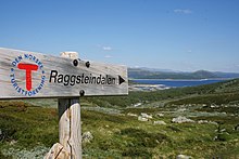 Signs are helpful and convenient, but no substitute for a map and compass. Raggsteindalen in Buskerud.
- It is easy to get lost at ridiculously short distances in unfamiliar terrain. Take a careful look even if you are going only for a minute. Dense forest, fog and open plateaus with no clear landmarks are the most difficult.
- Always take a map and compass with you when leaving the immediate vicinity of your camp (electronics is no substitute, only a supplement – instead of checking battery status you should create a good mental map). Learn to use a compass for navigation and learn to match your map with the terrain.
- If you do get lost, admit it and stop immediately. A few minutes of good rest is surprisingly effective at making you think clearly again. Lines in the terrain can be used to find way back, for instance rivers (rivers can lead you to settlements or to lakes and other points that can be identified on the map), power lines and slopes. But beware of slopes making you change direction and leading you only to a local depression, rivers leading you to hard-to-walk wet terrain, etc. Check the map for what lines are usable.
- Bugs และ สัตว์
- Mosquitoes and black flies are a nuisance in June and July, especially in Lapland and Finnmark. They do not carry diseases, but repellents, long sleeves, long pants and perhaps a mosquito hat in the worst areas are recommended. Avoid keeping doors and windows open in the evening.
- เห็บ can carry Lyme disease and TBE in some areas (especially south Norway to south-west Finland). The risk is small for a casual visitor, but you may want to take precautions.
- There are big predators like bears, wolves, lynxes and wolverines in the Nordic countries, but they are generally no threat to people, as they will flee in most circumstances once they smell or hear humans. Back out if you encounter bear cubs, as their mother will protect them. Also musk oxen, elks and boars can be dangerous if you go too close.
- If you are hiking in the hunting season (the autumn), in areas where hunting is allowed, you should wear some orange or red clothing. Ask for local advice about whether any areas should be avoided. Hunting season varies by species. Moose hunting is common in the forest areas of Sweden, Finland, East Norway and Trøndelag. Red deer hunting is common in West Norway. Reindeer hunting occurs mostly in the barren mountains.
- Be careful in sun
- Clear Nordic air, high altitude and snow patches can multiply the effect of the sun, which hardly sets during the Nordic summer. Snow blindness is a serious risk, so bring UV-resistant sunglasses, and preferably mountain goggles. Bring sun cream or sun block (sun protection factor). Light can be strong in the highlands even if the sun is not visible.
- Glaciers
 Do not go on your own. Jostedalsbreen glacier.
- Glaciers are one of the most dangerous places for visitors to the Norwegian outdoors. Never underestimate the power of the glacier. Observe warning signs. Never approach the front of the glacier. A glacier is not a stable piece of ice, it is constantly moving and huge chunks regularly fall off. Snowbridges can obscure crevasses.
- The sun's rays get reflected from the white snow, so it necessary to use sunscreen and sunglasses to protect your skin and eyes. Bring warm clothes for tours on the glacier.
- ทำ ไม่ enter a glacier without proper equipment and a skilled local guide.


Rules of mountain conduct
Norway's trekking association has compiled a set of rules or guidelines for sensible hiking, "fjellvettreglene":
- Don't go for a long hike without training.
- Tell where you are going.
- Respect weather and forecast
- Be prepared for storm and cold weather even on shorter hikes. Bring a rucksack with the kind of gear needed.
- Listen to experienced hikers.
- Dont hike alone.
- Use map and compass
- Turn back in time, it is nothing to be ashamed of.
- Don't waste your energy. Dig into snow if necessary.
Volcanic eruption

Out of the Nordic countries, Iceland is the only one with active volcanoes.
As a precautionary mesure carry a cell phone and a battery powered radio, and heed to warnings from the Icelandic civil protection about hazardous areas. Listen to either the radio station Rás 1 or Bylgjan. Rás 1 is on the LW frequencies 189 kHz and 207 kHz. For the FM frequencies see the frequency map of Ras และ frequencies of Bylgjan. Pay attention to any SMS messages you get, as the Icelandic civil protection does send out SMS messages in Icelandic and English to phones in hazardous areas.
Should an eruption occur the ash can spread throughout the whole country depending on the wind direction. Eruptions increase the chance of lightnings and a glacial eruption will generate n flood in rivers with sources at the melting glacier.
Regardless of where you are in the country during an eruption, consider the wind direction and consider whether the wind can spread the ash to you. As an alternative you can use the mobile website of the Icelandic met office. If so, walk high up in the landscape to avoid poisonous gases, cover your nostrils and mouth with a cloth. Should the ash get thick or if you have an asthma, go into the next day or wilderness hut, close windows on the side that the wind blows at, close the chimney and stay there until the wind direction changes.
Should you be in close proximity of an eruption walk opposite to the wind direction to get out of the area. If you have concerns that you cannot abandon a hazardous area in time, do not hesitate to call the emergency number 112.
เคารพ

Many people you meet on remote trails are there to be with nature only. They might not be interested in socializing and will probably frown upon noisy behaviour. It is common, though, to stop and exchange a few words, e.g. about the terrain ahead, and at least some kind of greeting is usually expected when you meet people on (or off) the trail. Some might of course be interested in where you come from. People are often less reserved with strangers when they are in the wilderness.
Smoking is disliked by many and can be a serious hazard. In hot and dry periods a cigarette butt can cause a forest fire (even if "extinguished"), so just like with other litter, avoid leaving them in nature. Smoking indoors is mostly prohibited. Where locals smoke you might follow their example, but otherwise try to be a good example yourself.
Even if there is right of access, wilderness is often privately owned. In Norway only barren high mountains are public (government) property. Trails and bridges are usually maintained by volunteers (the trekking association for instance) or by landowners for the visitors' benefit. โปรดทราบว่าคุณเป็นแขกบนที่ดินส่วนตัวของใครบางคน อาจมีสัตว์กินหญ้าและเกมใหญ่ที่ไม่ควรรบกวน อย่าทิ้งขยะไว้ข้างหลัง เป็นที่นิยมมากขึ้นในหมู่นักท่องเที่ยวในการสร้างกองหินในถิ่นทุรกันดาร ตามชายหาดที่เป็นหิน และบนทางผ่านภูเขา กองหินใช้สำหรับทำเครื่องหมายเส้นทางและในความเป็นจริงอาจทำให้เข้าใจผิดสำหรับนักปีนเขา ผู้เข้าชมที่สร้างแครนส์มักจะเลือกหินจากรั้วหิน ซึ่งบางส่วนเป็นมรดกทางวัฒนธรรมหรือใช้งานจริง การเปลี่ยนแปลงธรรมชาติเช่นนี้เป็นสิ่งผิดกฎหมาย แม้ว่าจะเป็นเพียงก้อนหินธรรมดาๆ ก็ตาม
การพิจารณาที่คล้ายกันนำไปใช้กับที่ดินสาธารณะ แลปแลนด์ส่วนใหญ่เป็นของรัฐบาลเนื่องจากชาวซามีไม่มีแนวคิดในการเป็นเจ้าของแบบเดียวกัน ผู้อยู่อาศัยต้องพึ่งพาถิ่นทุรกันดารราวกับว่าพวกเขาเป็นเจ้าของที่ดิน และในกรณีที่เงินของผู้เสียภาษีรักษาสิ่งอำนวยความสะดวกไว้ สิ่งเหล่านี้เป็นผลมาจากเจตจำนงร่วมกัน ซึ่งไม่ควรคำนึงถึงไม่น้อยไปกว่าการบริจาคของเอกชน
ชื่อสถานที่และคำที่มีประโยชน์
เนื่องจากชื่อบนแผนที่และป้ายต่างๆ มักบ่งบอกถึงภูมิประเทศ การทำความเข้าใจคำในภูมิประเทศบางคำจึงมีประโยชน์ หากคุณมีโอกาสศึกษาแผนที่ขนาดใหญ่ไว้ล่วงหน้า คุณอาจต้องการตรวจสอบความหมายของคำนำหน้าและคำต่อท้ายที่ใช้บ่อยที่สุด แต่บางส่วนได้แสดงไว้ที่นี่ พวกเขามักจะบอกสิ่งที่ไม่ชัดเจนจากแผนที่เกี่ยวกับคุณลักษณะภูมิประเทศหรือให้คำแนะนำเกี่ยวกับประวัติของพื้นที่
ในพื้นที่ Sami ชื่อสถานที่มักมีต้นกำเนิดจาก Sami และเมื่อสิ่งนี้ไม่ชัดเจน เช่น. เลมเมนโจกิ เดิมเป็น "แม่น้ำอุ่น" (จาก Sami: lemmi; ฟินแลนด์: lämmin) ไม่ใช่ "แม่น้ำแห่งความรัก" (ฟินแลนด์: lempi, lemmen) ลักษณะภูมิประเทศของพื้นที่มักถูกเรียกโดยคำภาษาซามิ (เช่น "jåkk" johkaแทนที่จะเป็นคำภาษาสวีเดนสำหรับสตรีม)
ภาษาที่เกี่ยวข้องใช้คำนามประสม โดยทั่วไปชื่อจะถูกสร้างขึ้นโดยใช้คำประสม โดยส่วนสุดท้ายระบุว่าเป็นคุณลักษณะแนวนอนแบบใด ตัวอย่างเช่น Jostedalsbreen เป็นชื่อที่สร้างขึ้นจาก Jostedal (Joste Valley) และ bre (ธารน้ำแข็ง) กล่าวอีกนัยหนึ่งคือธารน้ำแข็งที่ Jostedal บ่อยครั้งที่คำต่างๆ เป็นพหูพจน์และ/หรือสัมพันธการก ซึ่งปรับเปลี่ยนคำเล็กน้อย ในภาษาฟินแลนด์และซามีไม่ได้เล็กน้อยเกินไปเสมอไป
นอกจากนี้ ในภาษานอร์เวย์และสวีเดน บทความที่แน่นอน ("the") ปรากฏเป็นคำต่อท้ายซึ่งรวมอยู่ในคำนั้น ดังนั้น บรีน หมายถึง ธารน้ำแข็ง.
มีภาษา Sámi ที่แตกต่างกันสองสามภาษาและการสะกดการันต์ของพวกเขาได้รับมาตรฐานเมื่อไม่กี่ทศวรรษที่ผ่านมา ซึ่งหมายความว่ามีความแตกต่างในการสะกดคำโดยไม่ขึ้นกับว่าภาษาใดที่เกี่ยวข้อง
ตัวอักษรสวีเดน ä และ ö เขียนว่า æ และ ö ในภาษาไอซ์แลนด์ æ และ ø ในภาษานอร์เวย์ å เขียนด้วย o ในภาษาฟินแลนด์และภาษาซามีส่วนใหญ่ ภาษาสวีเดน ä มักจะออกเสียงใกล้เคียงกับ e และเขียนว่า e ในภาษานอร์เวย์ ในหลายกรณี การรับรู้ถึงความแตกต่างเหล่านี้และความแตกต่างที่เป็นระบบไม่มากก็น้อยในการสะกดหรือการออกเสียงจะช่วยให้เข้าใจคำที่คุณรู้จักจากภาษาอื่น เช่น joki/jåkk/jåkkå/johka ในพื้นที่ Sámi (การสะกดแบบฟินแลนด์ สวีเดน และซามี)
สวีเดนและนอร์เวย์

- kart/karta
- แผนที่
- fjell, fjäll
- ภูเขา ยอด ยอด (หมายถึงภูมิประเทศที่ทอดยาวเหนือแนวต้นไม้ อาจหมายถึง ยอดเฉพาะ หรือภูเขาโดยทั่วไป)
- vidde
- สูงเปิดที่ราบสูง (เหนือแนวต้นไม้)
- อินส์โจ, วานน์, วาท์น, เชอ
- ทะเลสาบ บ่อน้ำ
- tjärn, tjärn
- บ่อน้ำ ทะเลสาบเล็ก ธาร
- skog
- ป่า ป่า
- ไมร์, คาร์เร่
- โคลน บึง bo
.jpg/220px-Besseggen_Hike,_Norway_(14673663307).jpg)
- เอ่อ ตาลัสคอน
- หินกรวด เงินฝาก talus
- เบร/กลาเซียร์, ฟอนน์, สกาฟล
- ธารน้ำแข็ง กองหิมะ
- dal
- หุบเขา
- juv, kløft/klyfta, ราวิน
- หุบเขา หุบเขา หุบเขา,
- elv, bekk/älv, å, bäck
- แม่น้ำ ลำธาร ลำห้วย
- bro/bru, ซอมมาร์โบร, helårsbru
- สะพาน สะพานที่ถอนในฤดูหนาว สะพานตลอดปี
- vad
- ford
- สตูก้า/สตู, ไฮต์เท
- กระท่อม
- สำหรับฟอลเลน
- เน่าเปื่อย
- snaufjell / kalfjäll
- ภูเขาที่แห้งแล้ง
- เทรเกรนส์/trädgränsen
- แนวต้นไม้
- skyddsområde
- พื้นที่คุ้มครอง
- sti/stig
- เส้นทาง
- ruskmärkning
- เครื่องหมายในรูปแบบของกิ่งก้านในหิมะ
- øy/ö, โฮล์ม, สเกร์
- เกาะ เกาะเล็ก
- foss/fors, vattenfall
- น้ำตกแก่ง
ไอซ์แลนด์

- คอร์ท
- แผนที่
- ตก fjall
- ภูเขา
- heiði
- ที่ราบสูงเปิดสูง
- vatn tjörn
- ทะเลสาบ บ่อน้ำ
- มิริ
- โคลน บึง bo
- fjörður
- ฟยอร์ด อ่าว
- โจกุล
- ธารน้ำแข็ง
- ดาลูร์
- หุบเขา
- gjá gljúfur
- หุบเขา หุบเขา หุบเขา,
- á
- แม่น้ำ
- ฟอสซิล
- น้ำตก
- อีจา, สเกิร์ล
- เกาะ เกาะเล็ก
ภาษาฟินแลนด์และSámi
- kartta
- แผนที่
- vuori, tunturi/tuodtar, vaara / várri (várre, várrie, vaerie, vare)
- ภูเขา; vuori เป็นคำทั่วไปในภาษาฟินแลนด์ tunturi และ vaara do ตามลำดับไม่ขยายเกินแนวต้นไม้ – แต่ várri ในภาษา Sámi เป็นคำทั่วไปสำหรับเนินเขาหรือภูเขา (มักเกี่ยวกับที่สูงชัน) มัก "แปล" เป็น vaara; tunturi/duottarmailbmi ยังใช้เกี่ยวกับพื้นที่ทั้งหมดเหนือแนวต้นไม้ด้วย
- ไคซ่า/ไกซา; kero/tseärru; โอเอวี; kielas/gielas, kaita/skäidi; rova / roavvi
- ภูเขาในรูปแบบต่างๆ: ยอดเขาที่ปกคลุมด้วยหิมะสูง ภูเขารูปกองเหนือแนวต้นไม้ ภูเขากลมเหนือแนวต้นไม้ ("หัว"); สันเขา; เนินหินกับป่าโปร่ง
- ชอคกา (tjåhkkå, tjåhkka, tjahkke, tjåkkå)
- พีค ซัมมิท
- มากิ, คัลลิโอ, ฮาร์จู/ปูโอลด์ซา
- เนินเขา (เนินเขาของ) หินแข็ง esker
- skäidi, selkä/เซียลจิ
- สันเขา พื้นที่ลุ่มน้ำ (selkä ยังกว้างใหญ่ของทะเลหรือทะเลสาบขนาดใหญ่)/สันเขาที่มีต้นเบิร์ช ข้างภูเขา
- pahta/pahte
- เนินเขาสูงและชัน high
- järvi/jávri (jávrre, avrre, havrre, jávrrie, jaevrie, jävri, jäu'rr, jauri, jaure, jaur)
- ทะเลสาบ บ่อน้ำ
- vesi
- น้ำ มักหมายถึง "ทะเลสาบ" ในชื่อ
- ลาห์เด, คัลทิโอ/กัลดู
- ฤดูใบไม้ผลิ
- ลำปาง
- บ่อน้ำ ทะเลสาบเล็ก ธาร
- ละห์ตี/ลั่วตา (ลั่วตา, ลอกเต)
- อ่าว
- niemi/njárga (นจาร์กา, นจาร์กา)
- แหลม

- suo, rahka, räme, aapa/aaphe, jänkä/jeäggi, vuoma/vuobme
- โคลน, บึง; suo เป็นคำทั่วไป ส่วนคำอื่นๆ ต่างกัน vuoma/vuobmi ก็หุบเขาเช่นกัน
- ปัลสา
- กองน้ำแข็ง (ในโคลนหรือบึง)
- jaätikkö
- ธารน้ำแข็ง กองหิมะ
- laakso
- หุบเขา
- rotko, คุรุ/autsi, ävdzi, gorsa
- หุบเขา หุบเขา หุบเขา,
- joki/johka (jåhkå, juhka, johke, jåkkå, jåkk), eno/eädnu, ปูโร, oja/ája,
- แม่น้ำลำธารลำห้วย; joki/johka เป็นคำทั่วไป eno ค่อนข้างใหญ่ puro เล็ก oja tiny
- กะละมัง
- ford
- เมทซา; kuusikko, männikkö, koivikko เป็นต้น
- ป่า, ป่า; ไม้หลังของต้นไม้ชนิดต่างๆ (kuusi=spruce, mänty=pine, koivu=birch)
- ราชา
- ชายแดน จำกัด
- ปูราจา
- แนวต้นไม้
- ราชาวีโอไฮเกะ
- เขตชายแดน
- kuusimetsän ราชา
- (เหนือ) ขีด จำกัด สำหรับป่าโก้เก๋ ("kuusi")
- โพลคู เรตติ
- เส้นทาง
- mökki, pirtti, ทูปา; คามิ/แกมเม่
- กระท่อมกระท่อม; กระท่อมหญ้า
- สีดา
- หมู่บ้านหรือชุมชน Sámi

- seita/sieidi
- วิญญาณ วัตถุมงคล
- saari, luoto
- เกาะ เกาะเล็ก
- กอสกี นิวา เคิร์กคิโอ คอร์ทซี/กอร์ซเซgor
- แก่ง อันหลังสูงชันและเป็นหิน
- สุวันโต ซาวู
- น้ำนิ่ง (ใต้แก่ง)
- köngäs
- แก่งสูงชัน น้ำตกน้อย
- (vesi)putous
- น้ำตก
- latu (pl. ladut)/láhtu
- ลานสกี
เชื่อมต่อ

จดหมายหอยทาก
อาจมีกล่องจดหมายและแสตมป์ที่ร้านค้าและธุรกิจท่องเที่ยว แทนที่จะใช้ poste restante คุณอาจต้องการใช้ aเหมาะสม ที่อยู่ c/o ถามเกี่ยวกับการปฏิบัติในท้องถิ่น
โทรศัพท์
โดยทั่วไปมีความครอบคลุมโทรศัพท์มือถือที่ดีในประเทศนอร์ดิก แต่ไม่จำเป็นว่าคุณต้องการมันในที่ใด กระท่อมในถิ่นทุรกันดารบางแห่งมีโทรศัพท์สำหรับโทรฉุกเฉิน (ไม่มีในฟินแลนด์แล้ว แต่ในสวีเดนมีทั่วไป และควรใช้เพื่อบอกเกี่ยวกับความล่าช้าของคุณ และรับคำแนะนำหากจำเป็น ไม่ใช่แค่ในกรณีฉุกเฉิน)
ในภูมิประเทศที่เป็นภูเขามักจะไม่มีสัญญาณในหุบเขา ในพื้นที่ห่างไกลอาจไม่มีสัญญาณใด ๆ ยกเว้นบนยอดที่ตกลงมา คุณอาจต้องการทดสอบบริการอินเทอร์เน็ตที่สำคัญด้วยการเชื่อมต่อความเร็วต่ำ (แม้กระทั่ง 9600 บิต/วินาที) ล่วงหน้า มีบริการสภาพอากาศ SMS 3G เคยมีให้บริการเฉพาะใกล้กับเมืองใหญ่และรีสอร์ทท่องเที่ยวที่สำคัญและตามถนนสายหลักบางสาย แต่ตอนนี้มีให้บริการในฟินแลนด์แล้ว แม้แต่ในพื้นที่รกร้างว่างเปล่าส่วนใหญ่
ความครอบคลุมแตกต่างกันไปตามผู้ให้บริการรายอื่น หากคุณมีโทรศัพท์ (ซิมการ์ด) มากกว่าหนึ่งเครื่องในบริษัท คุณอาจต้องการมีผู้ให้บริการที่แตกต่างกัน โปรดทราบว่าสัญญาณที่ดีที่สุดอาจมาจากประเทศเพื่อนบ้าน ดังนั้นคุณอาจต้องจ่ายค่าโทรต่างประเทศแม้จะใช้ซิมการ์ดในประเทศ หากคุณให้โทรศัพท์เลือกผู้ให้บริการ
ในกรณีที่สัญญาณไม่ดี อย่าพยายามโทรออก แต่ใช้ SMS: ข้อความต้องการสัญญาณเพียงไม่กี่วินาที และจะทำให้ทั้งเชื่อถือได้มากขึ้นและใช้พลังงานน้อยลง
ทำให้โทรศัพท์ของคุณแห้ง จำไว้ว่าแบตเตอรี่ถูกใช้เร็วกว่ามากเมื่อมีสัญญาณไม่ดี ให้โทรศัพท์ของคุณปิดเกือบตลอดเวลา ไฟฟ้ามักจะไม่มีให้บริการในเขตทุรกันดาร ไม่จำเป็นแม้แต่ในกระท่อมและบ้านเรือน
โทรฉุกเฉิน
หมายเลขฉุกเฉิน 112 ทำงานในประเทศนอร์ดิกทั้งหมด อาจมีตัวเลขพิเศษสำหรับเหตุฉุกเฉินบางอย่าง แต่ ☏112 สามารถจัดการได้ทั้งหมด การโทรไปที่ 112 นั้นฟรีและใช้งานได้โดยไม่ต้องคำนึงถึงการล็อคในโทรศัพท์ส่วนใหญ่ เพียงพิมพ์หมายเลขหรือใช้ปุ่มฉุกเฉิน (ในสมาร์ทโฟนบางรุ่น) ที่จริงแล้ว ในบางกรณีคุณอาจต้องการถอดซิมการ์ดออกเพื่อให้แน่ใจว่าโทรศัพท์ใช้การเชื่อมต่อที่ดีที่สุด น่าเศร้าที่ 112 ของสวีเดนจะพักสายแบบไม่ใช้ซิมจนกว่าคุณจะกด "5" ในฟินแลนด์ สายดังกล่าวจะถูกพักไว้ประมาณครึ่งนาทีก่อนที่จะรับสาย
สำหรับ โทรศัพท์ดาวเทียม หมายเลขบริการฉุกเฉินคือ ☏ 46 63-107-112 (สวีเดน), 358 9 2355-0545 (ฟินแลนด์), 354 809-0112 (เช็คไอซ์แลนด์!). ดาวเทียม Inmarsat-14 อยู่เหนือขอบฟ้าทางใต้เพียง 15 องศา ดังนั้นจึงบล็อกได้ง่ายโดยภูมิประเทศที่สูงขึ้นหรือสิ่งกีดขวางอื่นๆ อิริเดียมไม่มีปัญหานี้
อย่าลังเลที่จะแจ้งบริการฉุกเฉินเกี่ยวกับปัญหาที่อาจนำไปสู่เหตุฉุกเฉิน อย่าลืมโทรหาพวกเขาเพื่อบอกว่าคุณปลอดภัย และเช่นเดียวกันเมื่อคุณมาสายและอาจมีคนโทรมาเพื่อเริ่มปฏิบัติการกู้ภัย ค่าใช้จ่ายเป็นตัวเลขห้าหลักอย่างง่าย - ในสกุลเงินยูโรต่อชั่วโมง (โดยปกติจ่ายด้วยเงินผู้เสียภาษี แต่คุณไม่ต้องการใช้ระบบในทางที่ผิด)
ตำแหน่งอาจบอกได้ดีที่สุดตามพิกัด ETRS89/WGS84 (ตรวจสอบล่วงหน้าว่าเป็นสิ่งที่ใช้บนแผนที่ของคุณหรือไม่) นอกจากนี้ยังสามารถใช้ทิศทางและระยะทางจากตำแหน่งที่รู้จักกันดีหรือระบบพิกัดใดๆ บนแผนที่ของคุณได้อีกด้วย บอกชื่อใกล้ตำแหน่งด้วย เพื่อหลีกเลี่ยงความผิดพลาด โปรดทราบว่าทั้งระบบ 360° และหลายล้านไมล์ (60, 63 หรือ 64 เฮกโตมิลสำหรับวงกลม) ถูกใช้บนวงเวียนและบางชื่อ เช่น ไอลิกัส ("ตกศักดิ์สิทธิ์") มีความคลุมเครือ ในฟินแลนด์ บริการฉุกเฉินอาจขอเทศบาลและที่อยู่ (ให้บริการในพื้นที่ขนาดใหญ่) แต่จะสมเหตุสมผลเมื่อคุณบอกพวกเขาว่าคุณไม่รู้
เนวิเกเตอร์ดาวเทียม (GPS ฯลฯ มักรวมอยู่ในสมาร์ทโฟน บางครั้งในกล้อง) ใช้พลังงานค่อนข้างมาก ดังนั้นจึงควรปิดไว้เกือบตลอดเวลา แต่มักจะให้พิกัดที่แม่นยำในกรณีฉุกเฉินได้ ต้องใช้เวลาพอสมควรในการค้นหาดาวเทียม และอาจให้พิกัดผิดไปจนกว่าจะถึงเวลานั้น ตรวจสอบว่าคุณเข้าใจการตั้งค่าและพฤติกรรมของพวกเขา
รับมือ
ของเสีย
มักจะมีถังขยะตามกระท่อม ที่พักพิง และสถานที่แคมป์ไฟ โดยเฉพาะบริเวณที่ไม่มีถนน คุณควรหลีกเลี่ยงการใช้สิ่งเหล่านี้ และเก็บสัมภาระแทน การล้างถังขยะในเขตทุรกันดารหมายถึงการจราจรที่ไม่จำเป็นและมีค่าใช้จ่ายสูง ไม่ควรทิ้งเศษอาหารและสิ่งที่คล้ายคลึงกันในถังขยะ เว้นแต่คุณจะรู้ว่าจะเททิ้งในไม่ช้า ขยะอินทรีย์จำนวนเล็กน้อย เช่น เศษอาหาร สามารถใส่ลงในโถส้วมแบบหลุมได้ (และโถสุขภัณฑ์ที่ใช้ปุ๋ยหมักขั้นสูง) มีเครื่องหมักแยกต่างหากในบางสถานที่ ที่จุดรีไซเคิลกระดาษ โลหะและแก้วอาจได้รับการดูแลแยกจากกัน ขยะอินทรีย์นอกเส้นทางสามารถฝังได้หากต้องการ แต่โดยเฉพาะอย่างยิ่งในพรุและเหนือแนวต้นไม้ การย่อยสลายอาจใช้เวลาหลายปี กระดาษบริสุทธิ์สามารถเผาในแคมป์ไฟและเตาได้ แต่ควรบรรจุกระดาษที่หุ้มด้วยโลหะหรือพลาสติก ไม่ทิ้งขยะให้ผู้อื่นเผา
ห้องน้ำ
ตามทางเดินจะมีห้องสุขาในกระท่อมและบ่อยครั้งที่ที่พักพิงและจุดแคมป์ไฟ โดยปกติแล้วจะเพียงพอสำหรับความต้องการที่ใหญ่กว่าของคุณหากคุณใช้บริการเหล่านั้น โดยปกติแล้วจะเป็นห้องส้วมแบบแห้ง: โรงเรือนที่มีรูบนม้านั่งและถังที่มีพีท ขี้เลื่อย หรือสิ่งที่คล้ายกันสำหรับคลุมอุจจาระของคุณ คุณอาจต้องใช้กระดาษชำระของคุณเอง การล้างมือมักเป็นปัญหาของคุณเอง (อย่าทำต้นน้ำจากจุดที่ผู้คนเอาน้ำดื่มไป หรือใกล้กับถังน้ำดื่ม) นอกเส้นทางและระหว่างกระท่อม คำแนะนำของ แคมป์ปิ้งไร้ร่องรอย สามารถติดตามได้
ซักผ้า
ในหลายพื้นที่ของประเทศมีลำธารและทะเลสาบหรือชายทะเลเป็นจำนวนมาก ดังนั้นการหาน้ำเพื่อล้างตัวเองจึงไม่ค่อยเป็นปัญหา แต่โดยเฉพาะอย่างยิ่งในภาคเหนือ และยกเว้นในเดือนกรกฎาคม-สิงหาคม ส่วนใหญ่จะค่อนข้างเย็น แค่พาตัวเองไปที่นั่นหรือใช้ห้องซาวน่า สำหรับการล้างมือ คุณสามารถอุ่นน้ำปริมาณเล็กน้อยบนเตาได้ แต่น้ำเย็นมักจะเพียงพอ ในหลาย ๆ ที่ คุณควรหลีกเลี่ยงไม่ให้สิ่งสกปรกหรือสบู่ตกลงไปในทะเลสาบหรือแม่น้ำ โดยส่วนใหญ่ล้างบนบก น้ำทะเลในทะเลบอลติกไม่เค็มเกินไปและไม่ค่อยพบในฟยอร์ด
โดยทั่วไปแล้วห้องอาบน้ำจะไม่มีให้บริการในกระท่อมที่รกร้างว่างเปล่า แต่อาจมีให้ในกระท่อมบางแห่งและที่ตั้งแคมป์จริงหากคุณพบเห็น แทนที่จะใช้ห้องซาวน่าซึ่งมีอยู่ในกระท่อมและกระท่อมค่อนข้างมาก สำหรับ ซาวน่า ขั้นตอน ดูบทความนั้น (เมื่อไม่ได้อยู่ในฟินแลนด์ ให้ตรวจสอบว่าพฤติกรรมที่คาดไว้แตกต่างกันหรือไม่) แต่การซักที่เหมาะสมมักจะเกิดจากการผสมน้ำร้อนและน้ำเย็นในอ่างแล้วใช้สิ่งนั้น ผสมชุดใหม่หรือสองชุดสำหรับล้าง