ขับรถเที่ยว นอร์เวย์ นำคุณไปยังสถานที่ต่างๆ นอกเมืองและที่ที่มีการขนส่งสาธารณะจำกัดหรือไม่บ่อย นี่เป็นวิธีที่ดีในการเดินทางหากคุณสนใจที่จะชมทิวทัศน์ธรรมชาติของนอร์เวย์ การจราจรปลอดภัย ความเร็วปานกลาง และถนนส่วนใหญ่มีการจราจรน้อย คนขับควรเผื่อเวลาให้เพียงพอสำหรับการขับรถและแวะเที่ยวชมสถานที่บ่อยๆ ทางไกลโดยเฉพาะทางใต้-เหนือ และผ่านทางสลับซับซ้อน ภูมิทัศน์ฟยอร์ดหมายความว่าการขับรถต้องใช้เวลา ไดรฟ์เช่นตลอดขอบเขตของ ถนน E6ซึ่งเป็นถนนสายหลักของนอร์เวย์ ใช้เวลาประมาณหนึ่งสัปดาห์เต็ม
เข้าใจ


สถานที่ท่องเที่ยวชั้นนำของนอร์เวย์อยู่นอกเมืองหลักซึ่งมีการขนส่งสาธารณะจำกัด การขับรถด้วยตนเองช่วยให้ผู้เยี่ยมชมมีความยืดหยุ่นในการหยุดรถได้ตามต้องการ เยี่ยมชมสถานที่ที่มีผู้คนพลุกพล่านน้อยลง เปลี่ยนแผนงาน และเยี่ยมชมถนนที่มีทิวทัศน์ห่างไกลซึ่งมีการขนส่งสาธารณะจำกัดหรือไม่มีเลย ภูมิประเทศที่ขรุขระที่เปลี่ยนแปลงตลอดเวลา ซึ่งเป็นสถานที่ท่องเที่ยวชั้นนำของนอร์เวย์ มีประสบการณ์ที่ดีที่สุดโดยการเคลื่อนที่ไปรอบๆ อย่างสบายๆ สถานที่ท่องเที่ยวทางธรรมชาติโดยทั่วไปไม่จำกัดเฉพาะสถานที่ แม้ว่าบางเมืองจะเป็นที่รู้จักกันอย่างแพร่หลายว่าเป็นท่าเรือสำราญ แต่พื้นที่อื่นๆ ก็สวยไม่แพ้กัน ถนนส่วนใหญ่ให้ทัศนียภาพที่ดีหรือยอดเยี่ยมของภูมิทัศน์โดยรอบผ่านกระจกรถ มีมอเตอร์เวย์ไม่กี่เส้น และถนนส่วนใหญ่เป็นแบบสองเลนธรรมดาที่ไม่มีการแบ่งแยก ซึ่งใครๆ ก็รถมาเพื่อพักรถได้ง่ายๆ ในช่วงฤดูร้อนจะมีแสงแดดส่องถึงเกือบ 24 ชั่วโมงในทุกที่ และในตอนเหนือดวงอาทิตย์ไม่เคยตก ทำให้นักท่องเที่ยวสามารถขับรถเที่ยวชมสถานที่ได้ตลอดเวลา
นอร์เวย์กว้างกว่าสหราชอาณาจักรและมีพื้นที่ใกล้เคียงกับเยอรมนี แต่ระยะทางระหว่างเหนือและใต้นั้นยาวกว่ามาก Finnmarkพื้นที่ทางเหนือสุดของนอร์เวย์นั้นกว้างกว่าเดนมาร์ก และการขับรถผ่าน Finnmark นั้นยาวกว่าลอนดอนไปยังกลาสโกว์ E6ถนนสายหลักของนอร์เวย์มีระยะทางมากกว่า 2600 กม. และเป็นถนนที่ยาวที่สุดในประเทศเดียวในยุโรป ยกเว้นรัสเซีย ในช่วงวันหยุดปกติในนอร์เวย์ มักจะมีเวลาขับรถไปรอบๆ ส่วนหนึ่งของนอร์เวย์เท่านั้น
เช่นเดียวกับในยุโรปส่วนใหญ่ นอร์เวย์ขับรถชิดขวา รถยนต์ส่วนใหญ่ในนอร์เวย์มักจะมีเกียร์ธรรมดา ("คันเกียร์") หลังจากปี 2015 มีการเปลี่ยนแปลงอย่างรวดเร็วในรถยนต์ไฟฟ้าและรถยนต์ที่มีระบบรองรับคนขับด้วยคอมพิวเตอร์และระบบเกียร์อัตโนมัติ ในปี 2020 รถยนต์ใหม่แทบทุกคันมีเกียร์อัตโนมัติ ประมาณ 10% ของรถยนต์ทั้งหมดในปี 2020 ใช้แบตเตอรี่ บริษัทให้เช่าอาจยังคงจัดสรรรถเกียร์ธรรมดา เว้นแต่คุณจะขอรถอัตโนมัติโดยเฉพาะเมื่อคุณทำการจอง ถนนส่วนใหญ่เป็นแบบสองเลนไม่มีการแบ่งแยก และมีเครือข่ายมอเตอร์เวย์จำกัดรอบออสโล ขีดจำกัดความเร็วทั่วไปคือ 80 กม./ชม. และความเร็วมักจะช้าลงเนื่องจากสภาพถนน
รถยนต์จะพาคุณไปยังมุมที่ห่างไกลโดยไม่มีทางรถไฟและด้วยระบบขนส่งสาธารณะที่จำกัด แต่โดยทั่วไปแล้วไม่จำเป็นต้องใช้รถยนต์ภายในเมืองหลัก ที่จอดรถเป็นสิ่งที่ท้าทายในเมืองหลักและอาจมีราคาแพง นอร์เวย์มีเส้นทางขับรถชมวิวหลากหลายรูปแบบ และเจ้าหน้าที่ดูแลถนนได้เลือก เส้นทางท่องเที่ยวแห่งชาติ ที่แนะนำเป็นพิเศษ ตลอดเส้นทางเหล่านี้มีการติดตั้งสิ่งอำนวยความสะดวกเพื่อให้การเดินทางสนุกสนานและเป็นประโยชน์สำหรับผู้มาเยือน

น้ำมันเบนซิน (เบนซิน) ถูกเก็บภาษีอย่างหนักและมีราคาแพง นอร์เวย์ใช้ระบบเมตริกและเซลเซียส (ไม่ทราบไมล์ แกลลอน และฟาเรนไฮต์) มีถนนเก็บค่าผ่านทางบางสาย โดยเฉพาะอย่างยิ่งเมื่อเข้าสู่เมืองหลัก ค่าผ่านทางโดยทั่วไปเป็นเพียงเศษเสี้ยวของค่าใช้จ่ายทั้งหมดในการเดินทางโดยรถยนต์
การขับขี่โดยทั่วไปเป็นเรื่องง่ายเนื่องจากการจราจรสงบ และผู้ขับขี่ส่วนใหญ่มีวินัยและปฏิบัติตามกฎหมาย แม้ว่าการใช้ความเร็วปานกลางจะเป็นเรื่องปกติบนทางหลวง อย่างไรก็ตาม ใจกลางเมืองบางแห่ง (เช่น เบอร์เกนและออสโล) อาจทำให้สับสนในการนำทางสำหรับผู้เข้าชมครั้งแรก เนื่องจากมีถนนเดินรถทางเดียวหลายสาย การจราจรไม่ค่อยหนาแน่น ส่วนใหญ่ในช่วง 'ชั่วโมงเร่งด่วน' ประมาณ ออสโล (ถนน E18 และ E6) เช่นเดียวกับช่วงบ่ายวันศุกร์ที่ออกจากออสโล ช่วงวันหยุดอีสเตอร์ การจราจรนอกเมืองมักจะเบาบางแม้บนถนนสายหลัก ในสถานที่ยอดนิยมบางแห่งเช่น Geiranger ถนนแคบๆ ในช่วงเวลากลางวันยังคงมีการจราจรหนาแน่น
ในบางส่วนของนอร์เวย์ ปั๊มน้ำมันถัดไปอาจอยู่ห่างออกไปมากกว่า 100 กม. หมู่บ้านเล็กๆ มักไม่มีปั๊มน้ำมัน แม้ว่าจะตั้งอยู่ห่างไกลก็ตาม เติมถังให้ทันเวลาและพิจารณานำเจอร์รี่กระป๋องไปด้วยเมื่อเดินทางในพื้นที่เหนือสุดที่มีประชากรเบาบาง
นอร์เวย์มีฤดูหนาวที่ยาวนานและถนนหลายสายถูกปกคลุมด้วยน้ำแข็งหรือหิมะที่แข็งเป็นเวลาหลายเดือน ในขณะที่การจราจรส่วนใหญ่ไม่มีสะดุด ตามถนนสายหลักหลายสาย อุณหภูมิจะลดลงถึง -20 °C หรือ -30 °C นักท่องเที่ยวที่เดินทางเข้านอร์เวย์โดยรถยนต์ระหว่างเดือนตุลาคมถึงปลายเดือนเมษายนควรเตรียมพร้อม ผู้เข้าชมไม่ควรประมาทความยากลำบากในการขับขี่ในฤดูหนาว ถนนสายหลักในฤดูหนาวแต่ละสายจะถูกปิดกั้นเป็นเวลาหลายชั่วโมงโดยผู้ขับขี่ชาวต่างชาติที่ไม่มีทักษะและอุปกรณ์เพียงพอในการขับขี่บนหิมะและน้ำแข็ง ตำรวจและเจ้าหน้าที่ดูแลถนนในฤดูหนาวแต่ละแห่งปฏิเสธการเข้าถึงถนนของนอร์เวย์สำหรับผู้ขับขี่ต่างชาติจำนวนมากที่ไม่ได้เตรียมการ
ถนนนอร์เวย์ มีคุณภาพแตกต่างกัน ถนนสายหลักคือทางหลวงยุโรปที่มีตัว "E" อยู่ข้างหน้าหมายเลข ตัวอย่างเช่น E6 เป็นทางเดินหลักเหนือ-ใต้ จากสวีเดน ผ่านออสโล ถึง คีร์เคเนส ทางตะวันออกเฉียงเหนือของนอร์เวย์ตอนเหนือ ดูสิ่งนี้ด้วย E6 ผ่านสวีเดนและนอร์เวย์. ทางหลวงยุโรปเชื่อมต่อเมือง ภูมิภาค และประเทศต่างๆ E18 เชื่อมต่อ Kristiansand และเมืองต่างๆ ทางใต้ของนอร์เวย์กับออสโลและสวีเดน E16 เชื่อมต่อเบอร์เกนกับออสโล (ผ่าน Flåm และ Voss) ถนน 7 เป็นเส้นทางอื่นไปยังเบอร์เกน (ผ่าน Hardangervidda) E39 เป็นถนนสายหลักริมชายฝั่งจาก Kristiansand ผ่าน Stavanger, Bergen และ Ålesund ถึง Trondheim E-roads นั้นยอดเยี่ยมสำหรับการนำทาง ถนนสายหลักอื่นๆ (ทางหลวงแผ่นดิน "riksvei") มีตัวเลขหนึ่งหรือสองหลักต่ำ ที่สำคัญที่สุดคือตัวเลขสีขาวบนพื้นหลังสีเขียว (ตรงข้ามกับสีดำบนพื้นขาวสำหรับทางหลวงส่วนใหญ่) อย่างไรก็ตาม โปรดทราบว่าความสำคัญของถนนไม่ได้บ่งบอกถึงคุณภาพ แม้แต่ E ก็อาจมีส่วนที่แคบและช้า มอเตอร์เวย์ของนอร์เวย์ส่วนใหญ่ใช้ E6 และ E18 แต่ E6 มีมอเตอร์เวย์น้อยกว่า 10% ในขณะที่ E18 มีทางด่วนเกือบ 50%
แผ่นยางมะตอยบนถนนในนอร์เวย์มักจะมีความหยาบและไม่ลื่นมากเมื่อเปียกน้ำ เช่นเดียวกับในประเทศอื่นๆ บางประเทศ อย่างไรก็ตาม โปรดทราบว่ายางฤดูหนาวแบบเรียงรายมักจะกินยางมะตอยในฤดูหนาว โดยทิ้งร่องลึก (หรือร่อง) ซึ่งจะทำให้รถไม่นิ่งโดยเฉพาะอย่างยิ่งในความเร็วสูง และหากเต็มไปด้วยน้ำ ยางอาจลอยอยู่บนน้ำทำให้ควบคุมรถได้ยาก (ราวกับว่าขับบนน้ำแข็งหรือหิมะ) เมื่อขับลงเนินบนถนนที่สูงชัน ควรใช้เกียร์ต่ำและปล่อยให้เครื่องยนต์ควบคุมความเร็ว เบรกอาจร้อนจัดจนทำให้น้ำมันเบรกเดือด

- ข้อผิดพลาดทั่วไป ได้แก่
- ขับรถโดยปิดไฟหน้าในช่วงเวลากลางวัน (จำเป็นต้องไฟหน้า)
- ขับรถชิดรถคันข้างหน้าเกินไป (ขั้นต่ำ 3 วินาที มากขึ้นในฤดูหนาว)
- ชะลอตัวลงมากเกินไปในอุโมงค์
- ประเมินระยะทางและเวลาขับรถต่ำเกินไป
- พยายามปกปิดมากเกินไปในเวลาจำกัด
- เบรกร้อนเกินไปในการลงทางยาว
- วิ่งจากจุดหนึ่งไปยังอีกจุดหนึ่ง (การขับรถให้ทัศนียภาพที่เปลี่ยนแปลงตลอดเวลา)
ระยะทาง
ผู้เข้าชมมักดูถูกดูแคลน ระยะทางและระยะเวลาในการขับขี่ ในภูมิประเทศของนอร์เวย์ ในหลายพื้นที่ของนอร์เวย์ นักท่องเที่ยวไม่ควรคาดหวังว่าจะทำเกิน 60 กม./ชม. โดยเฉลี่ย (หนึ่งนาทีต่อกิโลเมตร) บริการแผนที่ออนไลน์และระบบนำทางด้วยดาวเทียม (GPS) มักจะประเมินเวลาการขับขี่ต่ำเกินไป (ในขณะที่กิโลเมตรมีความแม่นยำ) ควรเพิ่มเวลาสำหรับการข้ามฟาก เรือพัก และช่วงถ่ายภาพเป็นเวลาโดยประมาณที่แนะนำไว้ที่นี่ ระยะทางที่สำคัญโดยรถยนต์:
| จากไป | ถนนสายสำคัญ | กิโลเมตร | เวลาที่ต้องการ | หมายเหตุ |
|---|---|---|---|---|
| ออสโล–นอร์ดคัป | 2200 | เน็ต 35 ชม ≈ 1 สัปดาห์ รวมการนอน | เรือเฟอร์รี่ | |
| ออสโล–โบเดอ | 1200 | เน็ต 20 ชม 3 วันรวมการนอน | ||
| ออสโล–แบร์เกน | 500 | 8 ชั่วโมง | ||
| ออสโล–คริสเตียนแซนด์ | 320 | 4 ชั่วโมง | ||
| ออสโล–สตาวังเงร์ | 540 | 8 ชั่วโมง | ||
| ออสโล–ทรอนด์เฮม | 500 | 8 ชั่วโมง | ||
| ทรอนด์เฮม–โบเดอ | 700 | 12 ชั่วโมง | ||
| ออสโล–ไกแรนเจอร์ | 450 | 7 ชั่วโมง | ||
| ออสโล–ฟลอม | 350 | 5 ชั่วโมง | ||
| โบเดอ–ทรอมเซอ | 600 | 10 ชั่วโมง | เรือเฟอร์รี่ | |
| Bodø–Nordkapp | 1050 | 16 ชั่วโมง (2 วัน) | เรือเฟอร์รี่ | |
| แบร์เกน–ไกแรนเจอร์ | 400 | 7 ชั่วโมง | เรือข้ามฟาก | |
| แบร์เกน–ฟลอม | 170 | 3 ชั่วโมง | ||
| แบร์เกน–คริสเตียนแซนด์ | 470 | 8 ชั่วโมง | เรือเฟอร์รี่ | |
| โอเลซุนด์–ทรอนด์เฮม | 300 | 6 ชั่วโมง | เรือข้ามฟาก |
ปิดรับฤดูหนาว
ทางผ่านภูเขาบางแห่ง รวมถึงถนนยอดนิยมรอบๆ Geiranger จะปิดโดยสิ้นเชิงในช่วงฤดูหนาว (โดยทั่วไปคือเดือนพฤศจิกายนถึงพฤษภาคม) ถนนบนภูเขาสายอื่นๆ อาจถูกปิดในช่วงเวลาสั้นๆ (หลายวันหรือเพียงคืนเดียว) ในช่วงที่สภาพอากาศเลวร้าย โดยทั่วไปแล้วถนนจะปิดเฉพาะทางผ่านภูเขาเท่านั้น (ระหว่างการตั้งถิ่นฐานถาวร) เวลาปิดทำการอาจแตกต่างกันไปขึ้นอยู่กับสภาพอากาศและหิมะที่เหลืออยู่ในฤดูหนาว
| ถนน | มาตรา | ปิดเดือน (ปกติ) |
|---|---|---|
| สการ์สวาก–Nordkappk (แหลมเหนือ) | ตุลาคม–เมษายน (เปิดเป็นครั้งคราว) | |
| Gaularfjell | ธันวาคม–พฤษภาคม | |
| ถนน 51 | Valdresflya | ธันวาคม–เมษายน |
| ถนน 55 | ซอกเนฟเยล | พฤศจิกายน–พฤษภาคม |
| ถนน 63 | Geiranger–หลังวัฒนะ | พฤศจิกายน–พฤษภาคม |
| ถนน 63 | โทรลสติเกน | ตุลาคม–พฤษภาคม |
| ถนน 243 | Aurland–แลร์ดาล (บัตรผ่านภูเขา Aurland) | พฤศจิกายน–มิถุนายน |
| ถนน 252 | Tyin–Eidsbugarden | ตุลาคม–มิถุนายน |
| ถนน 258 | กัมเล่ สตรีเนฟเยลส์เวก (ถนน Stynefjell เก่า) | ตุลาคม–มิถุนายน |
| ถนน 337 | บรอกเก้–ซูเลสการ์ด (อักเดอร์) | พฤศจิกายน–พฤษภาคม |
| ถนน 341 | Smelror–แฮมนิงส์เบิร์ก | พฤศจิกายน–พฤษภาคม |
| ถนน 355 | Melfjellet | พฤศจิกายน–พฤษภาคม |
| ถนน 520 | Hellandsbygd–Røldal | พฤศจิกายน–มิถุนายน |
| ถนน 886 | Vintervollen–Grense Jacobselv (จาร์ฟยอร์ดฟเยเลต์) | พฤศจิกายน–พฤษภาคม |
เรือข้ามฟาก


ขณะนี้มีท่าเรือข้ามฟากมากกว่า 100 แห่งบนถนนสาธารณะในนอร์เวย์ เรือข้ามฟากรถยนต์เหล่านี้เป็นส่วนหนึ่งของระบบถนน เช่น การข้ามฟากรวมอยู่ในหมายเลขถนนและถนนที่นำไปสู่ท่าเรือ ท่าเรือข้ามฟากมักตั้งอยู่ในพื้นที่ห่างไกล ณ จุดข้ามที่สั้นที่สุด เรือข้ามฟากรถยนต์ดำเนินการโดยบริษัทเอกชนในนามของหน่วยงานด้านถนนแห่งชาติ ราคาจะถูกควบคุมโดยกรมการขนส่งและอาจเป็น 50–300 kr สำหรับรถยนต์ ขึ้นอยู่กับความยาวของเส้นทาง แต่สองเท่าหรือมากกว่าสำหรับรถบ้าน เรือข้ามฟากบนถนนสายหลักออกทุกๆชั่วโมงในเวลากลางวัน 2 หรือ 3 ครั้ง น้อยกว่าในตอนเย็น เรือข้ามฟากสำคัญบางลำวิ่งข้ามคืน บางลำให้บริการจนถึง 23:00 น. หรือ 24:00 น. (23:00 น. หรือเที่ยงคืน) การข้ามมักใช้เวลา 10-30 นาทีเท่านั้น โดยทั่วไปไม่สามารถจองรถส่วนตัวได้ และไม่จำเป็น รถมาถึงท่าเรือและเข้าแถวตามลำดับก่อนหลัง เรือข้ามฟากมักจะมีความจุเพียงพอสำหรับรับรถที่รอทั้งหมด ในบางครั้งผู้เดินทางต้องรอการออกเดินทางครั้งต่อไป ขอแนะนำให้นักท่องเที่ยวเพิ่มเวลาสำหรับเรือข้ามฟากในการวางแผน เรือข้ามฟากมักจะปรากฏบนแผนที่เป็นเส้นประทั่วฟยอร์ด โดยทั่วไปแล้วไม่สามารถหลีกเลี่ยงเรือข้ามฟากได้หรือสามารถหลีกเลี่ยงได้เฉพาะทางอ้อม (มาก) เท่านั้น สำหรับนักท่องเที่ยวที่เดินทางมาพักผ่อน เรือข้ามฟากจะเพิ่มประสบการณ์ในการหยุดพักอย่างสงบและการเดินทางข้ามฟยอร์ดที่น่ารื่นรมย์ เรือข้ามฟากส่วนใหญ่จะวิ่งเล่นในน่านน้ำที่มีกำบังและไม่ได้รับผลกระทบจากคลื่นทะเล เรือข้ามฟากมักจะมีโรงอาหารบนเรือที่ให้บริการกาแฟและของว่าง และในบางกรณีอาจมีอาหารเย็นเต็มจำนวน
ถนน

การจำแนกประเภทเครือข่ายถนน:
- ทางอิเล็กทรอนิกส์. ถนนที่มีหมายเลขเป็นส่วนหนึ่งของเครือข่าย E-road ระหว่างประเทศ ไม่มีหมายเลขประเทศ นอกจากนี้ ป้ายจะเป็นสีขาวบนพื้นเขียว:

- ถนนแห่งชาติ. ถนนสายหลักอื่นๆ ("ถนนสีเขียว") นอกเหนือจากถนน E มีป้ายสีขาวบนพื้นเขียว:

- ถนนหมายเลข. ถนนหมายเลขภูมิภาค (แสดงบนป้ายถนน) ป้ายสีดำบนพื้นขาว:

- ถนนสายอื่นๆ. ถนนส่วนภูมิภาคและท้องถิ่น
โปรดทราบว่าระบบนี้ไม่ได้ระบุถึงคุณภาพของถนนเสมอไป ไม่มีคำนำหน้าหรือระบบการนับสำหรับทางหลวงพิเศษ ตัวเลขเป็นหลักสำหรับการนำทาง และการนำทางนอกเมืองด้วยตัวเลขมีความน่าเชื่อถือมากกว่าการนำทางด้วยดาวเทียม (GPS) และบริการแผนที่ออนไลน์ เนื่องจากบางครั้งอาจแนะนำเส้นทางที่ไร้สาระ ตัวอย่างเช่น E6 ถูกสร้างขึ้นเป็นมอเตอร์เวย์จริงเพียงบางกิโลเมตรทางเหนือและใต้ของออสโล ไกลออกไปทางเหนือเป็นกึ่งมอเตอร์เวย์ จากนั้นจะเปลี่ยนเป็นสองเลนธรรมดาที่ไม่มีการแบ่งแยก ผู้เข้าชมควรเชื่อถือหมายเลขถนนมากกว่าระบบนำทางด้วยดาวเทียม (GPS) ถนนสายตะวันออก-ตะวันตกจะมีตัวเลขคู่ (เช่น E10) ในขณะที่ถนนสายตะวันออกเฉียงเหนือมีตัวเลขคี่ (เช่น E39) E6 ซึ่งเป็นถนนสายหลักทางใต้-เหนือของนอร์เวย์เป็นข้อยกเว้นสำหรับกฎนี้ โปรดทราบด้วยว่าหมายเลขถนนอาจทับซ้อนกัน เช่น ถนนที่ทอดยาวอาจเป็นทั้ง E134 และถนน 13
.svg/180px-Map_E6_(Norway).svg.png)
.svg/180px-Map_E39_(Norway).svg.png)
ผู้เข้าชมควรระวังเส้นทางผ่านภูเขา เนื่องจากถนนอาจชัน (และแคบ) หรือเผชิญกับสภาพอากาศเลวร้าย (และปิดให้บริการในฤดูหนาวเป็นบางชั่วโมงหรือสองสามวันในฤดูหนาว) หิมะอาจตกลงมาบนภูเขาแม้ในช่วงปลายเดือนเมษายนหรือปลายเดือนกันยายน ในบางครั้งอาจพบหิมะและน้ำค้างแข็งที่เส้นทางที่สูงที่สุดแม้ในฤดูร้อน หากอุณหภูมิต่ำกว่า 10 °C ที่ระดับน้ำทะเล อุณหภูมิอาจอยู่ที่ประมาณหรือต่ำกว่า 0 °C ที่ 1500 เมตร
ถนนสายสำคัญ
ผู้เข้าชมควรรู้เกี่ยวกับถนนสายสำคัญจำนวนหนึ่งสำหรับการวางแผนและการนำทาง E6 เห็นได้ชัดว่ามีความสำคัญมากที่สุด เนื่องจากมีความยาว 2600 กม. จากทางใต้ถึงตอนเหนือสุดของนอร์เวย์ E6 มีความแตกต่างกันมากในด้านคุณภาพและการจราจร ตั้งแต่ถนนความเร็วสูง 4 หรือ 6 เลนรอบออสโล ไปจนถึงสองเลนธรรมดาที่ไม่มีการแบ่งแยกในพื้นที่ห่างไกล (บางครั้งแคบ) E6 วิ่งผ่าน 10 จาก 19 มณฑล ทางเหนือของทรอนด์เฮมเป็นถนนสายหลักเพียงสายเดียวที่ตั้งอยู่ทางใต้-เหนือ จริงๆ แล้วในบางพื้นที่ เท่านั้น ถนนที่การจราจรจะต้องเปลี่ยนเส้นทางผ่านสวีเดน/ฟินแลนด์เมื่อปิด ทางเหนือของออสโล (ถึงฮามาร์) E6 ได้รับการอัปเกรดที่โดดเด่นจนถึงปี 2015 และตั้งแต่จนถึงตอนนี้ Gudbrandsdalen กำลังดำเนินการอัปเกรด (ต่อ 2015) อย่างไรก็ตาม E6 ยังให้บริการการจราจรในท้องถิ่นระหว่าง Ringebu และ Trondheim
E39 เป็นถนนสายหลักของฟยอร์ดทางทิศตะวันตกที่วิ่งไปรอบ ๆ ส่วนตะวันตกจาก Kristiansand ถึง Trondheim ถนนสายนี้เป็นถนนที่สลับซับซ้อนและมีคุณภาพแตกต่างกันอย่างมาก (ส่วนใหญ่เป็นแบบสองเลนไม่มีการแบ่งแยก) อุโมงค์ประมาณ 100 แห่ง สะพานลอยน้ำ และเรือข้ามฟาก 8 ลำที่ข้ามฟยอร์ดอันโด่งดังของนอร์เวย์หลายแห่ง ซึ่งยังคงสั้นที่สุดระหว่างสตาวังเงร์-แบร์เกน-โอเลซุนด์ เหลือเพียงถนนแคบๆ ที่ทอดยาวระหว่าง Sognefjord และ Førde และคาดว่าจะมีการปรับปรุงในอีกไม่กี่ปีข้างหน้า (ต่อ 2016) ถนนสายนี้มีทิวทัศน์อันยาวไกล แม้ว่าเส้นทางอื่นจะมีทิวทัศน์ที่สวยงามกว่าก็ตาม ระหว่าง Skei และ Byrkjelo ไม่มีเส้นทางอื่นที่ใช้งานได้จริง ยกเว้นผ่านถนน 55 (ไปทางตะวันออกของนอร์เวย์) เส้นทางสำรองบางเส้นทาง (ถนน 51, 55 และ 63) จะปิดให้บริการในฤดูหนาวจนถึงเดือนเมษายนหรือพฤษภาคม
E18 เป็นหลอดเลือดแดงตะวันออก-ตะวันตกที่ไหลผ่านออสโลและศูนย์กลางประชากรอื่นๆ ทางตะวันออก/ใต้ สร้างขึ้นส่วนใหญ่เป็นทางด่วนที่กว้างและเร็ว ยกเว้นในเขตชานเมืองทางตะวันออกของออสโลที่ E6 เร็วกว่า ตัดกันสองครั้งด้วย E6
| เส้นทาง | คำอธิบาย | ผ่านภูเขาที่มีชื่อเสียง | เรือข้ามฟาก | คุณภาพและปริมาณการใช้งาน | จุดชมวิว | เส้นทางทางเลือก |
|---|---|---|---|---|---|---|
| ถนนสายหลักของนอร์เวย์ และข้อมูลอ้างอิงที่สำคัญสำหรับการขับรถในประเทศนอร์เวย์ จาก Halden ที่ชายแดนสวีเดนถึง Kirkenesken ที่ชายแดนรัสเซีย รวม 2628 กม. (และประมาณ 500 กม. ในสวีเดน) | Dovre, Saltfjellet (บางแห่งต้องเผชิญกับสภาพอากาศเลวร้ายในฤดูหนาว) | เรือข้ามฟาก 1 ลำ | มอเตอร์เวย์ Halden ถึง ฮามาร์. ความแออัดใกล้หรือภายในออสโลในชั่วโมงเร่งด่วนและวันหยุดสุดสัปดาห์ | ทิวทัศน์สวยงามหลายแนว | ||
| ถนนสายหลัก ตะวันออก-ตะวันตก. ชายแดนสวีเดนที่Ørjeผ่านออสโลถึง คริสเตียนแซนด์. | (ไม่มี) | ความแออัดทั่วไปใกล้ออสโลและออสโล-คริสเตียนแซนด์ โดยเฉพาะอย่างยิ่งในช่วงสุดสัปดาห์และตอนบ่าย มอเตอร์เวย์รอบออสโลและใกล้คริสเตียนแซนด์ | ทิวทัศน์ทอดยาว | |||
| ถนนสายหลักของนอร์เวย์ตะวันตก, 1300 กม. ผ่านประเทศฟยอร์ด คริสเตียนแซนด์-สตาวังเงร์-แบร์เกน-โอเลซุนด์-ทรอนด์เฮม | บอลต่ำส่วนใหญ่เช่น Romarheimsdalen | เรือข้ามฟากแปดแห่ง (มากกว่าถนนสายอื่นในยุโรป) | ถนนที่ซับซ้อนที่สุดของนอร์เวย์ มอเตอร์เวย์สายเล็กๆ บางช่วงแคบและช้า ความแออัดบางครั้งรอบ Stavanger และรอบ Bergen | ทิวทัศน์ทอดยาวผ่านพื้นที่ฟยอร์ด | ||
| ถนนเฮาเกลี-เฮาเกสซุนด์ จากนอร์เวย์ตะวันออก | Haukeli (ปิดเป็นครั้งคราวในฤดูหนาว) | (ไม่มี) | การจราจรโดดเด่นในช่วงเวลา ส่วนใหญ่อยู่ในระดับปานกลาง | ทิวทัศน์ทอดยาว | ||
| ดอมบาส-รอมสดาล-โอเลซุนด์ ถนน. ถนนสายหลักเข้า Møre og Romsdal เขต. | (ไม่มี) | การจราจรปานกลาง ไม่มีมอเตอร์เวย์ | ผ่านหุบเขาขนาดมหึมาและตามฟยอร์ดอันยิ่งใหญ่ | |||
| เฮดมาร์ค/Østerdalen ถนน. | (ไม่มี) | ทางเลือกที่สั้นกว่าเล็กน้อยสำหรับ E6 เหนือ-ใต้ (ออสโล-ทรอนด์เฮม) | ทิวทัศน์ของแม่น้ำขนาดใหญ่และเนินเขาขนาดใหญ่ แต่สวยงามน้อยกว่า E6 | |||
| ถนนที่เร็วและสั้นที่สุด ออสโล–แบร์เกน | ที่ราบสูงภูเขา Hardangervidda (มักปิดในฤดูหนาว) | (ไม่มี) | ถนนธรรมดา ในช่วงการจราจรค่อนข้างหนาแน่น โดยเฉพาะบริเวณใกล้ออสโล | สวยงามมาก ที่ราบสูงภูเขา หุบเขาสูงชัน วิวฟยอร์ด | ||
| "ภายใน" ขนานกับ E39 | Vikafjell (เปิดในฤดูหนาว), Gaularfjell (ปิดในฤดูหนาว) | เรือข้ามฟาก 2 ลำ | การจราจรต่ำหรือปานกลาง สองเลนไม่มีการแบ่งแยก ค่อนข้างแคบหรือชัน | ขับรถชมวิวไปตามฟยอร์ด น้ำตก และธารน้ำแข็งอันโด่งดัง ผ่านภูเขาหลายแห่ง | ||
| ถนนออตตาดาเลน-นอร์ดฟยอร์ด. เชื่อมต่อ E6 (Gudbrandsdalen) ถึง นอร์ดฟยอร์ด ภูมิภาค. | Stynefjell (ปิดให้บริการในฤดูหนาวเป็นครั้งคราว) | (ไม่มี) | การจราจรต่ำหรือปานกลาง สองเลนไม่มีการแบ่งแยก | ขับรถชมวิวผ่านหุบเขาอันยิ่งใหญ่ ผ่านภูเขาอัลไพน์ ตลอดจนทะเลสาบและฟยอร์ดที่สวยงาม | ||
| โลโฟเทน ถนน. จากชายแดนผ่าน นาร์วิก ถึง อัง ฉัน โลโฟเทน. | ที่ชายแดนสวีเดน | (ไม่มี) | ขับรถชมวิว |

ออสโล-แบร์เกน
การเดินทางจากออสโลไปยังเบอร์เกนใช้เวลาประมาณเจ็ดถึงเก้าชั่วโมง ขึ้นอยู่กับเส้นทาง สภาพการขับขี่ และการแวะพักตลอดเส้นทาง ให้เตรียมพร้อมที่จะเพิ่มเวลาขับรถหลายชั่วโมงในฤดูหนาว และจำไว้ว่าแสงแดดจะไม่ค่อยมีเป็นเวลาหลายเดือน ทุกเส้นทางจากออสโลไปยังเบอร์เกนวิ่งผ่านภูเขา อาจเป็นความคิดที่ดีที่จะใช้เวลาสองวันในทัวร์ในฤดูหนาวถ้าคุณไม่คุ้นเคยกับสภาพเหล่านี้ การขับรถเป็นเวลา 12 หรือ 14 ชั่วโมงบนถนนที่เย็นยะเยือกและมืดมิดในสภาพอากาศเลวร้ายนั้นไม่ค่อยดีนัก โปรดทราบว่าถนนหลายสายในนอร์เวย์มักจะแคบและช้าเนื่องจากการจราจรค่อนข้างต่ำและสภาพอากาศที่ยากลำบาก ถนนที่ตรงที่สุดระหว่างออสโลและเบอร์เกนวิ่งผ่านภูมิประเทศที่ยากลำบากแต่มีทิวทัศน์ที่สวยงาม และมักได้รับผลกระทบจากสภาพอากาศที่ไม่เอื้ออำนวยในเดือนพฤศจิกายนถึงเมษายน

| ชื่อ (ผ่านภูเขา) | กำหนดการเดินทาง | คำอธิบาย | หมายเหตุ | จุดชมวิวและจุดชมวิว | ระยะทาง |
|---|---|---|---|---|---|
| ผ่านภูเขา Filefjell | ถนนสายหลักอย่างเป็นทางการที่ผ่านภูเขา Filefjell แขนของ E16 เชื่อมต่อกับ E18 ที่ Sandvika หลักเดินทางต่อไปโดยผ่านสนามบินออสโลถึง Gävle, สวีเดน. | เชื่อถือได้ในฤดูหนาว เนื่องจากมีแนวโน้มที่จะปิดน้อยกว่าในช่วงเวลาสั้นๆ เนื่องจากสภาพอากาศ เมื่อเทียบกับทางข้ามภูเขาอื่นๆ ส่วนใหญ่การจราจรคล่องตัว E16 ยาวแต่ขับง่าย ผ่านหมู่บ้านช้าหน่อย วาลเดรส. อุโมงค์นับไม่ถ้วน (รวมถึงอุโมงค์ที่ยาวที่สุดในโลก) จาก Laerdal ถึง Bergen ระหว่างแลร์ดาลกับ Flåmผ่าน Lærdalstunnelen ซึ่งเป็นอุโมงค์ถนนที่ยาวที่สุดในโลก 24.5 กม. แยกออกเป็น 6 กม. ด้วยถ้ำขนาดใหญ่ ซึ่งผู้ขับขี่ที่ติดอุโมงค์สามารถดึงและพักผ่อนได้ | เส้นทางขับรถชมวิวที่มีฟยอร์ดอันโด่งดัง น้ำตก ภูเขา และทะเลสาบ รวมถึงมรดกทางวัฒนธรรม (โบสถ์ขั้นบันได) ผ่านความโรแมนติก วาลเดรส และป่า ซอคเนฟยอร์ด พื้นที่ถึง Voss และเบอร์เกน | 513 กม. | |
| ผ่านภูเขาเฮมซีดัล | ทางเลือกแทน E16 ด้านบน, เนินเขายาวบางส่วน, Lærdal ถึง Bergen เช่นเดียวกับ E16 | เป็นที่ต้องการของคนขับรถบรรทุก ปิดให้บริการในฤดูหนาวเป็นครั้งคราว หากมีลมแรง (พายุหิมะ) | ผ่านทัศนียภาพ เฮมซีดัล กับรีสอร์ทกีฬาฤดูหนาว | 474 กม. | |
| เส้นทาง Hol-Aurland | ผ่านหุบเขา Hallingdal อันยิ่งใหญ่ จากนั้นเลียบทะเลสาบและผ่านอุโมงค์ยาวไปจนถึงทางลงที่สูงชันสู่ Aurland ซึ่งเชื่อมกับ E16 | ค่อนข้างดุร้าย สูงชันและแคบ มีรถบรรทุกน้อยหรือไม่มีเลย บางครั้งปิดในฤดูหนาว | ทัศนียภาพ เข้าร่วม E16 ที่ Flåm. | ||
| เส้นทาง Hardangervidda | ข้ามที่ราบ Hardangervidda และผ่านหุบเขา Hallingdal | ผ่านสะพาน Hardanger (ค่าผ่านทาง) บันทึก: ค่าผ่านทาง 600 NOK (ต่อ 2015) สำหรับยานพาหนะที่มีน้ำหนักเกิน 3500 กก. เส้นทางหลักหาก E16 Voss-Flåm ปิด รถบรรทุกบางคันใช้เส้นทางนี้ การจราจรส่วนใหญ่ในช่วงฤดูท่องเที่ยว (วันหยุดฤดูร้อน) เส้นทางที่ 7 Hallingdal-Hønefoss ดีขึ้นอย่างเห็นได้ชัดในช่วงปี 2014 | ขับรถชมวิวสวยงามที่มีฟยอร์ด น้ำตก ภูเขา และทะเลสาบอันโด่งดัง มักปิดให้บริการในฤดูหนาวในช่วงที่มีพายุหิมะ | 455 กม. | |
| ผ่านภูเขา Haukeli | ผ่านภูมิประเทศที่ขรุขระและโรแมนติกของ เทเลมาร์ค. | รวมเรือข้ามฟากที่ Gjermundshamn-Årsnes ทางแยกทางเลือกที่ Jondal-Tørrvikbygd และที่ Kvanndal-Utne | การขับรถชมวิวผ่านธารน้ำแข็งและทะเลสาบ น้ำตก และฟยอร์ด | 510 กม. |
แบร์เกน-ทรอนด์เฮม
Bergen-Trondheim จะไปตามแนวชายฝั่งด้วยเรือข้ามฟากที่ต้องใช้เวลาถึงห้าครั้งในการจับหรือผ่านภูเขา
| ชื่อ (ผ่านภูเขา) | กำหนดการเดินทาง | คำอธิบาย | หมายเหตุ | จุดชมวิวและจุดชมวิว | ระยะทาง |
|---|---|---|---|---|---|
| ถนนเลียบชายฝั่ง | E39 | โอเลซุนด์-คริสเตียนซุนด์ | เส้นทางนี้เดินตามชายฝั่งเป็นหลัก และข้ามฟยอร์ดหลายแห่งด้วยเรือข้ามฟาก 5 แห่ง เรือข้ามฟากมีการเรียกเก็บค่าผ่านทางและใช้เวลานาน เนื่องจากไม่เพียงแต่จะช้าเท่านั้น แต่ยังรวมถึงเวลารอและเวลาขึ้นเรือ/ลงจากรถด้วย เส้นทางนี้มีการจราจรมากที่สุด ซึ่งก็คือการจราจรในท้องถิ่น เนื่องจากนักเดินทางชาวนอร์เวย์ที่เบอร์เกน-ทรอนด์เฮมต้องการเส้นทางอื่น | ฟยอร์ดรอบ ๆ Stryn มีทิวทัศน์ที่สวยงาม Sognefjord ลึก 1260 เมตรใต้เรือข้ามฟาก | 696 กม. |
| Stynefjell | E39-15-E6 | สตริน-ออตตา | เส้นทางนี้มีเรือข้ามฟากหนึ่งลำและน่าจะเร็วที่สุด อย่างน้อยก็นอกช่วงฤดูร้อน | ฟยอร์ดรอบ ๆ Stryn มีทิวทัศน์ที่สวยงาม ทางอ้อมไปยัง Geiranger นั้นงดงามมาก Sognefjord ลึก 1260 เมตรใต้เรือข้ามฟาก | 698 กม. |
| ซอกเนฟเยล | E39-55-15-E6 | ซงดาล-ออตตา | เส้นทางนี้มีเรือข้ามฟากหนึ่งลำและสั้นที่สุด รวมถึงเส้นทาง 55 ซึ่งเป็นถนนบนภูเขาที่มีความต้องการสูงซึ่งปิดให้บริการในฤดูหนาว | Sognefjord ที่มีอาวุธมีทิวทัศน์สวยงาม ภูเขาซกเนฟเยลล์ก็เช่นกัน | 652 กม. |
ถนนสายเก่าและสายใหม่
ถนนหลายสายในนอร์เวย์ตัดผ่านภูมิประเทศที่เป็นหินหรือภูเขา เมื่อมีการสร้างถนนส่วนใหม่ (มักจะลอดอุโมงค์) ในจุดที่ยากหรือเพื่อหลีกเลี่ยงหิมะถล่ม ถนนสายเก่ามักจะถูกทิ้งร้าง ปล่อยให้คนเดินเท้าหรือใช้เป็นถนนในท้องที่ ส่วนเก่าของถนนมักจะให้ทัศนียภาพที่น่าสนใจยิ่งขึ้น และวิศวกรรมถนนแบบเก่าเองก็มักจะน่าประทับใจหรือน่าสนใจ ถนน Tokagjelet 7 เป็นถนนสายหนึ่งที่สามารถเยี่ยมชมได้ Stalheimskleiva ที่มีชื่อเสียงบนถนน E16 ให้ภาพพาโนรามาที่ยอดเยี่ยมและน่าตื่นเต้นในการขับขี่ นักท่องเที่ยวมักไม่รับรู้ถึงเหตุการณ์เหล่านี้ขณะวิ่งไปตามถนนที่เร็ว

ยานพาหนะและเกียร์

บนถนนสาธารณะไม่จำเป็นต้องมีอะไรพิเศษในฤดูร้อน ในฤดูหนาว ระบบขับเคลื่อนสี่ล้ออาจมีประโยชน์ในการดึงถนนเส้นสุดท้ายที่มีหิมะปกคลุม แต่โดยทั่วไปไม่จำเป็นต้องใช้บนถนนสาธารณะ ในฤดูหนาว รถยนต์ของนอร์เวย์ใช้ยางสำหรับฤดูหนาวคุณภาพแบบนอร์ดิก (อนุญาตให้ใช้ยางแบบมีแกนตั้งแต่วันที่ 1 พฤศจิกายน) โดยทั่วไปแล้วโซ่จะไม่ถูกใช้ในรถยนต์ทั่วไป และมักจะไม่ได้รับอนุญาตจากบริษัทให้เช่า การนำทางด้วยดาวเทียม (GPS) อาจมีประโยชน์ในเมืองต่างๆ และรอบๆ ออสโล แต่การนำทางตามหมายเลขถนนมีความน่าเชื่อถือมากกว่า บริการ GPS และบริการแผนที่ออนไลน์บางครั้งอาจเป็นทางเลือกที่โง่เขลา
เกียร์ธรรมดาถือเป็นมาตรฐานในนอร์เวย์ หากคุณต้องการเช่ารถเกียร์อัตโนมัติ อย่าลืมสั่งซื้อกับบริษัทให้เช่า หากคุณอาศัยอยู่ในยุโรป ให้พิจารณานำของคุณเอง แต่ถ้าคุณมาถึงในช่วงฤดูหนาว (พฤศจิกายน - เมษายน) โปรดทราบว่าจำเป็นต้องใช้ยางสำหรับฤดูหนาว อย่าพยายามขับรถโดยไม่มีสถานการณ์ใด ๆ แม้ว่าคุณจะไม่ได้คาดหวังหิมะหรือ น้ำแข็ง. ยางฤดูหนาวต้องมีร่องลึกอย่างน้อย 3 มม. รถยนต์ที่มีน้ำหนักมากกว่า 3500 กก. (กลุ่มรถ M1, N1 ตั้งแต่ 3500 กก.) จะต้องนำโซ่หิมะมาในฤดูหนาว และเมื่อใดก็ตามที่สามารถคาดได้ว่าจะมีหิมะหรือน้ำแข็ง ขอแนะนำให้ใช้ความลึกของลายดอกยางอย่างน้อย 5 มม. สำหรับรถบรรทุกและรถยนต์หนัก น้ำมันดีเซลและของเหลวอื่นๆ ยังต้องทนต่ออุณหภูมิต่ำที่สามารถพบได้ในฤดูหนาว
นอร์เวย์มีรถยนต์เสียบปลั๊กไฟฟ้ามากกว่าประเทศอื่นๆ ส่วนใหญ่ รถยนต์ไฟฟ้าเต็มรูปแบบจะมีเครื่องหมาย "EL" หรือ "EK" บนป้ายทะเบียน
โดยรถบ้าน/รถบ้าน
หลายบริษัทจ้างรถบ้านเคลื่อนที่ที่ "มีอุปกรณ์ครบครัน" (เตียง ครัวขนาดเล็ก ตู้เย็น ห้องอาบน้ำ ห้องส้วม เครื่องทำความร้อน ฯลฯ) และเป็นการบ่งชี้คร่าวๆ ว่าพวกเขาคิดค่าใช้จ่ายเกี่ยวกับสิ่งที่อาจใช้ไปกับรถเช่าที่สมเหตุสมผลและที่พักที่เหมาะสม มีความยืดหยุ่นมากขึ้น
เป็นเรื่องปกติที่จะจอดรถค้างคืนในพื้นที่พักผ่อน แม้ว่าหลายๆ แห่งจะผิดกฎหมายก็ตาม มองหาที่จอดรถที่ออกแบบมาสำหรับรถบ้านโดยเฉพาะ ห้ามจอดรถบนสนามหรือที่โล่งริมถนน เพราะโดยทั่วไปแล้วที่ดินจะเป็นส่วนตัว สิทธิในการเดินป่าและนอนในเต็นท์ ("สิทธิของทุกคน") ไม่สามารถใช้กับการขับขี่ยานพาหนะและการนอนในรถบ้านเคลื่อนที่ได้
มีที่ตั้งแคมป์หลายร้อยแห่งที่รองรับรถบ้านเคลื่อนที่ (และคาราวาน หรือการตั้งแคมป์พร้อมเต๊นท์ – บางแห่งมีกระท่อมให้เช่า) และมีป้ายบอกทางที่ดี ทุกห้องมีสิ่งอำนวยความสะดวกพื้นฐาน (ไฟฟ้า ห้องน้ำ เครื่องทำน้ำอุ่น (จ่ายต่อนาที) ส่วนใหญ่เป็นพื้นราบ) และบางห้องมีอุปกรณ์ครบครัน (ซื้ออาหารสด เช่าเรือ ห้องครัวส่วนกลาง ข้อมูลท่องเที่ยว ฯลฯ)
บางส่วนเป็น "อุตสาหกรรม" ที่หลากหลาย (รถตู้หลายร้อยคัน สิ่งอำนวยความสะดวกไร้ที่ติ เส้นทางที่ตรงมาก กรวด ไม่ใช่หญ้า ปุ่มกดเพื่อเข้า กฎที่เข้มงวดมากมาย ด้านขวาของทางหลวง) และอื่นๆ อีกมากมาย... ผู้มาเยือน ระบบการให้เกียรติ สภาพแวดล้อมที่งดงาม หญ้าและพื้นที่มากมาย มันเป็นไปไม่ได้ที่จะบอกจากป้ายบอกทาง ดังนั้นอาจจำเป็นต้องขับรถผ่านไปเพื่อดูว่าที่ตั้งแคมป์เหมาะสมกับอารมณ์และความชอบของคุณหรือไม่
ตามคำแนะนำคร่าวๆ (สิงหาคม 2011) คืนหนึ่งในแคมป์ที่มีค่าไฟฟ้าอยู่ที่ประมาณ 200kr แต่อยู่ในช่วง 120 ถึง 300 kr ปกติอาบน้ำ 10 kr เป็นเวลา 4 นาที
มีจุดแวะพักมากมายบนถนนสายหลักและสายรองหลายสาย และมีระบบเส้นทางท่องเที่ยวแห่งชาติที่ยอดเยี่ยมพร้อมจุดแวะพัก (และสิ่งอำนวยความสะดวก) ที่งดงามเป็นพิเศษ จุดแวะพักส่วนใหญ่มีห้องน้ำและโต๊ะปิกนิก
โปรดทราบว่ารถบ้านหลายคันมีเครื่องยนต์ที่ค่อนข้างเล็ก และจะช้ากว่ายานพาหนะอื่นๆ บนเนินเขาของนอร์เวย์หลายแห่ง ยานพาหนะที่ช้าหรือขนาดใหญ่จำเป็นต้องดึงเพื่อให้ยานพาหนะที่เร็วกว่าผ่านไป – กฎนี้จะต้องนำมาใช้กับความยืดหยุ่นบางอย่าง ตรวจสอบกระจกของคุณแล้วถอยออกมาหากมีรถที่วิ่งเร็วกว่ามารวมกัน มิฉะนั้นจะไม่สามารถแซงได้
โปรดทราบว่าราคาเรือข้ามฟากสำหรับรถบ้านเคลื่อนที่มักจะมากกว่าสองเท่าสำหรับรถยนต์ สำหรับรถบ้านขนาดใหญ่กว่า 3½ ตัน ค่าทางด่วนก็เพิ่มขึ้นเป็นสองเท่าเช่นกัน
ค่าใช้จ่าย
การเช่ารถมีราคาแพง ดังนั้นผู้เข้าชมควรพิจารณาว่าต้องใช้เวลากี่วันและต้องใช้รถส่วนใดของการเดินทาง รถคอมแพคที่มีเครื่องยนต์ปานกลางมักจะถูกกว่า SUV หนักที่มีเครื่องยนต์ขนาดใหญ่มาก ไม่จำเป็นต้องใช้รถขับเคลื่อน 4 ล้อขนาดใหญ่ เพราะการขับรถนอกถนนสาธารณะนั้นผิดกฎหมาย

อัตรารายวันสำหรับรถยนต์มักเป็นค่าใช้จ่ายหลัก ราคาน้ำมันเป็นประเด็นสำคัญน้อยกว่า รถยนต์ขนาดกะทัดรัดที่มีเครื่องยนต์ขนาดพอเหมาะจะประหยัดน้ำมันมากที่สุด เรือข้ามฟากมีค่าใช้จ่ายเพิ่มเติมและไม่สามารถหลีกเลี่ยงได้บนถนนหลายสาย (โดยเฉพาะในฟยอร์ดตะวันตกและบางส่วนของนอร์เวย์ตอนเหนือ) เรือข้ามฟากข้ามฟากส่วนใหญ่ค่อนข้างสั้น (10-25 นาที) และอัตราค่าเรือข้ามฟากอยู่ในระดับปานกลางเมื่อเทียบกับค่าใช้จ่ายโดยรวมของการเช่ารถ – ข้อยกเว้นที่น่าสังเกตคือเรือข้ามฟากพิเศษสำหรับนักท่องเที่ยว Gudvangen–Kaupanger และ Geiranger–Hellesylt มีถนนเก็บค่าผ่านทางหลายสายในนอร์เวย์ แต่ค่าผ่านทางส่วนใหญ่อยู่ในระดับปานกลาง เช่น 25 kr สำหรับเข้าสู่เบอร์เกน ข้อยกเว้นที่โดดเด่นคือ 150 kr สำหรับสะพาน Hardanger ใหม่บนถนน 13/ถนน 7
ไดรฟ์ชมวิว
นอร์เวย์มีเส้นทางขับรถชมวิวจำนวนมาก และแทบทุกถนน (โดยเฉพาะในนอร์เวย์ตะวันตก บนภูเขา และในนอร์เวย์เหนือ) มีทิวทัศน์ที่สวยงาม บางส่วนของสิ่งเหล่านี้ได้รับการตั้งชื่อว่า เส้นทางท่องเที่ยวแห่งชาติ และขอแนะนำเป็นพิเศษ
เส้นทางท่องเที่ยวแห่งชาติ
เส้นทางท่องเที่ยวแห่งชาติเป็นทางหลวง 18 สายในนอร์เวย์ที่กำหนดให้มีทัศนียภาพอันงดงามและโครงสร้างพื้นฐานที่เป็นมิตรต่อนักท่องเที่ยว เช่น จุดแวะพักและจุดชมวิว เส้นทางเหล่านี้ครอบคลุมระยะทางรวม 1,850 กิโลเมตร (1,150 ไมล์) และตั้งอยู่ตามแนวชายฝั่งตะวันตก ในฟยอร์ดตะวันตก ทางตอนเหนือของนอร์เวย์ และในภูเขาทางตอนใต้ของนอร์เวย์ สองเส้นทางเป็นส่วนหนึ่งของเครือข่าย E-road ระหว่างประเทศ: E10 ถึง Lofoten และ E75 ผ่าน Varanger ถนนผ่านภูเขา เช่น Sognefjellsvegen, Valdresflye และ Trollstigen จะปิดให้บริการในช่วงฤดูหนาว บางช่วงมีความแคบและ/หรือลาดชัน ขอแนะนำให้ผู้ขับขี่วางแผนล่วงหน้าและใช้เกียร์ต่ำลงเขา
| ชื่อ | หมายเลขถนน | ความประทับใจ | หมายเหตุ |
|---|---|---|---|
| Geiranger-โทรลสติเกน | ถนน 63 | ในช่วงไฮซีซั่น รถติดมากตอนเที่ยง (11-14 น.) รถติด ให้ลองขับในช่วงเช้าหรือเย็น จุดสูงสุด 1,000 เมตร ปิดจนถึงกลางเดือนพฤษภาคม | |
| Hardangervidda |  | สัมผัสกับลมและอากาศหนาวเย็น อาจมีหิมะและน้ำค้างแข็งในเดือนพฤษภาคมและกันยายน | |
| Hardanger | ขับรถคลาสสิกรอบ Hardangerfjord | ||
| Gaularfjellet | ถนน 613 และ 610 | เบลสแตรนด์ไปยัง โยลสเตอร์ | |
| Aurlandsfjellet | ถนน 5627 | "ถนนหิมะ" Aurland-แลร์ดาล, ปิดในฤดูหนาว | |
| ซงเนฟเยเลต์ | ถนน 55 | จุดสูงสุด 1,400 เมตร ปิดช่วงหน้าหนาว | |
| รอนเดน | ฟราย สู่ฟอลดาล | ||
| Helgelandskysten (ชายฝั่งเฮลเกแลนด์) | ถนน 17 | 630 กม. 6 เรือเฟอร์รี่ ชายฝั่งทางใต้ นอร์ดแลนด์ | |
| โลโฟเทน | 230 กม. จากช่องแคบ Raftsundet ไปยังหมู่บ้าน Å | ||
| Varanger | 160 กม. จาก Varangerbotn (at E6) ถึง Hamningberg Finnmark, รวมถึงจุดตะวันออกสุดของนอร์เวย์ ถนน 341 ปิดในฤดูหนาว |
เส้นทางชมวิวอื่นๆ
เส้นทางอื่นๆ ที่มีทิวทัศน์สวยงามทอดยาว:
| เส้นทาง | กำหนดการเดินทาง | ความประทับใจ |
|---|---|---|
| ลิลแฮมเมอร์-อ๊อปดาลส่วนหนึ่งของ E6 | ||
| Fagernes-Lærdal-Flåm-Voss |  | |
| Aurland-Hol |  | |
| ซงดาล-ฟอร์ด | ||
| Byrkjelo-Sykylven | ||
| Hellesylt-Ørsta |  | |
| Lillehammer-Åndalsnes-โอเลซุนด์ |  | |
| นอตเด็น-เฮาเกสซุนด์ | ||
| คริสเตียนแซนด์-ทรอนด์เฮม ผ่านนอร์เวย์ตะวันตก |
คอร์นิช
ถนนหลายสายทอดยาวไปตามแนวชายฝั่งที่ไม่มีที่สิ้นสุดของนอร์เวย์และทะเลสาบนับไม่ถ้วน เนื่องจากภูมิประเทศที่ขรุขระ มักมีถนน Corniche ยาวๆ พร้อมทัศนียภาพอันงดงาม คล้ายกับถนนเลียบแม่น้ำ French และ Italian Riviera
คอร์นิชที่โดดเด่นบางส่วน
| ถนน | กำหนดการเดินทาง | ความประทับใจ |
|---|---|---|
| 650 | โชโฮลท์-วาลดาล | |
| 60 | Utvik-Stranda | |
| 79 | Eidfjord-Norheimsund (เส้นทางท่องเที่ยวแห่งชาติ) | |
| 13 | ออดดา-อิดฟยอร์ด | |
| E16 | แบร์เกน-โวส |
กิ๊บถนน

นอร์เวย์มีถนนที่มีปิ่นปักผมที่โดดเด่น โดยเฉพาะอย่างยิ่งบริเวณด้านในของฟยอร์ดทางตะวันตกของนอร์เวย์รอบๆ Åndalsnes-Geiranger-Stryn
- Trollstigen (ถนน 63) - อาจเป็นถนนที่มีสัญลักษณ์มากที่สุด สภาพแวดล้อมที่ยิ่งใหญ่ most
- ถนนไกแรนเจอร์ (ถนน 63) - การออกแบบที่โดดเด่นน้อยกว่า แต่เลี้ยวได้มากกว่า Trollstigen
- Ørnevegen (ถนน Eagles, 63 ด้วย)
- ถนน Lysebotn ที่ Lysefjord อันโด่งดัง ถนนโปร่งโล่งโปร่ง ปิ่นปักผม 27 อัน
- Tindevegen Årdal-Turtagrø (ส่วนตัว, ค่าผ่านทาง)
- Øvre Årdal - Tyin (ถนน 53) หนึ่งในอากาศที่โปร่งที่สุด
- ผ่านภูเขา Stynefjell (ถนนสายเก่าหมายเลข 258)
- Måbødalen ที่น้ำตก Vøringsfossen (ถนน 7) เส้นทางนี้ยังมีอุโมงค์ 360 องศาอีกด้วย
- Sognefjellet (ถนน 55 Skjolden-Lom) ถนนที่สูงที่สุดของนอร์เวย์ ปีนจากระดับน้ำทะเลถึง 1,400 เมตร
- Stalheimskleiva (ทางอ้อมจาก E16 ถนนสายเก่าที่ Stalheim ระหว่าง Voss และ Gudvangen) ทางโค้งที่คับคั่งและชันมาก
- Gaularfjell (ถนน 13 Balestrand-Førde)
อยู่อย่างปลอดภัย
มาตรฐานการขับขี่ค่อนข้างดีในนอร์เวย์ โดยสภาพการจราจร (ตามสถิติ) ถือว่าปลอดภัยที่สุดในโลก อัตราการเสียชีวิตลดลงอย่างต่อเนื่องเป็นเวลา 50 ปี โดยปี 2020 มีจำนวนผู้เสียชีวิตที่เกี่ยวข้องกับการจราจรต่ำที่สุดนับตั้งแต่สงครามโลกครั้งที่ 2 แม้ว่าจะมีการจราจรหนาแน่นถึง 10 เท่าก็ตาม มีถนนบนภูเขาที่คดเคี้ยวและแคบจำนวนมากในนอร์เวย์ และสัตว์ป่าและสภาพอากาศในฤดูหนาวเรียกร้องความสนใจจากผู้ขับขี่ แต่มีอุบัติเหตุค่อนข้างน้อยแม้ในสภาวะที่ยากลำบาก

มีการบังคับใช้กฎระเบียบอย่างเคร่งครัด (โดยเฉพาะการดื่ม การขับเร็ว และการแซงที่เสี่ยงภัย) และการจำกัดความเร็วนั้นพอประมาณเพื่อรักษาการจราจรที่ปลอดภัย การจำกัดความเร็วได้รับการปรับให้เข้ากับสภาวะต่างๆ ดังนั้นจึงมีเหตุผลสำหรับการจำกัดความเร็วที่เลือกอยู่เสมอ และนี่เป็นหนึ่งในเหตุผลหลักสำหรับการจราจรที่ปลอดภัยในนอร์เวย์ รูปแบบการขับขี่ที่ถูกจำกัดถือเป็นบรรทัดฐานในนอร์เวย์
ฤดูหนาว
- ดูสิ่งนี้ด้วย: การขับรถในฤดูหนาว
ขับรถใน ฤดูหนาว conditions may be a real challenge without proper training and experience, this particularly applies to mountain passes all over Norway as well as other roads in Northern Norway. The golden rule for driving on snow, ice and slush: don't rush. Braking distance increases dramatically, increase distance to the car in front of you from the standard 3 seconds to a 5–6 seconds or more. Inexperienced drivers should drive very carefully until they get used to the conditions and the car; experienced drivers always "feel" the contact between tires and road. Powerful acceleration or hard braking quickly tells you how slippery the road is. Do a "brake test" frequently to get precise information on the road surface.

Several main roads such as E6, E16, road 7 and E134 run through mountain passes or other places exposed to wind/snow. During winter (October–April) drivers should plan well and get specific information for critical stretches of road included in the trip. A handful of mountain roads are frequently closed temporarily during bad weather, and the authorities routinely issue road information on radio, TV and the อินเทอร์เน็ต; โทร ☏175, 47 815 48 99 for details, given in Norwegian only on the internet map page.
Convoy driving During blizzards on some roads you are only allowed to drive in a line behind a heavy snowplow, convoy driving, a method called kolonnekjøring in Norwegian. Drivers are then obliged to wait at a gate or sign until the snowplough arrives. Always obtain specific information about mountain roads the day and hours before going. Don't hesitate to ask locals or call the numbers above for last minute information. News reports routinely mention where convoy driving is in operation with road number and name of mountain pass (or other stretch) as key information. There are waiting points with gates and signs at either side of the mountain pass.  "Stop. Wait for snow plough". Convoy driving waiting point on road 7. There are precise rules for convoy driving that must be followed:
|
Some main roads, such as E6, E16 and road 3, also pass through the coldest areas in Norway, these are often much colder (often 10–20 °C, even 30 °C colder) than departure and destination points – drivers should make sure that the car is prepared for very low temperatures (for instance filling up the right diesel quality). Always bring enough clothes and food, always calculate plenty of time. Be prepared to cancel or postpone trips in winter.
Appropriate tires are required on winter roads – the driver is responsible for having the right tires for the conditions, do not try to drive with poor tires. Nordic type winter tires (studded or un-studded) are strongly recommended; these are much better fitted to Norwegian winter conditions than general winter tires. During winter (after November 1) tires of any type are by law required to have a minimum of 3 mm tread depth, while in summer 1.6 mm is legal. Heavy vehicles (over 3,500 kg) must bring chains in winter and minimum tread depth is 5 mm.
อุโมงค์

Norway's roads have many tunnels, some very long. Tunnels are generally very safe places to drive. In case of fire or smoke in the tunnel note the following: Use the emergency phones inside the tunnel (rather than your mobile phone) as this will inform traffic control exactly where you are. In case of fire, use the fire extinguisher inside the tunnel as this will alert traffic control and the fire brigade.
Never enter a tunnel if there is a red light. All tunnels have names that can be used to inform the police and fire brigades. Keep radio on inside tunnels as traffic control can send emergency messages. Long tunnels have signs indicating distance to exit in either direction. People inside the tunnel are expected to try to get out of the tunnel on their own. In case of fire or accident traffic control should be notified immediately via emergency telephones inside the tunnel. Use fire extinguisher to kill small fires and leave if not possible.
In case of fire in a one-way tunnel:
- Do not turn the car around; this is extremely dangerous.
- Leave the car with emergency lights on.
- Go to the nearest emergency exit.
In case of fire in a two-way tunnel (traffic in both directions):
- If possible, turn the car around, drive out and alert oncoming traffic.
- If it is difficult or dangerous to turn around, leave the car with emergency lights on and เดิน to the exit.
- Walk in the opposite direction as the smoke.
สัตว์
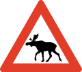
Roads are generally not fenced and animals may stray onto all sorts of roads. You need to look out for deer and moose - a moose collision in particular is very dangerous as these are tall and heavy animals. In the north you will also have to watch out for reindeer.
Moose/elk ("elg") and red deer can run onto the highway particularly at dusk and dawn so take extra care if driving at those times, particularly through forest. Red deer can also jump onto the highway without warning, particularly in Western Norway during late autumn and winter, special "crossing points" have been constructed several places, be aware. Reindeer may happen to walk on the road in Northern Norway. Note the warning signs. The elk, the most dangerous animal on the roads, is most active at full moon, after heavy snow fall and at dusk/dawn.Be extra careful to wild animals on the roads under these circumstances:
- Dusk/dawn.
- Springtime (as moose reject last year's calves and give birth to new ones).
- Edge of forests.
- Bridges across streams.
- Full moon
Several roads pass through pastures with grazing livestock and there may not be any fence to the road. Sheep, cows and goats may stroll on the road. A cattle grid ("ferist") or warning sign typically marks the start of such areas.
สภาพถนน

Norwegian roads have varying quality. All public roads have asphalt and are generally well maintained, but some popular roads are narrow, with many curves and steep hills. The main roads are the European highways indicated with an "E" in front of the number. ตัวอย่างเช่น E6 is the main north-south corridor from Sweden via Oslo to Kirkenes in the very east of Northern Norway. European highways connect cities, regions and countries. The E-roads are excellent for navigation. Other main roads (national highways, "riksvei") have low one- or two-digit numbers. Note however that the importance of the road does not indicate quality: even the E's may have narrow and slow sections. The E6 is only partly designed and constructed as motorway. Road qualities indicated by signs or markings:
| ป้าย | เครื่องหมาย | หมายเหตุ |
|---|---|---|
| Motorway or controlled-access highway (also known as A-class motorway). Grade-separeted crossings, wide shoulder and mechanical median barrier. Speed limit 80, 90, 100 or 110 kmh. Some stretches around Oslo and main cities only. | ||
| Semi-motorway or two-lane expressway (previously B-class motorway), speed limit 80 or 90 kmh. | ||
| Two-lane undivided is the standard road quality, narrow or no shoulder. Indicated with a median strip (centre line), sometimes with rumble strip. | ||
| Warning signs and/or no center line indicates a road narrower than two full lanes. |
Driving a car in ฤดูหนาว conditions may be a real challenge without proper training and experience, this particularly applies to mountain passes all over Norway as well as other roads in Northern Norway. The golden rule for driving on snow, ice and slush: don't rush. Authorities routinely issue road information on radio, TV and อินเทอร์เน็ต. Always obtain specific information about mountain roads the day and hours before going. Don't hesitate to ask locals or call ☏ 47 815 48 991, 175 for last minute information. Always bring enough clothes and food, always calculate plenty of time. Be prepared to cancel or postpone trips in winter.

Some mountain passes, including popular roads around Geiranger are totally closed during winter (typically Nov-May). On the highest mountain passes, such as Sognefjell (road 55), winter conditions can occasionally occur in May and September. Some exposed mountain passes can be closed for some hours or days in winter during strong wind.
Convoy driving ("kolonnekjøring") can also be used. When convoy driving is in effect vehicles have to wait for the snow plow and then drive in a line (convoy) behind the snow plow through the mountain pass or other difficult section. Convoy driving is slow and waiting times can be several hours. Convoy driving procedure:
- Make sure to a have full thank of fuel, there are no petrol stations on convoy stretches
- Bring rope, flashlight and shovel
- Bring food and warm drink
- Bring winter clothes and shoes
- Flash the emergency light when the convoy starts moving
- Keep close to the car ahead
- Stay in the convoy, keep a steady speed
- Don't leave the convoy or try to turn back
- Stay in the car if the convoy halts
- Don't stray from the car if you to stop
อุโมงค์

Any driving in Norway is not complete without tunnels. There are thousands of them, and they are fascinating to those unfamiliar with them. Most of the tunnels are in Western Norway and Nordland county. The longest is 24 km, but 1–3 km is more common. Road E16 has over 60 tunnels, covering 15% of the entire road. E6 has over 80 tunnels, E39 has over 100 tunnels.
Almost all are lit with "street" lighting, but may be narrower than the regular roads. Driving out from a tunnel, over a bridge spanning a deep gorge, back into a tunnel, then down a 12% gradient is something to be remembered. Some tunnels, particularly underwater tunnels, are relatively steep. Tunnels are generally safe and Norwegian drivers keep the same speed in tunnels as in the open, the main challenge is adapting to the darker tunnel during bright sunshine. Temperatures inside tunnels are usually different than outside, causing ice taps to form on road surface and in ceiling; condense on car windows may also be a problem. Animals may seek shelter inside tunnels. Length of tunnel is indicated at the entrance and for the longer tunnels kilometers to exit is also indicated inside the tunnel. Each tunnel has a name and drivers should use the name to inform the police in case of emergency.
Note that overtaking in a tunnel is dangerous and forbidden in many tunnels.
Rules and regulations

Rules and road signs are generally the same as in the rest of Europe. Virtually all signs use standardised symbols (pictograms), explanatory text in plain Norwegian used occasionally as supplement. Foreign visitors should be aware that police controls are common and that fines are very high. Traffic enforcement cameras are common. Jail sentence and suspension of licence is used for the most serious offences.
ถูกทาง
- Traffic from right hand has right of way (unless signs or lights). You must yield to traffic from any road to your right, except from separate areas such as parking lots, market square, pedestrian zone, and petrol stations.
- Turning vehicles must yield to pedestrians and bicycles that proceed straight ahead on road or shoulder.
 Traffic on roads with the standard "Yellow Diamond" sign has the right of way. This is widely used for main roads. Traffic from connecting roads will then see the give-way (yield) or stop sign.
 Universal give way (yield) sign.
 Give way for vehicles located within a roundabout.
 Buses have right of way when leaving a bus stop where the speed limit is 60 km/h or less.
 Trains, trams and light rail have right of way even from the left hand side.
- Traffic downhill is expected to yield to traffic uphill if road is too narrow for two cars (important in winter).
 Pedestrians have the right of way at all marked crossings with no traffic lights. You are required to stop even if the pedestrian is not yet in the crossing, only showing intention to cross. You may be severely fined and your driver's licence may be suspended if you don't. This rule is strictly enforced.
 Emergency service vehicles with flashing สีน้ำเงิน light (red light not used) has absolute right of way. Note: Emergency light is blue, silent response very common (no siren).
 Right turn on red is illegal even if road is clear.
- Opposing traffic must if necessary slow down or pull over on the right hand side (particularly applies to narrow mountain roads).
- Funeral processions have the right of way. People are required to yield, and not interfere or cause an obstruction.
Use of equipment
- Headlights are mandatory even during daylight. If you drive without lights you may find other drivers flashing their headlights at you to inform you.
- An EN standard hazard waistcoat is required in the vehicle, reachable from the driver's seat.
- Using a mobile phone when driving is forbidden.
- Wearing a seat belt is mandatory, also in back seats.
- Winter tires must have a minimum depth of tread of 3 mm. Cars (Vehicle group M1) heavier than 7500 kg (Vehicle group N1 over 3500 Kg) are required to carry snow chains during winter and whenever snow or ice can be expected. A minimum of 5 mm depth of tread is recommended for trucks and heavy cars.
- Using a vehicle's horn is considered impolite and may result in a fine unless used for an emergency.
จำกัดความเร็ว

 The general speed limit is 80 km/h in the countryside/on highways. Because 80 is the default speed limit, the 80-sign is rarely used and 80 is instead implied.
 50 km/h in urban/built-up areas, usually indicated with signs.
- Other speed limits are always indicated with signs; for instance, speed limits on motorways (controlled-access highway). The motorway sign does not imply any particular speed limit.
- Note that there are no specific rules for change of speed limit (as in some other countries) when driving conditions change. The driver is by law required to adjust speed downward to a safe level in, for instance, fog, heavy rain, or snow.
- Norway has some of the highest speeding fines in the world, including confiscating your driver's license and/or jail time (even for foreigners). There are speeding cameras frequently on major roads, and it's not uncommon for unmarked police cars to pull you over. It is highly recommended to use your car's cruise control system to stay at the speed limit.
- Vehicles pulling trailers, and vehicles over 3,500 kg, must not drive faster than 80 km/h ( except motorhomes up to 7500 Kg that can follow the speed limit up to 110 Kmh ), even on motorways with a higher speed limit.
- Speed limits are fine-tuned to conditions for maximum safety, so be aware that speed limits may adjusted slightly for a few kilometers only. For instance some good two-lane undivided roads in sparsely populated areas may have 70 kmh speed limit because of moose hazard or frequent icing.
- The highest speed limit is 110 kmh and used only on short stretches of the best motorways.
อุบัติเหตุ
- Every person is by law obliged to help and assist at site of accident, even if not involved or guilty.
- Call the police (emergency 112) if persons are injured or killed. Police should also be contacted if animals are injured or killed.
- If no persons are harmed, police should not be called, but drivers involved should resolve the situation themselves (exchange full contact information).
อื่นๆ
- Don't drink and drive. Your blood alcohol concentration must not exceed 0.2 ‰. One small beer can be enough. This rule is strictly enforced and violators risk a huge fine, a long (or even indefinite) suspension of the driver's licence, and prison time.
- New law from 2013: If you take medications (opiates, benzodiazepines or other narcotics) you are NOT allowed to drive unless you are taking them every day (long-term) for at least 14 days. Even if you have prescription you are not allow to drive if you use them “now and then”. All police checkpoints now check you for drugs as well as alcohol and they have their own “limit table” that if you are over “0,002%” you will go to jail and get your license confiscated (Even with prescription which only says “when needed”). Tourists should be very aware of this, so if you need to take a e.g painkiller you must wait until ALL of the drug has leaved your system.
- On typical Norwegian two-lane road with a narrow shoulder, overtaking is only allowed on long straightaways with plenty of visibility. Drivers are not expected to use the shoulder to facilitate overtaking. Overtake only if really necessary; consider alternatives like taking a short break.
- Overtaking is generally forbidden at crossroads.
- Off-roading is generally forbidden. Motor vehicles must stay on public roads.
 Where a road is not wide enough for two cars to meet, blue signs with a large M indicate passing points (M for "meeting" point).
Signs and markings

วงเวียน

Yield (give way)

Stop (and give way)

Crossroad on priority road

Give way to oncoming traffic

Oncoming traffic must give way

ห้ามเข้า

Speed limit (km/h)

Right turn mandatory


While road markings are informative, they are often covered by snow and ice in winter. Unlike other European countries, in Norway yellow lines separate opposing traffic, and white lines separate traffic in the same direction. In general yellow lines should be on your left hand side, while white lines should be on your right hand side. Caution: Yellow lines on your right hand side means you are heading in the wrong direction!
| เครื่องหมาย | คำอธิบาย | วัตถุประสงค์ | หมายเหตุ |
|---|---|---|---|
| Yellow line, Double line | Lane divider for opposing traffic | Crossing illegal | |
| Yellow line, continuous | Lane divider for opposing traffic | Crossing illegal | |
| Yellow line, long dashes, short gaps (warning line or hazard warning line) | Lane divider for opposing traffic | Crossing (overtaking) legal, but risky | |
| Yellow line, short dashes, long gaps (Lane line) | Lane divider for opposing traffic | Crossing legal (good visibility) | |
| Combined line (hazard warning line and lane line) | Regular overtaking hazardous | Observe the line closest to you | |
| Combined line (continuous line and lane line) | Lane divider for opposing traffic | Crossing illegal | |
| (no median/lane marking).These road have punctuated edge lines. | Road too narrow for lane marking | Caution, slow down for opposing traffic | |
| White line, short dashes, long gaps | Lane divider for traffic in same direction (motorways) | Crossing legal, low risk | |
| White line thick, dash and gaps same | Lane divider for special purpose lane (notably bus lane) | Driving in bus and taxi lanes and in high-occupancy vehicle lanes is only permitted as indicated by official traffic signs. Motorcycles, mopeds, bicycles or marked emergency vehicles may also use such lanes. | |
| Hatched area, yellow or white | Used to separate and guide the traffic instead of traffic islands. | It is forbidden to drive on hatched areas |
ที่จอดรถ

Parking is generally forbidden if speed limit is over 60 km/h. Parking in inner city is often difficult and usually strictly regulated or expensive. Within downtown เบอร์เกน parking is generally forbidden except on parking meters or within parking facilities. Parking on meters in Oslo and Bergen is relatively expensive. Electric cars can park for free on parking meters in public streets (applies to all of Norway), while "hybrid" cars including "plug-in hybrids" must pay (as of 2016). "Mot avgift" means that there is a fee for parking. While parking on public streets in Oslo is generally allowed, gradually fewer places are available as streets are redesigned. Illegally parked cars will be fined and in some cases towed at the expense of owner (clamps are not used). Note the use of parking zones where sign applies until invalidated (unlike the basic rule that signs are in force until next cross road).
ค่าผ่านทาง
![]() There are toll roads in Norway; most of these are part of AutoPass (automatic number plate recognition). Visitors in their own car can register their numberplate for the duration of their visit only, pre-buy kr. 300 worth of tolls, and directly debit their (European) bank account or credit card for top ups. Any un-used funds are returned within 90 days. For rental cars, follow the rental company procedure. Occasionally, it may be necessary to stop and pay for tolls (notably on the small number of private roads), but most are automated (numberplate is photographed while driving under a gantry over the road).
There are toll roads in Norway; most of these are part of AutoPass (automatic number plate recognition). Visitors in their own car can register their numberplate for the duration of their visit only, pre-buy kr. 300 worth of tolls, and directly debit their (European) bank account or credit card for top ups. Any un-used funds are returned within 90 days. For rental cars, follow the rental company procedure. Occasionally, it may be necessary to stop and pay for tolls (notably on the small number of private roads), but most are automated (numberplate is photographed while driving under a gantry over the road).
Motorhomes up to 7500 Kg has the same toll charge as a car under 3500 Kg on roads using Autopass.
อภิธานศัพท์
- For more information on Norwegian glossary, see the Norwegian phrasebook บทความ.
_(36359101261).jpg/220px-Hardangerfjorfd_in_a_Nutshell_(42)_(36359101261).jpg)


- anleggsarbeid
- road works/construction ahead
- beiteområde
- grazing livestock
- bensin
- น้ำมันเบนซิน
- bomvei/bompenger
- toll road/toll
- dekk
- tire/tires
- ดีเซล
- ดีเซล
- fotgjengere
- pedestrians
- ประตู
- ถนน
- gjelder ikke buss
- does not apply to buses
- gjelder høyre felt
- applies to right hand lane
- venstre
- ซ้าย
- gågate
- pedestrian zone
- høyre/høgre
- right hand (side)
- km/t
- kilometers per hour
- kjettinger
- chains
- kjør forsiktig
- drive carefully
- kjørelys
- headlights
- kolonnekjøring
- convoy driving
- lys
- เบา
- vent på brøytebil
- wait for snowplow (snow removal vehicle)
- kuldeport
- tunnel closed with gate to keep frost out
- lengde
- ความยาว
- olje
- น้ำมัน
- omkjøring
- diversion, detour
- over 1 time
- more than 1 hour
- opphøyd gangfelt
- raised pedestrian crossing
- piggdekk
- studded tires
- stengt
- ปิด
- stopp ved rød blink
- stop if red light signal
- særlig stor elgfare
- extraordinary moose hazard
- strekningsmåling
- speed camera for stretch of road
- telehiv, teleskade
- frost bulges, frost heaves, frost cracks
- tele
- frost in ground
- trekkrok
- tow bar, tow hitch, tow hook
- ulykke
- อุบัติเหตุ
- vei/veg
- road
- vegen
- the road
- ventetid
- waiting time
- vinterdekk
- winter tires, snow tires (same thing)
กำหนดการเดินทาง
