Struve Geodetic Arc คือ มรดกโลกขององค์การยูเนสโก ใน นอร์เวย์, สวีเดน, ฟินแลนด์, รัสเซีย, เอสโตเนีย, ลัตเวีย, ลิทัวเนีย, เบลารุส, มอลโดวา และ ยูเครน.
เข้าใจ

Struve Arc คือ a ห่วงโซ่ของสามเหลี่ยมสำรวจ ทอดยาวจากแฮมเมอร์เฟสต์ในนอร์เวย์ไปจนถึงทะเลดำ ผ่านสิบประเทศและกว่า 2,820 กม. สิ่งเหล่านี้คือจุดของการสำรวจซึ่งดำเนินการระหว่างปี 1816 ถึง 1855 โดยนักดาราศาสตร์ชื่อ Friedrich Georg Wilhelm Struve ซึ่งเป็นตัวแทนของการวัดที่แม่นยำครั้งแรกของส่วนที่ยาวของเส้นเมริเดียน สิ่งนี้ช่วยสร้าง ขนาดและรูปร่างที่แน่นอนของดาวเคราะห์ของเรา และเป็นก้าวสำคัญในการพัฒนาธรณีศาสตร์และการทำแผนที่ภูมิประเทศ เป็นตัวอย่างที่ไม่ธรรมดาของความร่วมมือทางวิทยาศาสตร์ระหว่างนักวิทยาศาสตร์จากประเทศต่างๆ และการทำงานร่วมกันระหว่างพระมหากษัตริย์ในประเด็นทางวิทยาศาสตร์ ส่วนโค้งเดิมประกอบด้วยรูปสามเหลี่ยมหลัก 258 รูปพร้อมจุดสถานีหลัก 265 จุด เว็บไซต์จดทะเบียน ประกอบด้วยจุดสถานีเดิม 34 จุด โดยมีเครื่องหมายต่างกัน เช่น รูเจาะในหิน ไม้กางเขนเหล็ก แครนส์ หรือเสาโอเบลิสก์ที่สร้างขึ้น
ไซต์ที่จารึกไว้หลายแห่งเป็นโพสต์ขนาดเล็กในฟิลด์และอาจไม่ให้รางวัลแก่การเข้าชม อย่างไรก็ตาม จุดโฟกัสของส่วนโค้งคือหอดูดาวดอร์ปัตใน Tartu, เอสโตเนีย.
ประวัติศาสตร์
รูปแบบและขนาดของโลกเป็นที่ถกเถียงกันมาตั้งแต่เริ่มแรก อย่างไรก็ตาม เป็นเวลานานในประวัติศาสตร์ อุปกรณ์และวิธีการไม่เพียงพอสำหรับการวัดที่แน่นอน นำไปสู่สถานการณ์ที่ คริสโตเฟอร์โคลัมบัส จะเชื่อว่าอินเดียจะ "อยู่ใกล้แค่หัวมุม" โดยการแล่นเรือไปทางตะวันตกจากสเปนหรือ มาเจลลัน แทบจะเอาชีวิตรอดจากการเดินทางข้ามมหาสมุทรแปซิฟิกซึ่งใหญ่กว่าที่เขาคาดไว้หลายเท่า
สามเหลี่ยม ถูกประดิษฐ์ขึ้นในศตวรรษที่ 17 เป็นวิธีการใหม่ในการวัดระยะทาง ชุดของจุดถูกจัดวางในแนวนอนในรูปแบบสามเหลี่ยม ต้องวัดระยะห่างระหว่างจุดสองจุด หลังจากนั้น จากแต่ละจุด วัดมุมระหว่างจุดอื่นๆ ทั้งหมดที่มองเห็นได้จากจุดนั้นโดยใช้ a กล้องสำรวจ. โดยพื้นฐานแล้วกล้องสำรวจคือกล้องโทรทรรศน์บนขาตั้งกล้องที่มีตาชั่งแสดงตำแหน่งที่แน่นอนที่หมุน และกากบาทและปุ่มเพื่อปรับทิศทางอย่างละเอียด
ในสมัยนั้นทราบกันดีอยู่แล้วว่าโลกไม่ได้เป็นทรงกลมที่สมบูรณ์แบบ แต่มีการถกเถียงกันว่าโลกถูกทำให้แบนบนเสาหรือตามแนวเส้นศูนย์สูตร เส้นรอบวงของโลกถูกกำหนดเป็น 360° แต่หนึ่งองศานั้นยาวแค่ไหน? มีการสำรวจหลายครั้งเพื่อวัดความยาวของส่วนโค้งตามยาว โดยเฉพาะอย่างยิ่งที่แลปแลนด์และเปรู การเดินทางครั้งก่อนนำโดยชาวฝรั่งเศส ปิแอร์ โมแปร์ตุยส์ ในช่วงทศวรรษ 1730 และการวัดของ Struve ใช้บรรทัดเดียวกันในอีกหนึ่งศตวรรษต่อมา แนวคิดคือการวัดส่วนโค้งตามยาวที่ละติจูดต่างๆ เพื่อสร้างแนวคิดเกี่ยวกับรูปร่างของโลก อย่างไรก็ตาม ส่วนโค้งนั้นค่อนข้างสั้นเมื่อเทียบกับส่วนโค้งของ Struve
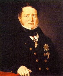
หลังจาก สงครามนโปเลียนกษัตริย์และชาติต่างๆ ในยุโรปตระหนักดีว่าจำเป็นต้องมีการทำแผนที่และการวัดที่แม่นยำยิ่งขึ้นเพื่อความสำเร็จในสงครามในอนาคต เฟรมเวิร์กหรือตารางที่สามารถวาดแผนที่ได้อย่างแม่นยำยิ่งขึ้น นักดาราศาสตร์ชาวเยอรมัน ฟรีดริช เกออร์ก วิลเฮล์ม ฟอน สตรูฟ (พ.ศ. 2336-2407) ทำงานที่มหาวิทยาลัยดอร์ปัต (ชื่อปัจจุบันของเมืองคือ Tartu) และตั้งแต่ปี ค.ศ. 1812 ที่รับผิดชอบการสำรวจเกี่ยวกับวิชาตรีโกณมิติในลิโวเนีย (พรมแดนปัจจุบันของเอสโตเนียและลัตเวีย) ได้เสนอโครงการนี้ต่อจักรพรรดิแห่งรัสเซียในปี พ.ศ. 2362 และในช่วงทศวรรษที่ 1820 การสำรวจครั้งแรกได้ดำเนินการระหว่าง Gogland และ เจกับพิลส์ (จาค็อบสตัดท์ในตอนนั้น) มหาวิทยาลัยดอร์ปัตได้รับเลือกให้เป็นจุดอ้างอิงของส่วนโค้ง ซึ่งพอดีกับรูปสามเหลี่ยมรอบล่าสุด วิลนีอุส โดย คาร์ล เทนเนอร์ (ค.ศ. 1783-1859) และงานของ Maupertuis ในหุบเขาแม่น้ำ Torne ซึ่ง Struve ทราบและวางแผนที่จะรวมเข้าด้วยกัน
งานสามเหลี่ยมที่นำโดย Struve จะไปถึง Gogland ทางเหนือภายในปี 1831 และถึง Tornio ภายในปี 1851 แต่เขาจะไม่ใช่คนเดียวที่เป็นผู้นำโครงการ เทนเนอร์นำรูปสามเหลี่ยมจากเจกับพิลส์ไปยังทะเลดำในสามช่วงคือ ค.ศ. 1816–28, 1835–40 และ 1846–51 ทางเหนือ บนดินสวีเดน-นอร์เวย์ Nils Selander (1804–70) สำรวจส่วนจาก Tornio ถึง เคาโตไคโน ค.ศ. 1845–52 และ คริสโตเฟอร์ แฮนสตีน (ค.ศ. 1784–1872) จากเคาโตไคโนถึง Fuglenes 1845–50.
ผลลัพธ์ถูกตีพิมพ์ในปี พ.ศ. 2403; ในหลายประเทศที่ส่วนโค้งตัดผ่าน มันจะเป็นกระดูกสันหลังของระบบสำรวจมานานหลายทศวรรษ และเป็นหนึ่งในส่วนโค้งที่ใช้โดยการคำนวณของอเล็กซานเดอร์ คลาร์ก นักธรณีวิทยาชาวอังกฤษเกี่ยวกับรูปโลก 1858–1880 เมื่อพิจารณาถึงเครื่องมือที่มีอยู่ในขณะนั้น ความแม่นยําก็น่าประทับใจ จากการคำนวณของ Struve รัศมีเส้นศูนย์สูตรจะอยู่ที่ 6,378,360.7 ม. ในขณะที่การวัดในปัจจุบันด้วยระบบนำทางด้วยดาวเทียมให้รัศมี 6,378,138.8 ม. - ความแตกต่างประมาณ 224 ม. หรือ 735 ฟุต
ในปี 2548 หลังจากโครงการวิจัยซึ่งครอบคลุมเวลาหลายปีโดยหน่วยงานต่างๆ ใน 10 ประเทศ ยูเนสโกได้จัดตั้งส่วนโค้งดังกล่าวขึ้นเป็นมรดกโลก ซากศพของการสำรวจซึ่งประกอบด้วยรูที่เจาะในหินเมื่อเกือบ 200 ปีที่แล้ว อาจไม่ค่อยมีอะไรให้ดูมากนัก แต่จุดแต่ละจุดมักให้ทัศนียภาพที่สวยงามของภูมิประเทศ และสำหรับบางแห่งก็มีการสร้างอนุสรณ์ที่น่าประทับใจ นอกจากนี้ การไปถึงจุดต่างๆ ก็ยังเป็นการผจญภัยอยู่ในปัจจุบัน และหากคุณได้เยี่ยมชมจุดต่างๆ มากมาย (นับประสาทั้งหมด) ความกว้างใหญ่ของโครงการที่ทำในยุคของม้าและเกวียนอาจหลุดออกมาได้อย่างน่าทึ่งจริงๆ เกี่ยวกับสถานที่ชุดนี้ทั่วยุโรปเหนือและตะวันออก
เตรียม
วิธีที่สะดวกที่สุดในการเยี่ยมชมทุกจุดในแผนการเดินทางนี้คือโดย รถยนต์. มันไม่ได้ผ่านส่วนต่างๆ ของโลกที่ห่างไกลจริงๆ แต่โดยเฉพาะอย่างยิ่งในตอนเหนือของการเดินทาง ระยะห่างระหว่างบริการต่างๆ อาจยาวนาน และเมื่อพิจารณาจากระยะทางโดยรวมของเส้นทางแล้ว คุณควรตรวจสอบให้แน่ใจว่ารถของคุณอยู่ในสภาพที่ดี นอกจากนี้ บางครั้งถนนสายเล็กๆ ก็มีรูปร่างไม่ดี โดยเฉพาะในอดีตกลุ่มตะวันออก
หากคุณตัดสินใจเดินทางโดย การขนส่งสาธารณะคุณมักจะต้องเดินทางไกล โบกรถ หรือนั่งแท็กซี่ในจุดที่ห่างไกลที่สุด แม้ว่าจะอยู่ติดกับถนนก็ตาม หรือคุณสามารถข้ามสิ่งเหล่านั้นได้ เดินทางตลอดการเดินทางโดย จักรยานหรือเท้า อย่างน้อยก็เป็นไปได้ในทางทฤษฎีถ้าคุณมีเวลาและความแข็งแกร่ง คำแนะนำสำหรับการเดินทางระหว่างจุดต่างๆ โดยระบบขนส่งสาธารณะเขียนเป็นตัวเอียงด้านล่าง ข้อมูลนี้อ้างอิงจากการวิจัยทางอินเทอร์เน็ต ณ เดือนมีนาคม 2564 เว็บไซต์ที่มีประโยชน์สำหรับตารางเวลาล่าสุดและเส้นทางที่มีสามารถพบได้ในหน้าพูดคุยของบทความนี้หรือในส่วนข้อมูลทั่วไปของบทความของประเทศและเมืองต่างๆ ที่มีกำหนดการเดินทาง
แม้ว่าคุณจะเดินทางอย่างสะดวกสบายระหว่างจุดต่างๆ แต่โปรดทราบว่าบางจุดต้องใช้ความพยายามบ้างในการไปถึง ตัวอย่างเช่น Tornikallio ทางตอนใต้ของฟินแลนด์มีการเดินขึ้นเนินจากที่จอดรถโดยมีเส้นทางข้ามโขดหินและรากไม้ และไม่สามารถอธิบายได้อย่างชัดเจนว่าสามารถเข้าถึงได้หากคุณทุพพลภาพทางร่างกายหรือทางสายตา
เข้าไป
จุดโค้งวิ่งกว่า 2,820 กม. จากเหนือเส้นอาร์กติกเซอร์เคิลไปจนถึงทะเลดำ ทำให้เป็นหนึ่งในจารึกที่ยาวที่สุดในรายการมรดกโลก เนื่องจากระยะทางที่ไกล จึงมีหลายวิธีในการรับชม
นอกจากจะแผ่ขยายไปทั่วพื้นที่ขนาดใหญ่แล้ว ส่วนประกอบหลายแห่งของแหล่งมรดกโลกนี้ยังอยู่นอกเมืองใหญ่และเมืองต่างๆ อา รถยนต์ น่าจะเป็นทางออกที่ดีที่สุดของคุณหากคุณต้องการเยี่ยมชมจุดต่าง ๆ ให้ได้มากที่สุดภายในระยะเวลาที่เหมาะสม จุดที่ตั้งอยู่ในอ่าวฟินแลนด์จะยังคงมีปัญหาในการเข้าถึง
นอร์เวย์ สวีเดน ฟินแลนด์ เอสโตเนีย ลัตเวีย และลิทัวเนียเป็นสมาชิกของ เขตเชงเก้น ในขณะที่เบลารุส มอลโดวา และยูเครนไม่ได้หมายความว่าพวกเขาแยกจากกัน วีซ่า ระบอบการปกครอง พลเมืองในสหภาพยุโรปส่วนใหญ่สามารถเดินทางสู่ประเทศที่ไม่ใช่กลุ่มเชงเก้นได้อย่างไม่ยุ่งยากในแผนการเดินทางนี้ แต่คุณควรพกหนังสือเดินทางไปด้วย เบลารุสเคยมีนโยบายการขอวีซ่า "ปิด" อย่างฉาวโฉ่ในอดีต แต่หลังจากนั้นก็ได้ผ่อนคลายกฎเกณฑ์สำหรับพลเมืองสหภาพยุโรปอย่างมาก ส่วนรัสเซียของ Struve Arc บนเกาะ Gogland ไม่สามารถเข้าถึงได้สำหรับนักท่องเที่ยว จึงต้องข้ามส่วนนี้และเดินทางจากฟินแลนด์ตรงไปยังเอสโตเนีย (หรือกลับกัน) สำหรับรายละเอียดเพิ่มเติม โปรดดูบทความของแต่ละประเทศ
ไป

นอร์เวย์
ทางเหนือสุดอยู่ทางเหนือที่ไกลที่สุดเท่าที่คุณจะหาได้ในยุโรป สามารถติดตามได้ที่ E6 ผ่านสวีเดนและนอร์เวย์ ถึงสไกดี เส้นทางทางเลือกสำหรับบางส่วนของการเดินทางคือ E45, E4 หรือ E8 ทั้งหมดขึ้นอยู่กับว่าคุณมาจากไหน แม้ว่าคุณจะขับรถไปทางหลังในการเดินทางลงใต้ก็ตาม จาก Skaidi ทางหลวงหมายเลข 94 จะพาคุณไปยัง Hammerfest
ไกลจากทุกสิ่งส่วนใหญ่ คุณอาจต้องการบินเข้าไป ทรอมโซ เป็นศูนย์กลางหลักของภูมิภาคนี้ และจากนั้นคุณสามารถบินไปยังแฮมเมอร์เฟสต์ได้ สนามบิน Hammerfest อยู่ห่างจาก Fuglenes เป็นระยะทางมากกว่าหนึ่งกิโลเมตร Hurtigruten ยังเรียกที่ Hammerfest ประมาณ 2.5 กม. รอบอ่าว Fuglenes จากท่าเรือ
- 1 ฟูกเนส แฮมเมอร์เฟสต์, Finnmark – Fuglenes "คาบสมุทรของนก" อยู่ในเขต Fuglenes ของ Hammerfest บนเนินเขาพร้อมทิวทัศน์ของทะเลอาร์กติก จุดนี้ถูกทำเครื่องหมายด้วยลูกโลกสีเขียวที่ยืนอยู่บนแท่นหินแกรนิต อนุสาวรีย์นี้เรียกว่า Meridianstøtten.
ย้อนรอยไปยัง Skaidi และขับไปทางตะวันตกเฉียงใต้ตาม E6 ไปยัง Alta ก่อนข้ามแม่น้ำอัลตา ให้เลี้ยวซ้ายไปยังถนนสายเล็กไปยัง Kaiskuru และเดินทางต่อไปที่ Raipas
เมื่อเทียบกับแผนการเดินทางที่เหลือ คุณจะมีตัวเลือกมากมายในการเดินทางไปยังอัลตา คุณสามารถเลือกระหว่างรถบัส เรือ หรือเครื่องบิน เมื่อถึงอัลตาก็ถึงเวลาสวมรองเท้าเดินของคุณ นั่นคือไม่มีระบบขนส่งสาธารณะไปยังที่จอดรถด้านล่าง ท่าเรือ สนามบิน และป้ายรถประจำทางที่ใกล้ที่สุดอยู่ทางตะวันออกของเมือง - หากคุณเดินทางโดยรถประจำทางอย่าไปจนสุดทางไปยังตัวเมือง Alta แต่ให้ลงที่ป้าย Storeng ที่ E6 ก่อนที่รถบัสจะข้าม Altaelva จากสนามบินและท่าเรือ เดินย้อนกลับตาม E6 และข้ามแม่น้ำนั้น จาก E6 ถนนชื่อ Kjosveien มุ่งสู่ Raipas ห่างออกไป 3.5 กม. จากจุดเริ่มต้น
- 2 ไรพาส Alta, Finnmark – จุด Raipas อยู่ไม่ไกลจาก Alta ขณะที่อีกาบินไป แต่ถนนที่นั่นไปอีกฟากหนึ่งของ Altaelva (แม่น้ำ Alta) ไปยังนิคมของ Raipas ถัดจากถนน มีที่จอดรถ ซึ่งคุณจะเดินขึ้นเนินไปอีกสองสามกิโลเมตรถึงยอดของ Lille Raipas ประมาณ 250 ม. ASL อัลตายังมีมรดกโลกอีกแห่งคืองานแกะสลักหินยุคก่อนประวัติศาสตร์ทางตะวันตกของเมืองตามแนว E6
จากอัลตา ใช้ E45 ไปทางทิศใต้สู่ Kaautokeino

กลับลงมาที่ E6 จากที่ซึ่งคุณสามารถขึ้นรถบัสไปยังใจกลาง Alta จากจุดที่คุณสามารถขึ้นรถบัสไปยัง Kautokeino หากคุณวางแผนที่จะเยี่ยมชมอีกสองจุดในนอร์เวย์ โปรดทราบว่าแต่ละแห่งมีการเดินป่าค่อนข้างมาก และอาจไม่มีรถบัสเข้าประเทศฟินแลนด์อีก ดังนั้นคุณจะต้องเดินทางกลับมายังอัลตาโดยรถประจำทาง หรืออาจจะเดินขึ้นหรือโบกรถเป็นระยะทาง 80 กม. ลงไปที่เอนอนเทคิโอ เพื่อไปยังจุดต่อไปนี้ ให้ลงที่ Suolovuopmi fjellstue (บ้านพัก Suolovuopmi) จากที่นั้นไปตามถนนลูกรังประมาณ 10 กม. และอีก 3 กม. ไปยังจุดด้านล่าง กลับที่พัก - ถ้าไม่กางเต๊นท์จะนอนแถวๆนี้...
- 3 ลุฟดิดโชคก้า, เคาโตไคโน, Finnmark – หนึ่งในจุดที่ท้าทายมากขึ้นในการเยี่ยมชม (เช่นเดียวกับสองสามจุดต่อไป) บนยอดเขา Luvdiidčohkka (หรือที่รู้จักในชื่อ Lohdizhjokki หรือ Lodiken) 638 m ASL จาก E45มีถนนลูกรังไปทางเหนือ ซึ่งอาจขรุขระเกินไปสำหรับรถธรรมดา จากจุดที่ใกล้ที่สุดบนถนนลูกรังนั้น (มีกระท่อมสีแดงอยู่ทางขวามือของถนน) มีการเดินขึ้นเขาประมาณ 3 กม. ตามเส้นทางสู่ยอดเขา

ต่อด้วยรถบัสไป Kaautokeino จากทางใต้ของเมือง ถนนแยกออกไปที่ Avzi ตามด้านล่าง ห่างจาก Avzi ประมาณ 11 กม. จาก Kaautokeino และเดินต่อไปอีก 5 กม.
- 4 บาเอลยาสวาร์รี เคาโตไคโน, Finnmark – จากเมือง Kaautokeino มีถนนสายเล็กๆ ไปทางตะวันออกไปยังหมู่บ้าน Ávži จากที่นั่น ทางเดินหรือถนนที่ค่อนข้างลูกรังซึ่งทำเครื่องหมายว่าเป็นทางสำหรับเคลื่อนบนหิมะจะแยกออกจากถนนสายหลัก Baelljasvárriคือ 585m ASL และมีการเดินป่าอีกสองสามกิโลเมตรเพื่อไปยังจุดนั้น
เดินทางต่อไปตามเส้นทาง E45 สู่ฟินแลนด์
หากต้องการข้ามสองสามจุดข้างหน้าหลังจากเยี่ยมชม Raipas หรือเดินทางต่อจาก Alta หลังจากจุดข้างต้น ดูเหมือนว่าจะไม่มีรถประจำทางไปทางตะวันตกจาก Alta ดังนั้นให้มุ่งหน้าไปยังสนามบิน บินไปที่ Tromsø และขึ้นรถบัสฟินแลนด์ไปยัง Rovaniemi . มันจะกลับไปที่ Skibotn และไปทางตะวันออกเฉียงใต้ตาม E8 และไปยังฟินแลนด์
หากไม่มีรถบัสเข้าประเทศฟินแลนด์ แสดงว่าคุณกำลังโบกรถ เดินไกลมาก หรือขึ้นเครื่องบินหลายเที่ยว แบบหลังหมายถึงการบินจากอัลตาไปยังออสโล และจากที่นั่นไปยังเฮลซิงกิและต่อไปยังคิตติลาหรือไปยังสตอกโฮล์มและต่อไปยังคิรูนาหรือผ่านลูเลโอไปยังปาจาลา
สวีเดน และ ฟินแลนด์ ตามแนวชายแดน
พื้นที่ถิ่นทุรกันดารสามารถเข้ามาได้จากบริเวณใกล้ชายแดนระหว่าง Kautokeino และ Enontekiö (เข้าจากฝั่งตะวันออก) หรือจากใกล้ Karesuvanto (เข้าจากด้านตะวันตกเฉียงใต้) ถ้ามาจากทาง Skibotn รถบัสจะจอดที่ Karesuvanto นี่เป็นจุดที่จะลงจากรถบัสด้วยหากคุณวางแผนที่จะเยี่ยมชมจุดต่อไปนี้ในสวีเดน หรือคุณสามารถเดินทางต่อโดยรถประจำทางไปจนถึง Rovaniemi เพื่อข้ามไปยังจุด Aavasaksa หรือ Tornio
หากคุณลงเอยที่ศูนย์Enontekiö (Hetta) คุณสามารถขึ้นรถบัสไปยังKilpisjärviเพื่อไปยัง Karesuvanto หรือมุ่งหน้าไปยัง Rovaniemi
- 5 Stuorrahanoaivi, Tarvantovaara Wilderness Area ทางเหนือของ คาเรสุวันโต, ใน Enontekiö, แลปแลนด์ฟินแลนด์ - จุดที่ห่างไกลที่สุด กลางพื้นที่รกร้าง Tarvantovaara ห่างจากหมู่บ้านเล็ก ๆ แห่ง Palojärvi บนทางหลวง Kaautokeino-Hetta ประมาณ 29 กม. ในขณะที่เดินทางไปและกลับจากจุด "ระยะไกล" อื่นๆ ที่ระบุไว้ในที่นี้โดยทั่วไปจะใช้เวลาสองสามชั่วโมง ในกรณีนี้ คำถามจะใช้เวลาประมาณสองสามวัน ไม่มีเส้นทางที่ทำเครื่องหมายไว้ตลอดเส้นทาง แต่คุณสามารถเริ่มจาก Palojärvi ไปตามเส้นทางสำหรับเคลื่อนบนหิมะซึ่งจะไปตามชายแดนนอร์เวย์ ที่ Salvasjärvi มีกระท่อมแบบเปิดโล่งซึ่งดำเนินการโดยหน่วยงานจัดการป่าไม้ของฟินแลนด์ ณ จุดหนึ่ง (นำอุปกรณ์ GPS และแผนที่มาด้วย) ให้มุ่งหน้าไปทางตะวันตกเฉียงใต้จากเส้นทางไปสองสามกิโลเมตรเพื่อไปยังจุดนั้น คุณควรมีประสบการณ์กับกิจกรรมกลางแจ้งและเตรียมอุปกรณ์ให้เรียบร้อยก่อนไปที่นั่น - ดูที่ของเรา เดินป่าในประเทศนอร์ดิก และ สิทธิในการเข้าถึงกลุ่มประเทศนอร์ดิก บทความสำหรับการแนะนำ
E45 ซึ่งมีหมายเลขเป็นทางหลวงแผ่นดินหมายเลข 93 ของฟินแลนด์ เดินทางต่อไปทางใต้สู่เมืองเฮตตา ทางตะวันตกไปยังปาโลโจเอินซู จากนั้นร่วมกับทางหลวงหมายเลข 8 และทางหลวง E8 ทางตะวันตกเฉียงเหนือสู่ คาเรสุวันโต/คาเรซวนโด ข้าม. หลังจากเข้าสู่สวีเดนแล้ว ให้ขับไปทางใต้ตามทางหลวงหมายเลข 99 ของสวีเดน อีกสองสามจุดถัดไปจะอยู่ใกล้ถนนเส้นนี้
จากคาเรสุวันโต ข้ามสะพานไปยังเมืองแฝด สะกดเป็นภาษาสวีเดน เนื่องจากไม่มีรถประจำทางไปทางทิศใต้ตามแม่น้ำทางฝั่งสวีเดน Tynnyrilaki จึงท้าทายในการเยี่ยมชมแบบปลอดรถยนต์ สุดถนนลูกรังที่กล่าวถึงด้านล่างอยู่ห่างจาก Karesuando ไปทางใต้มากกว่า 30 กม.
- 6 Pajtas-vaara: Tynnyrilaki, เทศบาลคีรูนา, Norrbottens lan - ด้านชายแดนสวีเดน คุณสามารถข้ามพรมแดนใน คาเรสุวันโต/คาเรซวนโด หรือ Muonio และเดินทางตามทางหลวงหมายเลข 99 ของสวีเดนตามชายแดน ที่ปลายด้านตะวันออกเฉียงใต้ของทะเลสาบ Paittasjärvi (มีหมู่บ้านเล็กๆ ที่มีชื่อเดียวกันอยู่ที่ชายฝั่งตะวันตก) ถนนแคบๆ ที่ไม่มีป้ายบอกทางไปทางทิศเหนือตามแนวชายฝั่งตะวันออกของทะเลสาบ อาจขับไปตามทางนั้นได้ หลังจากเลี้ยวไปอีกประมาณ 3-4 กม. จะมีทางแยกที่ควรเลี้ยวขวา อีกประมาณ 1.5 กม. จะมีเส้นทางเล็กๆ ไปทางขวาซึ่งนำไปสู่เนินเขา Pajtasvaara (445 ม. ASL) หรือที่เรียกว่า Tynnyrilaki Tynnyrilaki หมายถึง "ถังบน" ในภาษาฟินแลนด์ และชื่อนี้มาจากข้อเท็จจริงที่ว่าทีมของ Struve ยกไม้เรียวที่จุดวัดด้วยปลายกระบอกปืน และการตั้งค่านี้สามารถมองเห็นได้จากจุดการวัดถัดไป
ในขณะที่ไม่มีรถประจำทางไปตามแม่น้ำ แต่ก็มีรถประจำทางจาก Karesuando ไป Kiruna เดินทางไกลถึง Vittangi และขึ้นรถบัสอีกสายหนึ่งไปยัง Pajala ลงก่อนถึงตัวเมืองตรงทางแยกที่มีทางหลวงหมายเลข 99 เข้ามาจาก Karesuando เนินเขาจุปุกกะอยู่ทางเหนือประมาณ 3 กม. ตามทางหลวงหมายเลข 99

- 7 "เคโรจุปุกกะ" : จุปุกกะ, ปชาลา, Norrbottens lan - ไปตามทางหลวงสายเดียวกันทางใต้ และก่อนถึงปาจาลาเล็กน้อย จะผ่านใกล้เขาจุปุกกะ ซึ่งเป็นเนินเขาที่มีความสูง 277 ม. ASL และจุดกึ่งกลางของเขตอนุรักษ์ธรรมชาติจุปุคคา มีป้ายบอกทางถนนเล็กๆ นอกทางหลวงไปยังบริเวณที่จอดรถซึ่งมีทางชันขึ้นไปถึงยอดเขา
เดินกลับไปที่ทางแยกหรือไปยัง Pajala ซึ่งห่างออกไปทางใต้อีกประมาณ 5 กม. จาก Pajala มีรถโดยสารสี่คันในวันทำงานไปยัง Haparanda ที่อ่าว Bothnia ซึ่งอยู่ใกล้กับจุดสิ้นสุดของจุดนี้ ลิฟต์สกีไปยังจุด Pullinki อยู่ห่างจากหมู่บ้าน Svanstein ถัดจากทางหลวงประมาณ 3 กม.
- 8 พูลลิงกิ: Pullinki, เออเวอร์ทอร์เนีย, Norrbottens lan - ประเด็นนี้ และข้อที่ตามมา สามารถเข้าถึงได้เล็กน้อย เนินเขา Pullinki (335 ม. ASL) ทำหน้าที่เป็น สกีรีสอร์ทและมีลิฟต์สกีขึ้นสู่ยอดเขา (น่าจะเปิดแค่ช่วงฤดูเล่นสกี) นอกเหนือจากเส้นทางจากอาคารหลักของสกีรีสอร์ทไปจนถึงยอดเขา เนื่องจากที่นี่เป็นสกีรีสอร์ท ป่าไม้ถูกตัดทิ้งและมีทิวทัศน์ที่สวยงามของหุบเขาแม่น้ำทอร์นและฟินแลนด์ รวมทั้งอาวาสักสา Pullinki และจุด Struve บางส่วนที่อยู่ทางใต้ของหุบเขาแม่น้ำถูกใช้สำหรับการวัดที่คล้ายคลึงกันในช่วงทศวรรษ 1730 โดยนักวิทยาศาสตร์ชาวฝรั่งเศส Pierre Louis Maupertuis ผู้พิสูจน์ว่าโลกไม่ใช่ทรงกลมที่สมบูรณ์แบบ
จากÖvertorneå ให้ข้ามกลับฟินแลนด์ ผ่าน E8 ไปทาง Rovaniemi สองสามกิโลเมตร แล้วเลี้ยวซ้าย (ป้ายบอกว่า Aavasaksanvaara)
ไปทางใต้ด้วยรถบัสสวีเดน ลงที่สถานีขนส่ง Övertorneå เดินข้ามสะพานไปยังหมู่บ้าน Aavasaksa ของ Ylitornio ประเทศฟินแลนด์ ระยะทางประมาณ 2.5 กม. ไปยังจุดที่คุณข้ามทางหลวงหมายเลข 8 อีก 2.5 กม. ไปทางตะวันออกสู่ Rovaniemi จนถึงทางแยกจากที่ที่มีถนนขึ้นไปถึง Aavasaksa และอีก 2.5 กม. ถึงยอดเขา หากคุณข้ามจุดสวีเดนและเริ่มต้นจาก Rovaniemi มีรถบัสตรงไปยังหมู่บ้าน Aavasaksa และคุณสามารถลงที่ทางแยกดังกล่าว

- 9 อาวาสศักดิ์ อิลิโตนิโอ, แลปแลนด์ฟินแลนด์
 - Aavasaksa ในฟินแลนด์ ตรงข้ามกับสะพานข้ามพรมแดน Övertorneå/Ylitornio เป็นรีสอร์ทสำหรับนักท่องเที่ยวมาเกือบศตวรรษครึ่ง ในปี พ.ศ. 2424 เมื่อฟินแลนด์เป็นจังหวัดของรัสเซีย จักรพรรดิรัสเซียอเล็กซานเดอร์ที่ 2 ได้วางแผนไปเยือนและกระท่อมไม้ซุงขนาดใหญ่ (เกศรินมาจา) ถูกสร้างขึ้นสำหรับเขาที่ยอดเขา (ไม่เคยเดินทางในขณะที่เขาถูกลอบสังหาร) และวันนี้ก็เป็นหนึ่งในสถานที่ท่องเที่ยวของอาวศักดิ์ นอกจากนี้คุณยังสามารถหาอนุสรณ์สถานการเดินทางของ Maupertuis ได้ที่นี่ และหอสังเกตการณ์ที่สร้างด้วยอิฐโดยมีแผ่น Struve อยู่ด้านข้าง Aavasaksa เป็นภูมิประเทศระดับชาติแห่งหนึ่งของฟินแลนด์ และมีถนนที่วิ่งได้ตลอดเส้นทางสู่ยอดเขา (242 ม. ASL)
ย้อนรอยเข้าสู่สวีเดนและขับต่อไปทางใต้ตามทางหลวงหมายเลข 99
หากต้องการเยี่ยมชมจุด Perävaara ให้ย้อนกลับไปที่สถานีขนส่ง Övertorneå และขึ้นรถบัสไปทางทิศใต้จนถึง Karungi ในขณะที่คุณเดิน คุณอาจสามารถไปยังจุดจากหมู่บ้าน Karungi ได้ แทนที่จะต้องเดินไปทั่วป่าตามคำอธิบายรายการ ขณะที่อีกาบิน ระยะทางจาก Karungi คือ 4 กม. และ สิทธิในการเข้าถึงกลุ่มประเทศนอร์ดิก ใช้ได้ แต่การนำทางอาจเป็นปัญหาเนื่องจากไม่มีเส้นทางที่ทำเครื่องหมายไว้จากที่นั่น
หากต้องการข้าม Perävaara และประหยัดเวลาเดิน มีรถประจำทางตรงจาก Aavasaksa ไปยัง Tornio หรือคุณสามารถเดินทางผ่าน Rovaniemi
- 10 "Perra-vaara": Perävaara, ฮาปารันดา, Norrbottens lan - Perävaara อยู่ฝั่งสวีเดน อยู่ด้านล่างของแม่น้ำ Torne ภูมิประเทศจะราบเรียบยิ่งขึ้นเมื่ออยู่ใกล้ทะเล และที่ ASL Perävaara เพียง 89 ม. ยังคงลอยอยู่เหนือสภาพแวดล้อม อยู่กลางป่า ใกล้หมู่บ้าน Karunki และเป็นจุดเดียวในสวีเดนที่ยังคงเครื่องหมายเดิมไว้ มีหลายเส้นทางในป่า แต่การบริหารส่วนภูมิภาคของ Norrbotten แนะนำให้ขับรถไปตามทางหลวงหมายเลข 99 ประมาณ 10 กม. ทางใต้จาก Karunki จากนั้นไปตามถนนในท้องถิ่น 730 (ถนนดังกล่าวมักไม่มีหมายเลขในสวีเดน) ไปทาง Björkfors 1 กม. จากนั้นมุ่งหน้าไปทางเหนือตามถนนป่า 1 กม. ไปยังที่จอดรถที่กำหนดแล้วเดินไปตามถนนป่าจากที่นั่นเป็นระยะทาง 5 กม. ไปยังเส้นทางที่นำไปสู่ยอดเขา
กลับไปที่ทางหลวงสายหลัก ไปทางใต้สู่ Haparanda ข้ามไปยัง Tornio ประเทศฟินแลนด์ ขับไปทาง Kemi และคุณจะผ่านใต้สะพานรถไฟ เมื่อถึงทางแยกถัดไป ให้เลี้ยวขวาแล้วขับไปทางใต้ตามRöyttäntie หลังจากข้ามแม่น้ำสาขาหนึ่งแล้ว ให้เลี้ยวขวาที่ถนนถัดไป คุณจะเห็นโบสถ์อยู่ทางด้านซ้ายของถนน
ขึ้นรถบัสจาก Karungi ไป Haparanda (หรือสูงกว่านั้นจาก Aavasaksa) จะหยุดที่สถานีขนส่ง Tornio-Haparanda ตามทฤษฎีแล้ว เส้นทางที่สั้นที่สุดไปยังจุดถัดไปคือลงแม่น้ำและข้ามสะพานรถไฟไปยังฝั่งฟินแลนด์ซึ่งเชื่อมโยงไปถึงคุณเกือบจะติดกับโบสถ์ สะพานที่ใช้สำหรับการขนส่งสินค้าเป็นครั้งคราว แต่ในขณะที่ความเสี่ยงที่คุณจะพบรถไฟมีน้อย เกือบจะผิดกฎหมายอย่างแน่นอน (แม้ในขณะที่ผู้คนสามารถทำได้ ข้ามประเทศอย่างเสรี). ดังนั้น คุณต้องเดินเข้าไปใน Tornio จากสถานี ข้ามสาขาหลักของแม่น้ำ Tornio บนสะพานคนเดิน เดินลงน้ำไปยัง Länsipohjankatu ข้ามใต้ทางรถไฟ ตามRöyttäntie ทางใต้ และข้ามสะพานข้ามแม่น้ำสาขา เลี้ยวขวาเข้าสู่ Parasniementie ลอดใต้ทางรถไฟ และในไม่ช้า โบสถ์จะอยู่ทางด้านซ้ายมือของคุณ ระยะทางนี้ประมาณ 4 กม. หรืออีกทางหนึ่ง Tornio มีรูปแบบการขนส่งสาธารณะ ซึ่งเป็นรถสองแถวที่วิ่งรอบเมืองสองสามครั้งต่อวันในวันธรรมดา ซึ่งจะพาคุณจากสถานีขนส่งไปยังทางข้าม Röyttäntie/Parasniementie

- 11 Alatornion เคิร์กโก, Tornio, แลปแลนด์ฟินแลนด์ - โบสถ์ Alatornio เป็นหนึ่งในจุดที่เข้าถึงได้ง่ายกว่า มีโบสถ์หลายแห่งที่ยืนอยู่ในสถานที่นี้อย่างน้อยตั้งแต่ปี 1316 หรืออาจจะเร็วกว่านั้นด้วยซ้ำ หอคอยของโบสถ์ในปัจจุบัน (สร้างเสร็จในปี ค.ศ. 1797) ถูกใช้เป็นหอสามเหลี่ยมโดยทีมของ Struve ซึ่งเป็นหอคอยของโบสถ์รุ่นก่อน ในทางกลับกัน Maupertuis
เพื่อไปยังจุดต่อไป ให้ย้อนกลับไปที่ทางหลวงสายหลัก ขับไปที่ Kemi แล้วขับต่อไป ทางหลวงหมายเลข 4 ไปยังJyväskylä จากนั้นไปยัง Tampere
คนเดินเท้าสามารถมุ่งหน้ากลับไปที่ Röyttäntie และเดินไปทางเหนือจนเกือบถึงทางหลวงหมายเลข 29 - ไปยังถนน Putaankatu (ประมาณ 2 กม.) ตรงทางแยกมีป้ายรถเมล์ซึ่งคุณสามารถขึ้นรถประจำทางไป เคมี หรือไปที่สนามบิน Kemi-Tornio (ถ้าคุณต้องการบินไปเฮลซิงกิเพื่อข้ามจุดฟินแลนด์หรือแม้แต่บินไปยัง Tartu) จาก Kemi ให้เดินทางต่อโดยรถบัสไปยัง Oulu ต่อไปยังJyväskylä และต่อไปยังJämsä เพื่อไปยังจุด Oravivuori หรือขึ้นรถไฟไปยังเฮลซิงกิเพื่อข้ามจุดฟินแลนด์แต่ยังคงเดินทางบนบก
ฟินแลนด์ตอนกลางและตอนใต้
รถประจำทางวิ่งไปตามทางหลวงหมายเลข 9 ประมาณ 35 กม. จากจิแวสกี้ลา ลงรถที่ทางแยกถนนปูลัคกา และเดินต่อไปอีก 9 กม. เพื่อไปยังโอราวีวูรี
- 12 โอราวีวูริ กอร์ปิละห์ติ, ฟินแลนด์ตอนกลาง — จากถนนJyväskylä–Jämsä 9 E63 ให้เลี้ยวไปทาง Puolakka หากมาจากJyväskylä หรือ Saalahti หากมาจาก Tampere นี่เป็นจุดสิ้นสุดของถนนสายเดียวกัน ขับตามไปอีกประมาณ 10 กม. จนเห็นป้ายโซ่ Struve ไปทางลานจอดรถทางด้านขวา จากนั้นเดินขึ้นเนินไป 1 กม. ทิวทัศน์ของทะเลสาบ Päijänne จากหอคอยนั้นสวยงาม แม้ว่า ณ จุดที่เครื่องหมายยูเนสโกอยู่นั้น ทิวทัศน์ก็จะถูกบดบังด้วยต้นสน Oravivuori คือ 193 m ASL
ขับกลับไปที่ถนนสายหลัก ต่อไปยัง Jämsä และ Lahti และทางหลวงหมายเลข 4 ผ่าน Lahti ที่ทางแยกด้านใต้ของลาห์ตี ใช้ถนน 167 สู่ Orimattila และ Myrskylä ถนน 174 ไปทาง Artjärvi เพียงเล็กน้อย จากนั้นใช้ถนน 1751 มุ่งสู่ Porlammi

จาก Oravivuori ให้มุ่งหน้ากลับทางเดิมไปยังทางหลวงและขึ้นรถบัสไปยัง Jämsä, Lahti หรือแม้แต่ไปเฮลซิงกิ เมื่อถึงเฮลซิงกิ ให้ขึ้นรถบัสอีกสายหนึ่งไปยัง คูโวลา และลงรถก่อนถึงเมืองลาปินยาร์วี ใช้เวลาเดินประมาณ 14 กม. โดยเริ่มจาก Porlammi ก่อน จากนั้นไปยัง Myrskylä และไปตามถนนเล็กๆ สู่ Tornikallio มีป้ายรถเมล์ตามถนนในชนบท แต่ดูเหมือนจะไม่มีบริการ
- 13 ทอร์นิคัลลิโอ ลาปินจาร์วิ, Uusimaa — จากถนน Porlammi–Myrskylä ตามป้ายบอกทางไปยังที่จอดรถ จากนั้นให้ย้อนไปตามถนนเป็นระยะทาง 200 ม. และเดินขึ้นเนินประมาณ 400 ม. อาจไม่ใช่ความคิดที่ดีในฤดูหนาว มีทิวทัศน์ที่สวยงามของทะเลสาบ Pyhäjärvi แม้ว่า ณ จุดที่เครื่องหมายยูเนสโกอยู่นั้น ส่วนใหญ่จะถูกบดบังด้วยต้นสน Tornikallio คือ 98 ม. ASL
ขับต่อไปผ่าน Porlammi ถึง Lapinjärvi และทางหลวงหมายเลข 6 จุดต่อไปยากและยากมากที่จะไปถึง หากต้องการข้ามไปถึงจุดเอสโตเนีย ให้ไปที่เฮลซิงกิเพื่อขึ้นเรือข้ามฟาก มิฉะนั้น ถนน 167 จากใจกลาง Lapinjärvi ลงไป โลวิซ่า. Lovisa หรือ Pyhtää/Pyttis อาจเป็นจุดเริ่มต้นหากคุณสามารถจัดเรือไปมุสตาวิรี อีกทางเลือกหนึ่งคือเข้าไปใกล้บนบก ในกรณีนี้ ให้ขับผ่านเมือง (หรือหยุดเพื่อเที่ยวชม) และเมื่อคุณเห็นป้อมปราการ Ungern ทางด้านซ้าย ให้เลี้ยวขวาไปยัง Hästholmen และไปตามถนนจนสุดทาง หมู่บ้านเล็ก ๆ แห่งโซเดอร์บี เกาะนี้อยู่ห่างจากตะวันออกเฉียงใต้ไม่ถึง 10 กม.
จาก Tornikallio ให้เดินย้อนกลับไปยัง Highway 6 และ Lapinjärvi จากที่นี่คุณมีหลายทางเลือก มุ่งหน้ากลับไปที่เฮลซิงกิเพื่อไปยังจุดเอสโตเนีย หรือใช้รถบัสคันเดียวกันไปยังVanhakylä (Gammelby) ข้ามด้านล่างของมอเตอร์เวย์และขึ้นรถบัสอีกสายหนึ่งไปยัง Lovisa และ Kotka เพื่อไปยังจุดชมวิวเดียวกัน ให้ลงจากรถหลังจากผ่านโลวิซ่า ไปตามถนนในชนบทไปยัง Söderby ประมาณ 23 กม. หากคุณเลือกที่จะข้ามไปแต่ต้องการไปที่ Kotka เพื่อไปดู Gogland (หรือไปรัสเซีย) ให้อยู่บนรถบัส หรือคุณสามารถขึ้นรถบัสจาก Lapinjärvi ไป Kouvola แทน และรถไฟลงไป Kotka
- 14 มุสตาวิรี ปีห์เตอ, ไคเมนลัคโซ — ตั้งอยู่ในอ่าวฟินแลนด์ คุณจะ ต้องการเรือ เพื่อไปให้ถึงจุดนี้
รัสเซีย
เนื่องจากทางการรัสเซียได้ประกาศให้เกาะ Gogland เป็น "พื้นที่ชายแดน" จึงไม่อนุญาตให้ชาวต่างชาติเดินทางไปที่เกาะนี้โดยไม่มีใบอนุญาตพิเศษ สิ่งนี้จำกัดการท่องเที่ยวจากต่างประเทศไปยังกลุ่มเล็ก ๆ ที่รับทีละคน มีจุด Struve Geodetic Arc สองจุดบน Gogland: 15 "ฮอกแลนด์ ซี" และ 16 "มากิ-ปาลีส".
ในกรณีที่คุณสามารถเดินทางไป Gogland ได้ การเดินทางของคุณน่าจะเริ่มต้นที่รัสเซีย ดังนั้นให้มุ่งหน้าไปทางตะวันออก อย่างไรก็ตาม เกาะนี้ไม่ห่างไกลนักแม้ว่าจะอยู่ห่างจากชายฝั่ง 40 กม. Gogland ถูกเรียกว่า Suursaari - "Big Island" - ในภาษาฟินแลนด์และเป็นสิ่งที่ค่อนข้างใหญ่ในใจกลางอ่าวฟินแลนด์ จากเหนือจรดใต้ 11 กม. และกว้าง 3 กม. ณ จุดที่กว้างที่สุด โดยมีเนินเขาหลายลูกที่สูงกว่า 100 ม. และจุดสูงสุดเหนือระดับน้ำทะเล 173 ม. สามารถมองเห็นได้จากบางแห่งบนชายฝั่ง (หากไม่มีเกาะอื่นขวางทาง) หรือจากหอสังเกตการณ์ Haukkavuori ใน Kotka.
หากต้องการไปยังจุดเอสโตเนีย ให้มุ่งหน้าไปยังเฮลซิงกิและเรือข้ามฟากทาลลินน์ หากคุณได้รับใบอนุญาตให้เยี่ยมชม Gogland และจะเริ่มการเดินทางในรัสเซีย รถบัสจากเฮลซิงกิไปเซนต์ปีเตอร์สเบิร์กมักจะหยุดที่ Kotka หรือคุณสามารถขึ้นรถไฟไปยัง Kouvola ซึ่งรถไฟสายไปรัสเซียไปและขึ้นรถไฟไปทางทิศตะวันออกจากที่นั่น
เอสโตเนีย
ที่จะได้รับจากฟินแลนด์ไปยังเอสโตเนีย คุณสามารถใช้บ่อย เรือข้ามฟาก ที่ข้ามจากเฮลซิงกิไปยังทาลลินน์ เรือข้ามฟากเหล่านี้ค่อนข้างเป็นที่นิยมโดย Finns กำลังเดินทางไปทางใต้เพื่อความสนุกสนานและเอสโตเนียไปทางเหนือเพื่อทำงาน
จากทาลลินน์ ขับไปทางทิศตะวันออกบนทางหลวงหมายเลข 1 (E20) ประมาณ 100 กม. ถึง รักเวเร่ไปตามถนนวงแหวนของเมือง จากทางตะวันตกเฉียงใต้ของเมือง Highway 22 ถึง Väike-Maarja และผ่านเมืองไปยัง Ebavere จากนั้นเลี้ยวไปทาง Simuna ตามถนน 109 หากคุณเคยไป Gogland จากรัสเซีย คุณสามารถใช้ E20 ไปยังชายแดนเอสโตเนียได้ที่ อีวานโกรอด/นาร์วาไปที่ Rakvere และดำเนินการต่อตามด้านบน
ออกจากเรือข้ามฟากในทาลลินน์ มุ่งหน้าไปยังสถานีรถไฟ Balti Jaam - ของทาลลินน์ - และขึ้นรถไฟไปยัง Tartu ลงที่ Rakke หรือ Tamsalu จากจุดที่มีรถประจำทางท้องถิ่นใช้เส้นทางต่างๆ ที่สามารถพาคุณไปยัง Simuna หรือแม้แต่ Võivere (ในกรณีอื่นๆ ให้เดินจาก Simuna ไปทางตะวันตกเฉียงเหนือประมาณ 4 กม.) จุดต่อไปอยู่ทางทิศตะวันออกของหมู่บ้าน
มาจากรัสเซีย ขึ้นรถไฟเซนต์ปีเตอร์สเบิร์ก-ทาลลินน์ไปยังรัคเวเร และรถประจำทางท้องถิ่นสายเดียวกันจากที่นั่นเพื่อไปยังซีมูนา
- 17 "วูบิเฟอร์": Võivere, อแวนดูเซ, เลน-วิรู - กลางทุ่งข้างถนน Ebavere-Simuna มีอาคารเพียงหลังเดียวที่เหลืออยู่ของคฤหาสน์ Võivere เป็นกังหันลมที่ทำหน้าที่เป็นจุดสามเหลี่ยมและขณะนี้ได้รับการบูรณะให้กลายเป็นศูนย์นักท่องเที่ยวแล้ว ถัดจากโรงสีลมจะมีเครื่องหมายอยู่ในพื้นดินที่มีกรดกำมะถันป้องกันไว้
- 18 "Katko": Simuna, Avantuse, Lääne-Viru - จุดต่อไปอยู่ไม่ไกลจากจุดเดิม ทางตะวันออกของ Simuna ตามถนนไป Paasvere มีเสาหินเล็กๆ อยู่ในทุ่ง ทำเครื่องหมายจุดสิ้นสุดของเส้น Simuna

จาก Simuna ใช้ถนน 124 ถึง Rakke และทางหลวงหมายเลข 22 ป้ายจะอ่าน Tartu แล้วและเส้นทางไปตามทางหลวงหมายเลข 22, 39 และ 3
ขึ้นรถประจำทางท้องถิ่นสายหนึ่งไปยังสถานีรถไฟบนสายทาลลินน์-ตาร์ตู แล้วต่อรถไฟไปยังทาร์ทู
- 19 "ดอร์ปัต": หอดูดาวทาร์ทู Tartu - หอดูดาวเก่าแก่ของ Tartu คือจุดที่หนึ่งบนส่วนโค้ง Struve และถือได้ว่าเป็นหัวใจสำคัญของแผนการเดินทางนี้ Tartu เป็นเมืองมหาวิทยาลัยมาหลายศตวรรษแล้ว และที่นี่เป็นที่ที่นักดาราศาสตร์อาศัยและทำงาน และกำกับการสำรวจสามเหลี่ยม หอดูดาวเก่ามีนิทรรศการดาราศาสตร์และมีการสังเกตการณ์สาธารณะในตอนกลางคืนฟรีที่นี่
ลัตเวีย
นำแผนที่หรือเครื่องนำทาง GPS ของคุณออกมา และเตรียมพร้อมที่จะขับในส่วนที่ยาวกว่าบนถนนที่ไม่มีการปูถนน (บางครั้งแคบ) ผ่านป่าและทุ่งนาที่มีป้ายบอกทางเล็กๆ
จาก Tartu ขับไปตามทางหลวงหมายเลข 3 สู่เมืองแฝดของ วัลกา/วัลคา แบ่งครึ่งตามชายแดนเอสโตเนีย-ลัตเวีย และ P24 เป็นต้นไป เป็น สมิลทีน. จาก Smiltene ขับต่อไปตาม P27 ไปทาง Gulbene ในหมู่บ้านเล็ก ๆ ของ Ķeņģi ไปตามถนนประมาณ 16 กม. เลี้ยวขวาไปยัง Jaunpiebalga และจากที่นั่น P33 ไปทาง Vecpiebalga และต่อไปยัง Ērgļi จาก Ērgļi ใช้ P79 ไปทาง Irši และป้ายนี้อยู่ทางใต้ประมาณ 8 กม. ตามถนนสายนี้
เดินทางต่อไปยัง Valga โดยรถประจำทางหรือรถไฟ จากนั้นขึ้นรถไฟสายอื่น (หรือรถประจำทาง) ไปยังเมืองริกา เป็นเมืองที่ถูกแบ่งแยกโดยมีสถานีรถไฟอยู่ทางฝั่งเอสโตเนีย หากคุณต้องการเดินทางต่อโดยรถประจำทาง คุณต้องข้ามไปยัง Valka จุดต่อไปค่อนข้างยากในการเข้าถึงโดยไม่ต้องใช้รถ ให้ข้ามไปจนสุดทางไปยังริกา มิฉะนั้น ให้ลงที่ Cēsis มีรถบัสให้บริการทุกวันตั้งแต่เช้าตรู่จาก Cēsis ลงไปที่ Ērgļi และไปจนถึง Jēkabpils และ Daugavpils จาก Ērgļi มีรถประจำทางท้องถิ่นสองสายต่อวันพาคุณไปยังป้ายรถเมล์ Barkaizi ซึ่งอยู่ไม่ไกลจากจุด Sestukalns หรือคุณสามารถเดินจาก Ergli ได้ โดยจุดดังกล่าวอยู่ห่างจากเมืองไปทางใต้ประมาณ 7 กม.

- 20 "Sestu-kalns": ซีเอสตู, ซอสเนจา, ภาคของ มาดอนน่า - เครื่องหมาย Sestukalns นั้นอยู่ห่างจากพื้นที่ที่สร้างขึ้นเล็กน้อย แต่เข้าถึงได้ไม่ยากหากคุณมีรถยนต์ ห่างจากถนน P79 เข้าสู่ป่าประมาณ 100 ม. ปัจจุบันเนินเขา (216.5 ม. ASL) เรียกว่า Ziestu
หากต้องการตรงไปยังจุดที่ขึ้นทะเบียนมรดกโลกต่อไป ให้ต่อไปยัง Irši และตามถนนสายตะวันออกสู่ P78 ซึ่งจะพาคุณลงใต้ไปยัง Paviņas จากที่นั่นทางหลวง A6 ไป Jēkabpils ตามแม่น้ำ Daugava
อีกทางหนึ่งคือโอกาสของคุณที่จะเยี่ยมชมจุดสูงสุดของประเทศ ย้อนรอยไปยัง Ērgļi ใช้เส้นทาง P78 ตะวันออกเฉียงใต้เป็นระยะทางสั้นๆ จากนั้นจึง P81 ไปทาง Madona In the village of Vestiena, road signs show the way to Gaiziņkalns, at 312 m ASL the highest hill in Latvia. The hill wasused by Struve's team for triangulation and there's also a marker here (although not part of the world heritage site). From Gaiziņkalns, continue along the same unnumbered road to Bērzaune, by P37 to Pļaviņas and A6 to Jekabpils.
From Ērgļi, catch the same bus you traveled on from Cēsis to get to Jēkabpils. If you've started this leg in Riga (skipped the last point), you can get to Jēkabpils by bus or to Krustpils on the other side of Daugava by train. In the latter case, there's a 5 km walk to get from Krustpils railway station to the point.
- 21 "Jacobstadt": Jekabpils, Region Jekabpils - This marker, unlike the former, is in an urban environment (and one of those easily accessible without a car), in a park nowadays named Struves Parks bordering Daugava.
ลิทัวเนีย

From Jēkabpils, continue along P75 towards Nereta. From Birži, drive along P72 and P74 to Aknīste. Turn to an unnumbered road leading to Juodupė in Lithuania, and another unnumbered one to Rokiškis. Then continue west along road 122 towards Kupiškis.
Looking at a map, it would seem logical to travel to Daugavpils and towards the Lithuanian points from there. However, public transport across the border from Daugavpils and in northeastern Lithuania are surprisingly scarce. Therefore it's easiest to head up to Riga, take a bus towards Lithuania as far as Panevėžys (stay on the bus to Vilnius if you wish to skip the two next points). Continues by bus or train (one each daily) towards Rokiškis until Panemunėlis. The point is next to the highway and the nearest bus stop, Baltakarčiai, is less than 1 km from the point, whereas there's about 4.5 km of walking from Panemunėlis railway station.
- 22 "Karischki": Gireišiai, Panemunelis, Northern Lithuania - Right next to the road between Rokiškis and Kupiškis, the place is more visible than other rural points as there's a fence around the marker, and elevated viewpoint to have a look around the fields, a little playground and a big parking area.
Continue for a few kilometers further along the road, then turn to a smaller road going south to Kamajai. From there, road 120 southwest to Svėdasai, then road 118 southeast to Utena. Then, the trip continues for almost 70 km along a major road, highway A14 towards Vilnius. Turn west towards Paberžė - the marker is signposted from the main highway.
To continue, you may be in for a walk of around 10 km to Rokiškis. From there, there are a couple of daily buses to Vilnius, and the following point is near the highway. Nevertheless, make sure that the bus stops at the Naujasėdžiai bus stop near the point, apparently buses from as far as Rokiškis skip stops closer to Vilnius. Otherwise you should change buses along the road, for instance in Molėtai. Once off the bus, the point is about 1 km off the highway towards Meškonys and into the woods.
- 23 "Meschkanzi": Meškonys, Nemencine, Eastern Lithuania - This marker is in the hamlet of Meškonys, there's a small parking pocket next to the road and from there a path goes for 200 m slightly uphill through the meadow to the marker.
Continue along the highway to the Lithuanian capital วิลนีอุส, whose old town is on the world heritage list. A few kilometers after leaving the marker you will pass another monument next to the highway marking the center of Europe (according to one calculation).If you're collecting world heritage sites, and want one more, don't head straight to Vilnius but turn right to Maišiagala along road 108 and on to Dūkštos and from there towards Kernavė along road 116. Kernavė is an archaeological site and the former capital of Lithuania and features pre-Christian grave mounds. Backtrack to Dūkštos, continue in the same direction via Sudervė, Avižieniai and highway A2 to get to Vilnius.

From Vilnius, head east towards the Belarusian border along Highway A3. When the exit says Naujoji Vilnia, get off the highway and drive northeast passing under the highway. Immediately turn right towards Rukainiai and drive parallel to the highway for 1.5 km or so, then there's a sign guiding you to turn left to get to the next Struve point along gravel roads.
Walk back to the highway and take a bus to Vilnius. The following point is in the eastern outskirts of the Lithuanian capital and is accessible by city bus. Bus 14 takes you to 1-asis Didžiasalis, from the bus stop you should walk east for about 2 km to the hamlet of Paliepiukai where the point is.
- 24 "Beresnäki": Paliepiukai, Nemežis, Eastern Lithuania - This marker sits in the middle of a field just outside Vilnius. This point is fairly simple, an information sign and a bench, but on the upside you can get right next to it by car.
The marker in Paliepiukai is the last one in the Baltic States, and indeed the European Union and Schengen area. To cross into Belarus most nationalities will need a visa and a green card for your car - see our เบลารุส บทความสำหรับรายละเอียด Somewhat less bureaucracy is needed to enter Ukraine and Moldova (e.g. western nationalities can generally enter visa-free), so if you want to avoid that you could head west to Marijampolė and Poland, drive via Białystok and Lublin and then turn east to enter Ukraine. Nevertheless if you have your papers in order, get back on the highway and head for the Belarusian border, which isn't that far away. If you want to visit another country high point, this is possible through a short side trip: turn right towards Mednininkai just before the border and drive past the village. Follow the signs to Juozapinės kalnas, to get to Aukštojas, at 294 m ASL the highest point in Lithuania.
เบลารุส
From now on be prepared for a different driving experience, much of the rest of the itinerary will take you along rural side roads in comparatively poor countries. The fun doesn't end there; place names in Belarus are often transcribed to Latin letters in more than one way, and may have Russian name with usually with a few vowels and "s" sounds changed which also may be transcribed in different ways.
.jpg/220px-Цюпішкі._Дуга_Струвэ._Пункт_«Тупішкі»_(01).jpg)
After crossing the border, continue towards Minsk (Мінск) along M7. At the town of Kreva (Крэва), get off the highway and drive west along P95. After some 14 km on the road, turn right towards the hamlet of Ciupiški (Цюпішкі).
To get into Belarus, take train from Vilnius towards Minsk. The first point is another one that takes some effort to access by public transit. One option would be taking the train to Smargon (Смаргонь), and from there a bus (there are two daily, leaving early and late in the morning) towards Grodno (Гродна). These go via Halshany (Гальшаны) and stop at the junction to Tyupiski (Цюпішкі) too from where there is about 2 km to the point. If you travel by bus to Minsk, the highway passes Ashmanyany (Ашмяны), from where there might be buses towards Halshany from where you need to walk a bit back towards Tyupiski. To skip this point, remain on the train until Molodechno (Маладзечна) and change to a train going towards Grodno (Гродна).
- 25 "Tupischki": Tupishki, Oshmyany, Grodno Oblast - About 500m southwest of the hamlet lies the marker; apparently at a height of 311 m ASL. It's marked by a small black obelisk with a globe representing the Earth on the top of it.
Get back on the road and continue in the same direction to Haĺšany and on (the road is now numbered P48) to Iuye (Іўе). Take P5 south for a few kilometers to Highway M6, and continue west past Lida (Ліда, a somewhat bigger city) towards the regional capital of Grodno. At Vialikaje Mažejkava (Вялікае Мажэйкава), also known by the Russian name Bolshoe Mozheikovo, turn off the highway to the southeast and drive south to the town of Zhaludok (Жалудок). Continue west along P141 to Rozhanka (Ражанка) and after a little more than 10 km the Lopati marker is right next to the road, on the left-hand side.
Catch the next bus (or stay overnight in Halshany or take a taxi) to get to Lida. From there, continue towards Grodno (Гродна) by train - the same which you would travel on if having skipped the previous point - and travel to Rozanka (Ражанка). The Lopati point is about 6 km east of Rozanka railway station.
- 26 "Lopati": Lopaty, Zelva, Grodno Oblast - The Lopati marker is easily accessible in the middle of a field right next to the P141 road.
After Lopaty, turn back and drive east along the P141 to Belitsa (Беліца). Just before the town, turn to the M11 and drive south past Dziatlava (Дзятлава) and สโลนิม (Слонім) to the southern end of the road, then Highway M1 southwest towards Brest (Брэст) for about 10 km. At Ivatsevitsy (Івацэвічы), turn southeast to the P6 and drive almost all the way to Pinsk (Пінск). Just after crossing Yaselda River, the road makes a sharp bend to the left, and there's a junction going straight ahead and another one immediately afterwards turning right - turn off here and drive northwest parallel to the river towards Motal (Моталь) for a little more than 20 km, just past the village of Moladava (Моладава) to get to the first of a set of three points quite close to each other.
Walk back to Rozhanka. From here you can board the Grodno-Gomel (Гомель) nighttrain, that has cars going to Brest (Брэст) (going back west from Luninets). Travel on that train to Pinsk (Пінск) (no, not Minsk), and from there there are a few daily local buses to Motal. Get off just before Motal (Моталь), in Molodovo (Моладава) or Osovnitsa (Асаўніца), as the point is between these villages, a few kilometers along paths off the road.
- 27 "Ossownitza": Ossovnitsa, Ivanovo, Brest Oblast - The point is in a field, about 500 m south of the road between Moladava and Osovnitsa/Asaunitsa. Nevertheless the paths from the road zigzag back and forth so the distance is almost certainly longer. This is again a black pedestal with a black globe on top. Next to it there's a tripod with a "barrel" a few meters above ground.
Continue to Motal (Моталь), and turn south towards Ivanovo/Ivanava (Іванава). After about 13 km, turn right to a smaller road towards the hamlet of Shchekotsk (Шчакоцк), and after 100 m a road or path veers off to the right into the forest to the next marker.

Some more walking is required to get to the next point; 3 km to Motol (Моталь) and another 13 km south towards Ivanovo (Іванава) and a few hundred meters into the forest to get to Chekutsk (Шчакоцк). As there will be even more walking from there before public transportation is available, this is another point people who aren't fans of that may want to skip it. To get directly to the next point, return to Pinsk by bus, and continue west by train to Yanov-Polesski (Янов-Полесский), the station serving Ivanovo.
- 28 "Tchekutsk": Chekutsk, Ivanovo, Brest Oblast - Similar in design to the other two points in the region, this marker is in the middle of a pine forest a few hundred meters from the Motal-Ivanava road.
Continue towards Ivanava (Іванава), and when you come to the last town before Ivanava, Lyaskovichi (Ляскавiчы), turn left at the Pereluok Yubileynii (переулок Юбилейный, "Jubileum street"), the 6th street on the left and drive it to the end. The street will first have one-family homes at both sides, then it will change name to Ulitsa Beryozovaya (улица Берёзовая) and there will be houses on the left and forest on the right. The street will end at a field or meadow, with another street or path going to the left. The marker is in that field, more or less straight ahead.
It's 5.5 km to the town of Lyaskovichi, more exactly to the junction of Pereluok Yubileynii (переулок Юбилейный, "Jubileum street") which you should walk east for 1.5 km to the end to get to the next point, which is in the middle of a field.
If you've stepped off the train in Yanov-Polesski (Янов-Полесский), cross over the railway to Ulitsa Chapayeva (вуліца Чапаева), walk it one block to the east and head north on Polevaya Ulitsa (Палявая вуліца) past some industrial plants. After these, turn right and walk Ulitsa Gagarina (улица Гагарина) to its end, turn right again and walk Ulitsa Sovietskaya (улица Советская) to the M10 highway. Cross it and walk along the path with the field on your right side (forest on your left), after a while there's another path veering off right leading to the marker.
- 29 "Leskowitschi": Leskovichi, Ivanovo, Brest Oblast - In a field, reportedly it's good to rubber boots when walking here to avoid getting your feet wet. It's again a black marker and a barrel on a tripod.
Get back to the main road, and continue south to Ivanava (Іванава), and get on P144 south towards Rudsk (Рудск) and the village of Kalena (Калена) and through the Mokhro (Мохро)-Dolsk (Дольськ) border crossing into Ukraine.
From the Leskovichi marker, head down to the Yanov-Polesski railway station like in the description above but in the opposite order.
ยูเครน และ Moldova
After the border, the road will get the Ukrainian number P14. Keep going all the way to Lutsk (Луцьк), with more than 200,000 inhabitants the biggest city on this itinerary since Vilnius. From there, take Highway M19 to Dubno (Дубно) and on to another relatively big city, Ternopil (Тернопіль) (no, not Chernobyl - that's a few hundred kilometers northeast ). From Ternopil, turn east along Highway M12 E50 and drive almost to the next large city, Khmelnytskyi (Хмельницький). About 20 km before, turn north on a smaller road numbered T2302 (though may not be signposted as such) towards Vodychky (Водички). Drive along that road for about 20 km to the twin towns of Maryanivka (Мар'янівка) and Chornyi Ostriv (Чорний Острів) bisected by a railway, and continue north towards Antonivka (Антонівка). Just outside town, take the road that forks off left to the hamlet of Katerinovka (Катеринівка), drive past the hamlet and the point is in the field to the right at some distance from the road.
Take a train to Brest (Брэст). As there does not seem to be any train services into Ukraine, you need to take the bus to Kovel (Ковель). From there, ride the train to Kiev (Київ) until Rovno/Rivne (Рівне) or Shepetivka (Шепетівка) and take a bus to Khmelnytskyi (Хмельницький). This city can serve as a base for exploring three points around it - each of which will entail long walks. To get to the Katerinovka point, take a local train northwest to Chorni Ostriv (Чорний Острів). From the station, walk north halfway to Antonivka (Антонівка), then take the road left to Katerinovka (Катеринівка), walk past the hamlet and the marker is on the right-hand side, about 11 km from the station. Then, backtrack to Chorni Ostriv and Khmelnytskyi.

- 30 "Katerinowka": Katerinowka, Antonivka, Khmelnytskiy ภูมิภาค - The Katerinowka marker is about 500 m northwest of the rural road north of Katerinovka. There is a straight path from the road to the point, which is made up of a black stone a bit reminiscent of a gravestone with an inscription in Ukrainian describing Struve's measurement project. Next to it there's a tripod with a small disk on the middle rod.
The last points in Belarus were a set of three close to each other, and the first ones in Ukraine is also a set of three fairly close to each other (though not as close as the Belarusian ones). Backtrack to the M12, drive back 1 km towards Ternopil (Тернопіль) and turn south towards Gvardyiske (Гвардійське). Past that small town, the following point is near the road.
There are (not that frequent) local buses from Khmelnytskyi driving a circular route to Yarmolintsy (Ярмолинці), Gorodok (Городок), past the Felschtin point and back to Khmelnytskyi. Another option are buses west along the M-12 to the Klimkyvtsy (Климківці) bus stop among several gas stations. From there it's a 10 km walk down past Nemichintsy (Немичинці) and Gvardyyske (Гвардійське) to the marker.

- 31 "Felschtin": Felschtin, Hvardiiske, Khmelnytskiy ภูมิภาค - Like many other markers in the southern part of the world heritage, this one is also in a field on a little elevated point and is one of those where little hiking is required as it is almost next to the road. Again it is a black stone, a bit larger than the last one, has a tripod setup and a white Orthodox Christian cross next to it.
Continue along the same road to the next bigger town, which is Gorodok (Городок). For a sidetrip to another world heritage site, drive west along P50 to Sataniv (Сатанів), and from there P48 south for some 15 km, after which you should turn west to Ivankivtsi (Іванківці). Just south of that village is the Satankivski botanical garden, listed under the name Satanivska Dacha as one of the components of the Beech forests of Europe เว็บไซต์. After this natural visit, drive back to Gorodok (Городок). From Gorodok, take P50 east to Yarmolitsi (Ярмолинці), and from there road H03 towards Khmelnytskyi. Just after Yarmolitsi, turn right on a smaller road to the village of Sutkivtsi (Сутківці). Continue along the same road to the village of Baranivka (Баранівка), the point is on the left side of the road just before that village.
From Khmelnytskyi there are local buses to the hamlet of Baranovka (Баранівка) right next to the point; but apparently there are no buses in the other direction - they continue to Krutye Brody (Круті Броди) and from there somewhere without passengers. From the point, there's about 12 km back to the Khmelnytskyi-Yarmolintsy highway, and if you can't flag down a bus back to Khmelnytskyi there, another 3 km to central Yarmolintsy.
- 32 "Baranowka": Baranowka, Baranivka, Khmelnytskiy ภูมิภาค - About 100 m off the road in a field surrounded by some trees, this is a simpler marker comprising a black stone with inscription in Ukrainian.
The itinerary will again go along smaller roads for quite some distance. Past Baranivka (Баранівка), in the same direction, the road gets a bit narrower and zig-zags south through the fields, eventually connecting to T2315 (probably unnumbered on signs) between Solobkivtsi (Солобківці) and Zinkiv (Зіньків), head east to the latter, and on to Vinkivtsi (Віньківці). From there, continue east along T2305 to Yaltushkiv (Ялтушків), T0610 to Bar (Бар) and just before that town, turn to T0229 southeast eventually taking you to M21 E583 heading south to Mohyliv-Podilsky (Могилів-Подільський), where the Dnestr river is crossed into Otaci in Moldova. From Otaci, drive along R9 towards Soroca. Some 20 km along that road, the road passes near the village of Rudi with the only point in Moldova on the right hand side of the road.
Moving on from the region around Khmelnytskyi, you can take a train or bus to Vinnytsya (Вінниця), and from there a bus to Mogliv-Podilsky (Могилів-Подільський) on the Dnestr river. Cross the border to Otaci in Moldova and take a bus towards Soroca. It will stop at Rudi, if the bus stops at the junction from the highway that'll be right next to the point, if in the village, you need to walk 2.5 km to the point.
- 33 "Rudy": รูดิ, Soroca Judetul - The marker is near the Otaci-Soroca highway. A smaller road leads off the highway and then there's a path to the white pedestal with a while globe on the top of it, a marker stone in the ground, and an information sign.

The highway continues to Soroca, from there take Highway M2 down to Orhei และเมืองหลวง Chisinau. From there, follow Highway M3 via Comrat and further south. Just before the town of Vulcănești, the road will pass right next to a border crossing back into Ukraine. Turn left, cross the border and drive a short distance to the next town, Bolhrad. From there, south to อิซเมล (Ізмаїл) at the Danube Delta. A few kilometers to the east is the small town of Stara Nekrasivka (Стара Некрасівка), with the final point in this itinerary.
Continue by bus to Soroca, and on to Chisinau where you probably will arrive at the northern bus station. The southern bus station where buses to Izmail depart from is southeast of the city, some 6.5 km from the northern station. There are city buses going there, if you're not in the mood for a walk, that is. From Chisinau, the bus goes to the south of the country, crosses back into Ukraine and to Izmail (Ізмаїл). From Izmail bus station, there may be local buses to Staro Nekrasivka, other than that it's a 7.5 km walk. Walk east along Pushkina Vulitsya (Пушкіна вулиця) until it ends at a church, walk one block south and then turn left to continue east along Lysova Vulitsya (Лісна вулиця). That street turns into a straight road leading out of Izmail, across a field and into the town of Stara Nekrasivka (Стара Некрасівка) becoming its main street. Almost through the town, turn right at Lenina Vulitsya (Ленина Вулиця) and walk one block south. There it is; the southernmost point.
- 34 "Staro-nekrassowka": Stara Nekrasivka, Nekrasivka, โอเดสซา ภูมิภาค - This point is unusually set among single-family homes in the southeast of the town, south of the main road. It's the grandest of the rather modest Ukrainan markers and made up of a black obelisk with inscriptions including the Russian imperial eagle on the top. It's right at the corner of Lenina Vulitsya (Ленина Вулиця) and Poshtova Vulitsya (Поштова вулиця) so no hiking is required.
For where to head next you have more option in this end of the arc than in the top of Europe. The same goes if you're doing the trip in reverse, starting from the south. To get in to Stara Nekrasivka from Northern, Western or Central Europe, head towards Vienna, Budapest, Cluj-Napoca, Brasov and Galati. From further south, you could head towards Trieste, Zagreb, Novi Sad, Timisoara, Brasov and Galati. From the southern Balkans head towards Bucharest and to Galati. There's no road crossing from Romania to Ukraine, so you need to cross into Moldova from Galati and on to Ukraine, alternatively cross the Danube by ferry domestically, drive to Isaccea and take another ferry across to Ukraine. From eastern Europe, you could drive in via Kiev and Odessa.
Getting out (or in if you start here) from the southernmost point means getting back to Izmail. From there you can take a train to Odessa, or stay on the same train all the way to Kiev. Backtracking to Chisinau is another alternative. Romania is close by, you need to travel through Moldova to get there.
อยู่อย่างปลอดภัย
Consult the individual country articles for safety precautions.
Some of the points are hard to access and entail hiking uphill or through difficult terrain.
ไปต่อไป
Stretching along most of Europe from north to south, there are several places worth visiting near the route of the arc.
If you are at the northern end of the Geodetic Arc, Nordkapp, the northernmost point in Europe reachable by car, isn't far away. Or you could explore Finnmark or travel the Norwegian coast with Hurtigruten.
In the southern end, you're already in the สามเหลี่ยมปากแม่น้ำดานูบ, the Black Sea metropoles of โอเดสซา และ คอนสแตนตา are relatively nearby as is the great city of บูคาเรสต์. The other "end" of Europe (in a sense), is อิสตันบูล, a few hundred kilometers south and on the way there you can explore coastal บัลแกเรีย.